Property Record
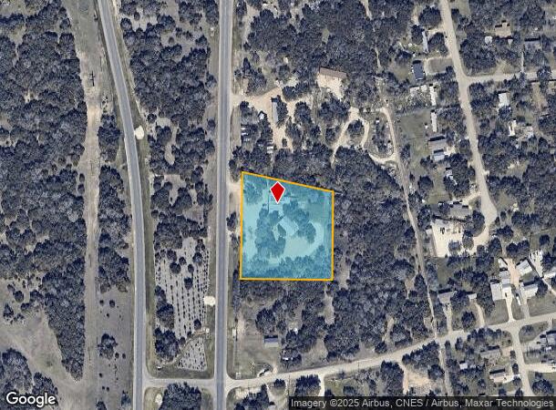
13430 N Us Highway 281 N, Spring Branch, TX 78070
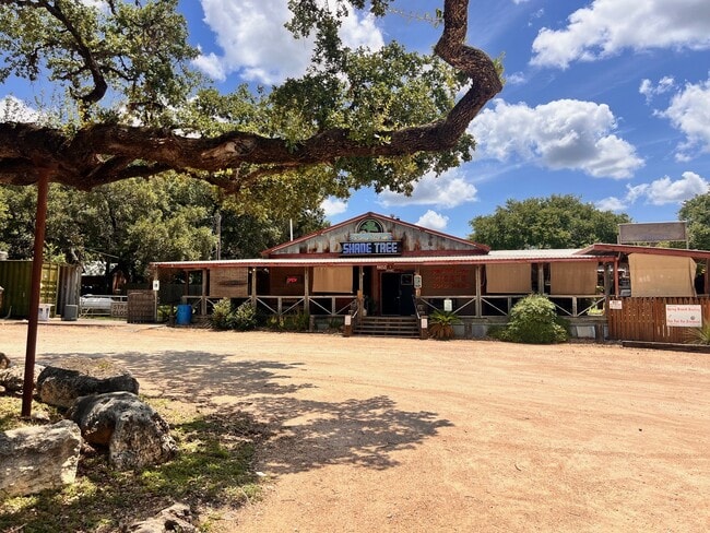
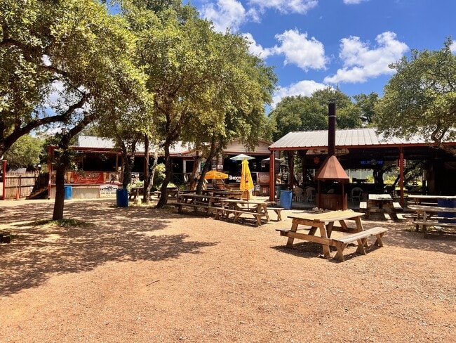
This Property Is For Sale
NEARBY LISTINGS FOR SALE OR LEASE
Property Detail
13430 N Us Highway 281 N
San Antonio-New Braunfels, TX
Lost Meadows
32-0485-0004-00
LOST MEADOWS, LOT 4
Commercialnec
Comal
X
Texas
48259C0350F
4
2024
2.75 AC
2025
Comal County
310610
San Antonio
3,730 SF
DEMOGRAPHICS near 13430 N Us Highway 281 N
1 Mile
3 Mile
5 Mile
2024 Total Population
1,835
6,803
11,312
2029 Population
2,526
9,314
15,470
Pop Growth 2024-2029
+ 37.66%
+ 36.91%
+ 36.76%
Average Age
38
42
43
2024 Total Households
642
2,544
4,289
HH Growth 2024-2029
+ 37.54%
+ 36.71%
+ 36.61%
Median Household Inc
$61,931
$73,579
$81,627
Avg Household Size
2.60
2.50
2.50
2024 Avg HH Vehicles
2.00
2.00
2.00
Median Home Value
$410,849
$342,000
$363,316
Median Year Built
1995
2004
2004
Nearby Places
Map Layers
Map Styles
 Street
 Aerial
- Restaurants
- Banks
- Shops
- Fitness
- Groceries
PUBLIC TRANSPORTATION
AIRPORT
San Antonio International
DRIVE
WALK
Distance
San Antonio International
37 min
31.4 mi
Nearby Properties
Address
Land Use
TOTAL SIZE
Lot Size
Zoning
Address
Land Use
TOTAL SIZE
Lot Size
Zoning
17,400 SF
3.76 AC
Address
Land Use
TOTAL SIZE
Lot Size
Zoning
8,896 SF
3.19 AC
Address
Land Use
TOTAL SIZE
Lot Size
Zoning
1,728 SF
4.14 AC
Address
Land Use
TOTAL SIZE
Lot Size
Zoning
16,264 SF
21.01 AC
Address
Land Use
TOTAL SIZE
Lot Size
Zoning
13,162 SF
25.99 AC
Address
Land Use
TOTAL SIZE
Lot Size
Zoning
12,968 SF
15.54 AC
Address
Land Use
TOTAL SIZE
Lot Size
Zoning
95.22 AC
Address
Land Use
TOTAL SIZE
Lot Size
Zoning
5,288 SF
133.02 AC
Address
Land Use
TOTAL SIZE
Lot Size
Zoning
26,658 SF
31.10 AC
Address
Land Use
TOTAL SIZE
Lot Size
Zoning
3,584 SF
10.54 AC
Address
Land Use
TOTAL SIZE
Lot Size
Zoning
10,000 SF
2.01 AC
Address
Land Use
TOTAL SIZE
Lot Size
Zoning
2,160 SF
13.79 AC
Address
Land Use
TOTAL SIZE
Lot Size
Zoning
2,240 SF
16.82 AC
Address
Land Use
TOTAL SIZE
Lot Size
Zoning
8,357 SF
15.47 AC
Address
Land Use
TOTAL SIZE
Lot Size
Zoning
2,800 SF
25.73 AC
Address
Land Use
TOTAL SIZE
Lot Size
Zoning
Address
Land Use
TOTAL SIZE
Lot Size
Zoning
4,736 SF
58.42 AC
Address
Land Use
TOTAL SIZE
Lot Size
Zoning
9,036 SF
0.98 AC
Address
Land Use
TOTAL SIZE
Lot Size
Zoning
5,109 SF
2.07 AC
Address
Land Use
TOTAL SIZE
Lot Size
Zoning
9,416 SF
3.47 AC
Address
Land Use
TOTAL SIZE
Lot Size
Zoning
9,760 SF
2.85 AC
Address
Land Use
TOTAL SIZE
Lot Size
Zoning
Address
Land Use
TOTAL SIZE
Lot Size
Zoning
465 SF
16.03 AC
Address
Land Use
TOTAL SIZE
Lot Size
Zoning
5,450 SF
17.74 AC
Address
Land Use
TOTAL SIZE
Lot Size
Zoning
4,400 SF
2 AC
Address
Land Use
TOTAL SIZE
Lot Size
Zoning
1,268 SF
3.91 AC
Address
Land Use
TOTAL SIZE
Lot Size
Zoning
3,396 SF
37.34 AC
Address
Land Use
TOTAL SIZE
Lot Size
Zoning
Address
Land Use
TOTAL SIZE
Lot Size
Zoning
3,364 SF
2 AC
The World's #1 Commercial Real Estate Marketplace
Connect with us
© 2025 CoStar Group
The information above has been obtained from sources believed reliable. While we do not doubt its accuracy we have not verified it and make no guarantee, warranty or representation about it. It is your responsibility to independently confirm its accuracy and completeness. Any projections, opinions, assumptions, or estimates used are for example only and do not represent the current or future performance of the property. The value of this transaction to you depends on tax and other factors which should be evaluated by your tax, financial, and legal advisors. You and your advisors should conduct a careful, independent investigation of the property to determine to your satisfaction the suitability of the property for your needs.