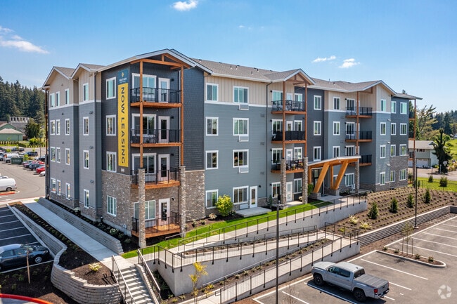
Property Record
13432 Se 169Th Ave, Clackamas, OR 97015
Property Detail
13432 Se 169Th Ave
05035211
PARTITION PLAT 2019-088 PT PARCEL 4 SEE RELATED PROPERTY 01104
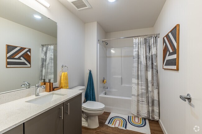
Multifamilydwelling
CLACKAMAS
MURM2
Oregon
B and X Area of moderate flood hazard, usually the area between the limits of the 100-year and 500-year floods.
0.87 AC
2025
Rock Creek
2025
Portland
023202
Portland-Vancouver-Hillsboro, OR-WA
NEARBY LISTINGS FOR SALE OR LEASE
-
-
View all Clackamas listings for sale on LoopNet.com
DEMOGRAPHICS near 13432 Se 169Th Ave
1 mile
3 mile
5 mile
2025 Total Population
10,832
50,434
133,227
2030 Population
11,241
51,184
133,567
Pop Growth 2025-2030
+ 3.78%
+ 1.49%
+ 0.26%
Average Age
38
40
41
2025 Total Households
3,524
16,722
46,683
HH Growth 2025-2030
+ 3.77%
+ 1.44%
+ 0.12%
Median Household Inc
$111,567
$112,138
$95,908
Avg Household Size
3.00
2.90
2.70
2025 Avg HH Vehicles
2.00
2.00
2.00
Median Home Value
$717,749
$689,673
$622,089
Median Year Built
2010
1997
1990
Nearby Places
Map Layers
Map Styles
 Street
 Aerial
Transit
 Traffic
 Biking
Places
Listings with unknown addresses are not visible on the map
- Restaurants
- Banks
- Shops
- Fitness
- Groceries
PUBLIC TRANSPORTATION
COMMUTER RAIL
Oregon City Amtrak (Amtrak Cascades - Amtrak)
Drive
Walk
Distance
Oregon City Amtrak (Amtrak Cascades - Amtrak)
17 min
9.2 mi
AIRPORT
Portland International
Drive
Walk
Distance
Portland International
28 min
16.7 mi
Freight Ports
Port of Portland
Drive
Walk
Distance
Port of Portland
32 min
20.0 mi
Nearby Properties
Address
Land Use
TOTAL SIZE
Lot Size
Zoning
Address
Land Use
TOTAL SIZE
Lot Size
Zoning
6.92 AC
MCC
Address
Land Use
TOTAL SIZE
Lot Size
Zoning
2,232 SF
15.74 AC
MUC
Address
Land Use
TOTAL SIZE
Lot Size
Zoning
12.06 AC
MCC
Address
Land Use
TOTAL SIZE
Lot Size
Zoning
9 AC
MUE
Address
Land Use
TOTAL SIZE
Lot Size
Zoning
22.99 AC
LI
Address
Land Use
TOTAL SIZE
Lot Size
Zoning
8 AC
MURM1
Address
Land Use
TOTAL SIZE
Lot Size
Zoning
2,089 SF
4.30 AC
MURM2
Address
Land Use
TOTAL SIZE
Lot Size
Zoning
6 AC
GI
Address
Land Use
TOTAL SIZE
Lot Size
Zoning
1,032 SF
5.50 AC
MR2
Address
Land Use
TOTAL SIZE
Lot Size
Zoning
7.25 AC
LI
Address
Land Use
TOTAL SIZE
Lot Size
Zoning
3,342 SF
9.34 AC
MUE
Address
Land Use
TOTAL SIZE
Lot Size
Zoning
17.04 AC
GI
Address
Land Use
TOTAL SIZE
Lot Size
Zoning
4.83 AC
MCC
Address
Land Use
TOTAL SIZE
Lot Size
Zoning
5.66 AC
MCC
Address
Land Use
TOTAL SIZE
Lot Size
Zoning
1 AC
MURX
Address
Land Use
TOTAL SIZE
Lot Size
Zoning
5.52 AC
MURM1
Address
Land Use
TOTAL SIZE
Lot Size
Zoning
Address
Land Use
TOTAL SIZE
Lot Size
Zoning
14.44 AC
MR2
Address
Land Use
TOTAL SIZE
Lot Size
Zoning
3.15 AC
MURM2
Address
Land Use
TOTAL SIZE
Lot Size
Zoning
1,896 SF
1.96 AC
VO
Address
Land Use
TOTAL SIZE
Lot Size
Zoning
4.76 AC
MUC
Address
Land Use
TOTAL SIZE
Lot Size
Zoning
5.31 AC
C2
Address
Land Use
TOTAL SIZE
Lot Size
Zoning
Address
Land Use
TOTAL SIZE
Lot Size
Zoning
Address
Land Use
TOTAL SIZE
Lot Size
Zoning
Address
Land Use
TOTAL SIZE
Lot Size
Zoning
9 AC
LI
Address
Land Use
TOTAL SIZE
Lot Size
Zoning
6.60 AC
LI
Address
Land Use
TOTAL SIZE
Lot Size
Zoning
3,414 SF
6.16 AC
VA
Address
Land Use
TOTAL SIZE
Lot Size
Zoning
7,000 SF
11 AC
LI
The World's #1 Commercial Real Estate Marketplace
Connect with us
© 2026 CoStar Group
The information above has been obtained from sources believed reliable. While we do not doubt its accuracy we have not verified it and make no guarantee, warranty or representation about it. It is your responsibility to independently confirm its accuracy and completeness. Any projections, opinions, assumptions, or estimates used are for example only and do not represent the current or future performance of the property. The value of this transaction to you depends on tax and other factors which should be evaluated by your tax, financial, and legal advisors. You and your advisors should conduct a careful, independent investigation of the property to determine to your satisfaction the suitability of the property for your needs.