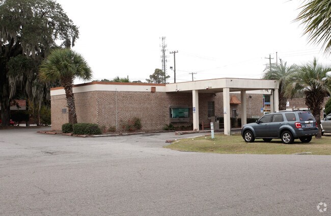
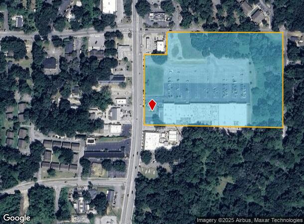
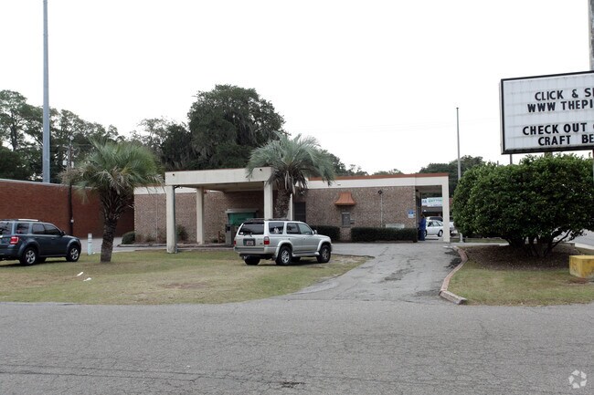
Property Record
1345 Ribaut Rd, Port Royal, SC 29935
NEARBY LISTINGS FOR SALE OR LEASE
Property Detail
1345 Ribaut Rd
Hilton Head Island-Bluffton-Beaufort, SC
Ribaut Rd So. Commercial Corri
R110-007-000-0106-0000
ROYAL OAKS SHOPPING CENTER *T ACCT 83 CORRECT VALUE
Stripcommercialcenter
Beaufort
2024
South Carolina
2024
13.50 AC
000700
Hilton Head/Beaufort
112,700 SF
Other Market Areas
DEMOGRAPHICS near 1345 Ribaut Rd
1 Mile
3 Mile
5 Mile
2024 Total Population
5,521
17,793
42,191
2029 Population
6,076
19,699
46,485
Pop Growth 2024-2029
+ 10.05%
+ 10.71%
+ 10.18%
Average Age
40
42
38
2024 Total Households
2,535
7,701
15,670
HH Growth 2024-2029
+ 9.51%
+ 10.23%
+ 10.31%
Median Household Inc
$63,519
$62,014
$59,746
Avg Household Size
2.10
2.20
2.40
2024 Avg HH Vehicles
2.00
2.00
2.00
Median Home Value
$254,128
$314,725
$289,708
Median Year Built
1981
1984
1991
Nearby Places
Map Layers
Map Styles
 Street
 Aerial
- Restaurants
- Banks
- Shops
- Fitness
- Groceries
PUBLIC TRANSPORTATION
AIRPORT
Hilton Head
DRIVE
WALK
Distance
Hilton Head
54 min
37.7 mi
Savannah/Hilton Head International
DRIVE
WALK
Distance
Savannah/Hilton Head International
65 min
46.4 mi
Freight Ports
Georgia Ports - Savannah
DRIVE
WALK
Distance
Georgia Ports - Savannah
64 min
45.1 mi
Nearby Properties
Address
Land Use
TOTAL SIZE
Lot Size
Zoning
Address
Land Use
TOTAL SIZE
Lot Size
Zoning
8,358 SF
21.89 AC
6611
Address
Land Use
TOTAL SIZE
Lot Size
Zoning
245,864 SF
19.36 AC
6601
Address
Land Use
TOTAL SIZE
Lot Size
Zoning
24,000 SF
4.45 AC
6601
Address
Land Use
TOTAL SIZE
Lot Size
Zoning
101,304 SF
6.47 AC
6611
Address
Land Use
TOTAL SIZE
Lot Size
Zoning
78,168 SF
11 AC
Address
Land Use
TOTAL SIZE
Lot Size
Zoning
34,200 SF
4.18 AC
6601
Address
Land Use
TOTAL SIZE
Lot Size
Zoning
144,226 SF
41.30 AC
6611
Address
Land Use
TOTAL SIZE
Lot Size
Zoning
116,067 SF
27 AC
6611
Address
Land Use
TOTAL SIZE
Lot Size
Zoning
4,928 SF
4.76 AC
6611
Address
Land Use
TOTAL SIZE
Lot Size
Zoning
1,394 SF
47.49 AC
6611
Address
Land Use
TOTAL SIZE
Lot Size
Zoning
60,440 SF
9.28 AC
6611
Address
Land Use
TOTAL SIZE
Lot Size
Zoning
50,800 SF
4.03 AC
6611
Address
Land Use
TOTAL SIZE
Lot Size
Zoning
37,624 SF
2.42 AC
6611
Address
Land Use
TOTAL SIZE
Lot Size
Zoning
6,024 SF
10.60 AC
6611
Address
Land Use
TOTAL SIZE
Lot Size
Zoning
134,446 SF
19.90 AC
6611
Address
Land Use
TOTAL SIZE
Lot Size
Zoning
16,197 SF
7.50 AC
6611
Address
Land Use
TOTAL SIZE
Lot Size
Zoning
6,784 SF
10.50 AC
6111
Address
Land Use
TOTAL SIZE
Lot Size
Zoning
71,309 SF
2.30 AC
6601
Address
Land Use
TOTAL SIZE
Lot Size
Zoning
52,322 SF
6.86 AC
6601
Address
Land Use
TOTAL SIZE
Lot Size
Zoning
53,862 SF
6.67 AC
9999
Address
Land Use
TOTAL SIZE
Lot Size
Zoning
36,020 SF
3.46 AC
6611
Address
Land Use
TOTAL SIZE
Lot Size
Zoning
32,035 SF
7.39 AC
4201
Address
Land Use
TOTAL SIZE
Lot Size
Zoning
45,668 SF
9.01 AC
6611
Address
Land Use
TOTAL SIZE
Lot Size
Zoning
35,734 SF
5.80 AC
6611
Address
Land Use
TOTAL SIZE
Lot Size
Zoning
11,592 SF
2.48 AC
6611
Address
Land Use
TOTAL SIZE
Lot Size
Zoning
41,664 SF
4.10 AC
Address
Land Use
TOTAL SIZE
Lot Size
Zoning
60,696 SF
0.62 AC
6611
Address
Land Use
TOTAL SIZE
Lot Size
Zoning
41,760 SF
8.75 AC
6612
Address
Land Use
TOTAL SIZE
Lot Size
Zoning
119 AC
6601
The World's #1 Commercial Real Estate Marketplace
Connect with us
© 2026 CoStar Group
The information above has been obtained from sources believed reliable. While we do not doubt its accuracy we have not verified it and make no guarantee, warranty or representation about it. It is your responsibility to independently confirm its accuracy and completeness. Any projections, opinions, assumptions, or estimates used are for example only and do not represent the current or future performance of the property. The value of this transaction to you depends on tax and other factors which should be evaluated by your tax, financial, and legal advisors. You and your advisors should conduct a careful, independent investigation of the property to determine to your satisfaction the suitability of the property for your needs.