Property Record
1349 Main St, Reading, MA 01867


NEARBY LISTINGS FOR SALE OR LEASE
Property Detail
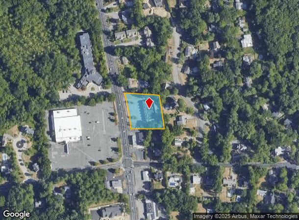
1349 Main St
Storebuilding
Middlesex
X
Massachusetts
25017C0311F
0.93 AC
2025
Wilmington/Reading
2025
Boston
334300
Boston-Cambridge-Newton, MA-NH
8,400 SF
READ-000051-000000-000151
DEMOGRAPHICS near 1349 Main St
1 Mile
3 Mile
5 Mile
2024 Total Population
4,705
45,799
137,311
2029 Population
4,639
45,607
136,277
Pop Growth 2024-2029
(1.40%)
(0.42%)
(0.75%)
Average Age
43
42
42
2024 Total Households
1,587
16,755
51,703
HH Growth 2024-2029
(1.51%)
(0.41%)
(0.84%)
Median Household Inc
$147,162
$138,266
$128,169
Avg Household Size
2.80
2.70
2.60
2024 Avg HH Vehicles
2.00
2.00
2.00
Median Home Value
$808,539
$723,834
$698,185
Median Year Built
1968
1966
1967
Nearby Places
Map Layers
Map Styles
 Street
 Aerial
- Restaurants
- Banks
- Shops
- Fitness
- Groceries
PUBLIC TRANSPORTATION
COMMUTER RAIL
Reading (Haverhill Line - Massachusetts Bay Transportation Authority Commuter Rail (Purple Line))
DRIVE
WALK
Distance
Reading (Haverhill Line - Massachusetts Bay Transportation Authority Commuter Rail (Purple Line))
5 min
2.5 mi
North Wilmington (Haverhill Line - Massachusetts Bay Transportation Authority Commuter Rail (Purple Line))
DRIVE
WALK
Distance
North Wilmington (Haverhill Line - Massachusetts Bay Transportation Authority Commuter Rail (Purple Line))
8 min
4.2 mi
AIRPORT
General Edward Lawrence Logan International
DRIVE
WALK
Distance
General Edward Lawrence Logan International
29 min
17.2 mi
Manchester Boston Regional
DRIVE
WALK
Distance
Manchester Boston Regional
55 min
38.3 mi
SALE & LEASE HISTORY
LISTING DATE
SALE/LEASE

Apr 06, 2017
For Lease
Nearby Properties
Address
Land Use
TOTAL SIZE
Lot Size
Zoning
Address
Land Use
TOTAL SIZE
Lot Size
Zoning
42.20 AC
S-2
Address
Land Use
TOTAL SIZE
Lot Size
Zoning
502,199 SF
47.78 AC
IO
Address
Land Use
TOTAL SIZE
Lot Size
Zoning
411,956 SF
23.94 AC
S20
Address
Land Use
TOTAL SIZE
Lot Size
Zoning
304,672 SF
58.97 AC
HB
Address
Land Use
TOTAL SIZE
Lot Size
Zoning
368,748 SF
40.10 AC
IND
Address
Land Use
TOTAL SIZE
Lot Size
Zoning
129,028 SF
7.17 AC
I-P2
Address
Land Use
TOTAL SIZE
Lot Size
Zoning
153,906 SF
4 AC
S15
Address
Land Use
TOTAL SIZE
Lot Size
Zoning
10.73 AC
I-P2
Address
Land Use
TOTAL SIZE
Lot Size
Zoning
141,968 SF
11.28 AC
R20
Address
Land Use
TOTAL SIZE
Lot Size
Zoning
6.77 AC
I-P2
Address
Land Use
TOTAL SIZE
Lot Size
Zoning
78,384 SF
34.20 AC
IO
Address
Land Use
TOTAL SIZE
Lot Size
Zoning
113,502 SF
8.50 AC
LB
Address
Land Use
TOTAL SIZE
Lot Size
Zoning
5.91 AC
I-P2
Address
Land Use
TOTAL SIZE
Lot Size
Zoning
175,682 SF
20.80 AC
IB
Address
Land Use
TOTAL SIZE
Lot Size
Zoning
262,220 SF
11.79 AC
Address
Land Use
TOTAL SIZE
Lot Size
Zoning
141,827 SF
8.10 AC
S15
Address
Land Use
TOTAL SIZE
Lot Size
Zoning
167,470 SF
8.50 AC
B
Address
Land Use
TOTAL SIZE
Lot Size
Zoning
156,846 SF
11.79 AC
Address
Land Use
TOTAL SIZE
Lot Size
Zoning
238,042 SF
28 AC
IND
Address
Land Use
TOTAL SIZE
Lot Size
Zoning
146,088 SF
8.93 AC
IND
Address
Land Use
TOTAL SIZE
Lot Size
Zoning
76,854 SF
0.97 AC
S15
Address
Land Use
TOTAL SIZE
Lot Size
Zoning
127,016 SF
11.01 AC
IB
Address
Land Use
TOTAL SIZE
Lot Size
Zoning
110,812 SF
32.87 AC
RA
Address
Land Use
TOTAL SIZE
Lot Size
Zoning
260,027 SF
20 AC
IND
Address
Land Use
TOTAL SIZE
Lot Size
Zoning
206,905 SF
13.31 AC
IND
Address
Land Use
TOTAL SIZE
Lot Size
Zoning
76,577 SF
8.56 AC
PUD
Address
Land Use
TOTAL SIZE
Lot Size
Zoning
290,370 SF
21.37 AC
IND
Address
Land Use
TOTAL SIZE
Lot Size
Zoning
124,741 SF
13.35 AC
HB
Address
Land Use
TOTAL SIZE
Lot Size
Zoning
166,800 SF
13.25 AC
GI
Address
Land Use
TOTAL SIZE
Lot Size
Zoning
165,671 SF
15.08 AC
I-P2
The World's #1 Commercial Real Estate Marketplace
Connect with us
© 2026 CoStar Group
The information above has been obtained from sources believed reliable. While we do not doubt its accuracy we have not verified it and make no guarantee, warranty or representation about it. It is your responsibility to independently confirm its accuracy and completeness. Any projections, opinions, assumptions, or estimates used are for example only and do not represent the current or future performance of the property. The value of this transaction to you depends on tax and other factors which should be evaluated by your tax, financial, and legal advisors. You and your advisors should conduct a careful, independent investigation of the property to determine to your satisfaction the suitability of the property for your needs.