Property Record
135 Deo Dr, Newark, OH 43055
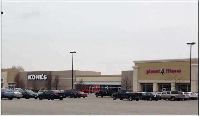

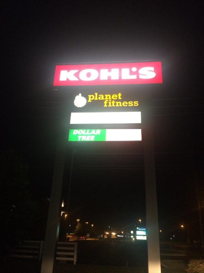

Property Detail
135 Deo Dr
054-270270-00.000
6.97 AC R12 T2 Q1 TIF 2007-2036 (100%)
Communitycenter
Licking
B and X Area of moderate flood hazard, usually the area between the limits of the 100-year and 500-year floods.
Ohio
2025
6.97 AC
2025
Licking County
751600
Columbus
24,200 SF
Columbus, OH
NEARBY LISTINGS FOR SALE OR LEASE
DEMOGRAPHICS near 135 Deo Dr
1 mile
3 mile
5 mile
2025 Total Population
7,942
46,361
74,917
2030 Population
8,104
47,482
77,195
Pop Growth 2025-2030
+ 2.04%
+ 2.42%
+ 3.04%
Average Age
43
41
41
2025 Total Households
3,597
19,171
30,275
HH Growth 2025-2030
+ 2.03%
+ 2.36%
+ 2.98%
Median Household Inc
$56,244
$54,362
$60,793
Avg Household Size
2.10
2.30
2.30
2025 Avg HH Vehicles
2.00
2.00
2.00
Median Home Value
$196,339
$186,475
$220,915
Median Year Built
1967
1961
1968
Nearby Places
Map Layers
Map Styles
 Street
 Aerial
Transit
 Traffic
 Biking
Places
Listings with unknown addresses are not visible on the map
- Restaurants
- Banks
- Shops
- Fitness
- Groceries
PUBLIC TRANSPORTATION
AIRPORT
John Glenn Columbus International
Drive
Walk
Distance
John Glenn Columbus International
44 min
34.1 mi
Freight Ports
Port of Toledo
Drive
Walk
Distance
Port of Toledo
198 min
162.7 mi
SALE & LEASE HISTORY
LISTING DATE
SALE/LEASE

Sep 25, 2016
For Lease
Nearby Properties
Address
Land Use
TOTAL SIZE
Lot Size
Zoning
Address
Land Use
TOTAL SIZE
Lot Size
Zoning
54,600 SF
101.38 AC
Address
Land Use
TOTAL SIZE
Lot Size
Zoning
288,448 SF
56.10 AC
Address
Land Use
TOTAL SIZE
Lot Size
Zoning
87,785 SF
37.26 AC
Address
Land Use
TOTAL SIZE
Lot Size
Zoning
68,326 SF
28.51 AC
Address
Land Use
TOTAL SIZE
Lot Size
Zoning
1,537,139 SF
11.11 AC
Address
Land Use
TOTAL SIZE
Lot Size
Zoning
143,636 SF
7.25 AC
Address
Land Use
TOTAL SIZE
Lot Size
Zoning
206,532 SF
21.65 AC
Address
Land Use
TOTAL SIZE
Lot Size
Zoning
118,791 SF
16.01 AC
Address
Land Use
TOTAL SIZE
Lot Size
Zoning
73,269 SF
15.64 AC
Address
Land Use
TOTAL SIZE
Lot Size
Zoning
31,271 SF
20.10 AC
Address
Land Use
TOTAL SIZE
Lot Size
Zoning
94,672 SF
13.37 AC
Address
Land Use
TOTAL SIZE
Lot Size
Zoning
57,280 SF
4.04 AC
Address
Land Use
TOTAL SIZE
Lot Size
Zoning
33,492 SF
1.07 AC
Address
Land Use
TOTAL SIZE
Lot Size
Zoning
22,974 SF
1.64 AC
Address
Land Use
TOTAL SIZE
Lot Size
Zoning
79,454 SF
19.13 AC
Address
Land Use
TOTAL SIZE
Lot Size
Zoning
63,635 SF
13.97 AC
Address
Land Use
TOTAL SIZE
Lot Size
Zoning
63,635 SF
7.91 AC
Address
Land Use
TOTAL SIZE
Lot Size
Zoning
5,158 SF
36.05 AC
Address
Land Use
TOTAL SIZE
Lot Size
Zoning
65,860 SF
3.35 AC
Address
Land Use
TOTAL SIZE
Lot Size
Zoning
316,800 SF
10.74 AC
Address
Land Use
TOTAL SIZE
Lot Size
Zoning
7,400 SF
10.50 AC
Address
Land Use
TOTAL SIZE
Lot Size
Zoning
97,368 SF
31.71 AC
Address
Land Use
TOTAL SIZE
Lot Size
Zoning
7,038 SF
3.15 AC
Address
Land Use
TOTAL SIZE
Lot Size
Zoning
37,176 SF
0.90 AC
Address
Land Use
TOTAL SIZE
Lot Size
Zoning
17,144 SF
4.55 AC
Address
Land Use
TOTAL SIZE
Lot Size
Zoning
204,400 SF
84.83 AC
Address
Land Use
TOTAL SIZE
Lot Size
Zoning
45,951 SF
6.64 AC
Address
Land Use
TOTAL SIZE
Lot Size
Zoning
99,664 SF
16.18 AC
Address
Land Use
TOTAL SIZE
Lot Size
Zoning
2,979 SF
13.37 AC
Address
Land Use
TOTAL SIZE
Lot Size
Zoning
85.95 AC
The World's #1 Commercial Real Estate Marketplace
Connect with us
© 2026 CoStar Group
The information above has been obtained from sources believed reliable. While we do not doubt its accuracy we have not verified it and make no guarantee, warranty or representation about it. It is your responsibility to independently confirm its accuracy and completeness. Any projections, opinions, assumptions, or estimates used are for example only and do not represent the current or future performance of the property. The value of this transaction to you depends on tax and other factors which should be evaluated by your tax, financial, and legal advisors. You and your advisors should conduct a careful, independent investigation of the property to determine to your satisfaction the suitability of the property for your needs.