Property Record
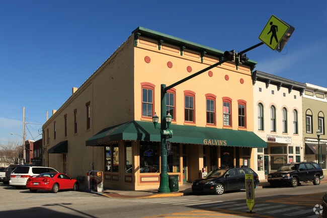
135 E Main St, Georgetown, KY 40324


Property Detail
135 E Main St
166-30-347.000
COMM DOWNTOWN
Commercialnec
Scott
B and X Area of moderate flood hazard, usually the area between the limits of the 100-year and 500-year floods.
Kentucky
2025
0.10 AC
2025
Scott County
040102
Lexington/Fayette
7,331 SF
Lexington-Fayette, KY
NEARBY LISTINGS FOR SALE OR LEASE
DEMOGRAPHICS near 135 E Main St
1 mile
3 mile
5 mile
2024 Total Population
9,389
39,815
46,695
2029 Population
9,989
42,310
49,674
Pop Growth 2024-2029
+ 6.39%
+ 6.27%
+ 6.38%
Average Age
37
36
36
2024 Total Households
3,560
15,203
17,602
HH Growth 2024-2029
+ 6.26%
+ 6.49%
+ 6.62%
Median Household Inc
$47,119
$77,665
$80,749
Avg Household Size
2.30
2.50
2.50
2024 Avg HH Vehicles
2.00
2.00
2.00
Median Home Value
$214,023
$265,385
$276,117
Median Year Built
1974
1998
1999
Nearby Places
Map Layers
Map Styles
 Street
 Aerial
Transit
 Traffic
 Biking
Places
Listings with unknown addresses are not visible on the map
- Restaurants
- Banks
- Shops
- Fitness
- Groceries
PUBLIC TRANSPORTATION
AIRPORT
Blue Grass
Drive
Walk
Distance
Blue Grass
30 min
18.5 mi
SALE & LEASE HISTORY
LISTING DATE
SALE/LEASE

May 28, 2025
For Lease
Mar 27, 2018
For Lease
Jun 09, 2023
For Lease
Jul 13, 2017
For Lease
Nearby Properties
Address
Land Use
TOTAL SIZE
Lot Size
Zoning
Address
Land Use
TOTAL SIZE
Lot Size
Zoning
72,834 SF
102.76 AC
Address
Land Use
TOTAL SIZE
Lot Size
Zoning
4,104 SF
25.48 AC
Address
Land Use
TOTAL SIZE
Lot Size
Zoning
317,572 SF
2.49 AC
Address
Land Use
TOTAL SIZE
Lot Size
Zoning
312,633 SF
40.29 AC
Address
Land Use
TOTAL SIZE
Lot Size
Zoning
228,770 SF
19.05 AC
Address
Land Use
TOTAL SIZE
Lot Size
Zoning
10.63 AC
Address
Land Use
TOTAL SIZE
Lot Size
Zoning
263,265 SF
13.62 AC
Address
Land Use
TOTAL SIZE
Lot Size
Zoning
Address
Land Use
TOTAL SIZE
Lot Size
Zoning
192,944 SF
16.03 AC
Address
Land Use
TOTAL SIZE
Lot Size
Zoning
208,400 SF
14.39 AC
Address
Land Use
TOTAL SIZE
Lot Size
Zoning
1,248 SF
15.31 AC
Address
Land Use
TOTAL SIZE
Lot Size
Zoning
158,779 SF
17.69 AC
Address
Land Use
TOTAL SIZE
Lot Size
Zoning
97,000 SF
20.28 AC
Address
Land Use
TOTAL SIZE
Lot Size
Zoning
1,664 SF
27.52 AC
Address
Land Use
TOTAL SIZE
Lot Size
Zoning
Address
Land Use
TOTAL SIZE
Lot Size
Zoning
108,392 SF
26.32 AC
Address
Land Use
TOTAL SIZE
Lot Size
Zoning
194,790 SF
21.97 AC
Address
Land Use
TOTAL SIZE
Lot Size
Zoning
217,560 SF
9.43 AC
Address
Land Use
TOTAL SIZE
Lot Size
Zoning
68.54 AC
Address
Land Use
TOTAL SIZE
Lot Size
Zoning
28,750 SF
3.42 AC
Address
Land Use
TOTAL SIZE
Lot Size
Zoning
Address
Land Use
TOTAL SIZE
Lot Size
Zoning
130,600 SF
12.18 AC
Address
Land Use
TOTAL SIZE
Lot Size
Zoning
115,500 SF
7.24 AC
Address
Land Use
TOTAL SIZE
Lot Size
Zoning
266,311 SF
54.15 AC
Address
Land Use
TOTAL SIZE
Lot Size
Zoning
51,992 SF
10 AC
Address
Land Use
TOTAL SIZE
Lot Size
Zoning
1,540 SF
52.10 AC
Address
Land Use
TOTAL SIZE
Lot Size
Zoning
81,073 SF
6.52 AC
Address
Land Use
TOTAL SIZE
Lot Size
Zoning
194 SF
38.23 AC
Address
Land Use
TOTAL SIZE
Lot Size
Zoning
13.90 AC
Address
Land Use
TOTAL SIZE
Lot Size
Zoning
79,599 SF
30.74 AC
The World's #1 Commercial Real Estate Marketplace
Connect with us
© 2026 CoStar Group
The information above has been obtained from sources believed reliable. While we do not doubt its accuracy we have not verified it and make no guarantee, warranty or representation about it. It is your responsibility to independently confirm its accuracy and completeness. Any projections, opinions, assumptions, or estimates used are for example only and do not represent the current or future performance of the property. The value of this transaction to you depends on tax and other factors which should be evaluated by your tax, financial, and legal advisors. You and your advisors should conduct a careful, independent investigation of the property to determine to your satisfaction the suitability of the property for your needs.