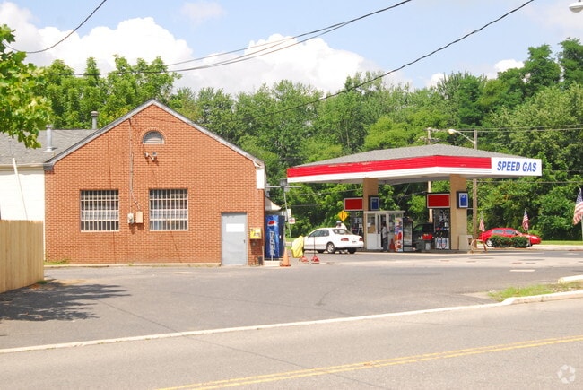
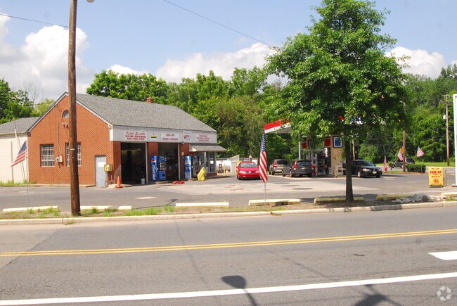
Property Record
135 E Main St, Marlton, NJ 08053


Property Detail
135 E Main St
13-00026-0000-00010-01
ADDITIONAL LOTS: L10.02
Servicestation
BURLINGTON
C-2
New Jersey
B and X Area of moderate flood hazard, usually the area between the limits of the 100-year and 500-year floods.
10.1
2024
0.65 AC
2025
South Burlington County
704007
Philadelphia
2,552 SF
Philadelphia-Camden-Wilmington, PA-NJ-DE-MD
NEARBY LISTINGS FOR SALE OR LEASE
DEMOGRAPHICS near 135 E Main St
1 mile
3 mile
5 mile
2025 Total Population
7,859
67,579
144,495
2030 Population
8,080
69,394
147,967
Pop Growth 2025-2030
+ 2.81%
+ 2.69%
+ 2.40%
Average Age
45
43
43
2025 Total Households
3,089
26,392
55,674
HH Growth 2025-2030
+ 2.85%
+ 2.72%
+ 2.46%
Median Household Inc
$106,220
$122,441
$131,421
Avg Household Size
2.50
2.50
2.50
2025 Avg HH Vehicles
2.00
2.00
2.00
Median Home Value
$374,633
$414,598
$441,186
Median Year Built
1977
1984
1983
Nearby Places
Map Layers
Map Styles
 Street
 Aerial
Layers
 Traffic
 Biking
Places
Listings with unknown addresses are not visible on the map
- Restaurants
- Banks
- Shops
- Fitness
- Groceries
PUBLIC TRANSPORTATION
COMMUTER RAIL
Lindenwold (NJT) (Atlantic City Line - NJ Transit Commuter Rail (NJ Transit))
Drive
Walk
Distance
Lindenwold (NJT) (Atlantic City Line - NJ Transit Commuter Rail (NJ Transit))
15 min
7.2 mi
Cherry Hill (Atlantic City Line - NJ Transit Commuter Rail (NJ Transit))
Drive
Walk
Distance
Cherry Hill (Atlantic City Line - NJ Transit Commuter Rail (NJ Transit))
14 min
8.9 mi
AIRPORT
Philadelphia International
Drive
Walk
Distance
Philadelphia International
38 min
24.6 mi
Trenton Mercer
Drive
Walk
Distance
Trenton Mercer
55 min
38.2 mi
Atlantic City International
Drive
Walk
Distance
Atlantic City International
74 min
41.0 mi
Freight Ports
South Jersey Port
Drive
Walk
Distance
South Jersey Port
21 min
13.3 mi
Nearby Properties
Address
Land Use
TOTAL SIZE
Lot Size
Zoning
Address
Land Use
TOTAL SIZE
Lot Size
Zoning
1,896 SF
93.79 AC
LD
Address
Land Use
TOTAL SIZE
Lot Size
Zoning
60,132 SF
18.57 AC
RA
Address
Land Use
TOTAL SIZE
Lot Size
Zoning
53.35 AC
LD
Address
Land Use
TOTAL SIZE
Lot Size
Zoning
44.80 AC
C-1
Address
Land Use
TOTAL SIZE
Lot Size
Zoning
58.48 AC
MD
Address
Land Use
TOTAL SIZE
Lot Size
Zoning
52.30 AC
MD
Address
Land Use
TOTAL SIZE
Lot Size
Zoning
2,600 SF
37.38 AC
AH-1
Address
Land Use
TOTAL SIZE
Lot Size
Zoning
114,852 SF
12.73 AC
GB2
Address
Land Use
TOTAL SIZE
Lot Size
Zoning
Address
Land Use
TOTAL SIZE
Lot Size
Zoning
9.38 AC
C-1
Address
Land Use
TOTAL SIZE
Lot Size
Zoning
122,264 SF
5 AC
RR
Address
Land Use
TOTAL SIZE
Lot Size
Zoning
90,080 SF
5.22 AC
MB
Address
Land Use
TOTAL SIZE
Lot Size
Zoning
42.80 AC
MF
Address
Land Use
TOTAL SIZE
Lot Size
Zoning
25.28 AC
C-1
Address
Land Use
TOTAL SIZE
Lot Size
Zoning
23.43 AC
INS
Address
Land Use
TOTAL SIZE
Lot Size
Zoning
2,264 SF
17.30 AC
C-1
Address
Land Use
TOTAL SIZE
Lot Size
Zoning
31.88 AC
MD
Address
Land Use
TOTAL SIZE
Lot Size
Zoning
36,274 SF
11.73 AC
GB2
Address
Land Use
TOTAL SIZE
Lot Size
Zoning
77,224 SF
7.65 AC
RR
Address
Land Use
TOTAL SIZE
Lot Size
Zoning
10.38 AC
C-1
Address
Land Use
TOTAL SIZE
Lot Size
Zoning
1,416 SF
16.88 AC
C-1
Address
Land Use
TOTAL SIZE
Lot Size
Zoning
132,728 SF
8.82 AC
GB2
Address
Land Use
TOTAL SIZE
Lot Size
Zoning
12.62 AC
C-1
Address
Land Use
TOTAL SIZE
Lot Size
Zoning
5,484 SF
12.90 AC
C-1
Address
Land Use
TOTAL SIZE
Lot Size
Zoning
28,036 SF
8.52 AC
GB2
Address
Land Use
TOTAL SIZE
Lot Size
Zoning
140.84 AC
MD
Address
Land Use
TOTAL SIZE
Lot Size
Zoning
5.52 AC
AH1A
Address
Land Use
TOTAL SIZE
Lot Size
Zoning
10,000 SF
10.80 AC
RD-1
Address
Land Use
TOTAL SIZE
Lot Size
Zoning
75,581 SF
20 AC
MF
Address
Land Use
TOTAL SIZE
Lot Size
Zoning
100,800 SF
5.76 AC
O3
The World's #1 Commercial Real Estate Marketplace
Connect with us
© 2026 CoStar Group
The information above has been obtained from sources believed reliable. While we do not doubt its accuracy we have not verified it and make no guarantee, warranty or representation about it. It is your responsibility to independently confirm its accuracy and completeness. Any projections, opinions, assumptions, or estimates used are for example only and do not represent the current or future performance of the property. The value of this transaction to you depends on tax and other factors which should be evaluated by your tax, financial, and legal advisors. You and your advisors should conduct a careful, independent investigation of the property to determine to your satisfaction the suitability of the property for your needs.