Property Record
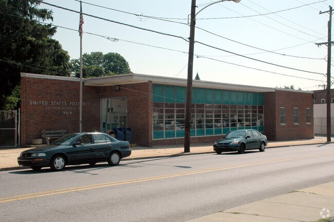
135 E Springfield Rd, Springfield, PA 19064


Property Detail
135 E Springfield Rd
Philadelphia-Camden-Wilmington, PA-NJ-DE-MD
1 STY BLDG 152 X 216 X 132 X 143
10-00-01831-01
DELAWARE
Federalproperty
Pennsylvania
B and X Area of moderate flood hazard, usually the area between the limits of the 100-year and 500-year floods.
1-4
2024
0.55 AC
2025
Delaware County
407804
Philadelphia
8,084 SF
NEARBY LISTINGS FOR SALE OR LEASE
-
-
View all Springfield listings for sale on LoopNet.com
DEMOGRAPHICS near 135 E Springfield Rd
1 mile
3 mile
5 mile
2024 Total Population
28,739
230,922
545,584
2029 Population
28,986
232,572
547,215
Pop Growth 2024-2029
+ 0.86%
+ 0.71%
+ 0.30%
Average Age
40
39
39
2024 Total Households
11,590
87,249
210,431
HH Growth 2024-2029
+ 0.94%
+ 0.78%
+ 0.25%
Median Household Inc
$73,630
$70,414
$65,816
Avg Household Size
2.40
2.60
2.50
2024 Avg HH Vehicles
2.00
2.00
1.00
Median Home Value
$221,589
$236,919
$251,624
Median Year Built
1953
1951
1949
Nearby Places
Map Layers
Map Styles
 Street
 Aerial
Transit
 Traffic
 Biking
Places
Listings with unknown addresses are not visible on the map
- Restaurants
- Banks
- Shops
- Fitness
- Groceries
PUBLIC TRANSPORTATION
TRANSIT/SUBWAY
Springfield Road (Route 102 - Southeastern Pennsylvania Transportation Authority Rapid Transit (SEPTA Subway & Trolley))
Drive
Walk
Distance
Springfield Road (Route 102 - Southeastern Pennsylvania Transportation Authority Rapid Transit (SEPTA Subway & Trolley))
1 min
3 min
0.2 mi
Penn Street (Route 102 - Southeastern Pennsylvania Transportation Authority Rapid Transit (SEPTA Subway & Trolley))
Drive
Walk
Distance
Penn Street (Route 102 - Southeastern Pennsylvania Transportation Authority Rapid Transit (SEPTA Subway & Trolley))
1 min
4 min
0.2 mi
Clifton-Aldan (Route 102 - Southeastern Pennsylvania Transportation Authority Rapid Transit (SEPTA Subway & Trolley))
Drive
Walk
Distance
Clifton-Aldan (Route 102 - Southeastern Pennsylvania Transportation Authority Rapid Transit (SEPTA Subway & Trolley))
1 min
5 min
0.3 mi
Clifton-Aldan (R3 - Southeastern Pennsylvania Transportation Authority Regional Rail (SEPTA Regional Rail))
Drive
Walk
Distance
Clifton-Aldan (R3 - Southeastern Pennsylvania Transportation Authority Regional Rail (SEPTA Regional Rail))
1 min
6 min
0.3 mi
Baltimore Pike (Route 102 - Southeastern Pennsylvania Transportation Authority Rapid Transit (SEPTA Subway & Trolley))
Drive
Walk
Distance
Baltimore Pike (Route 102 - Southeastern Pennsylvania Transportation Authority Rapid Transit (SEPTA Subway & Trolley))
1 min
7 min
0.3 mi
COMMUTER RAIL
Clifton-Aldan (Route 102 - Southeastern Pennsylvania Transportation Authority Rapid Transit (SEPTA Subway & Trolley))
Drive
Walk
Distance
Clifton-Aldan (Route 102 - Southeastern Pennsylvania Transportation Authority Rapid Transit (SEPTA Subway & Trolley))
1 min
5 min
0.3 mi
Clifton-Aldan (R3 - Southeastern Pennsylvania Transportation Authority Regional Rail (SEPTA Regional Rail))
Drive
Walk
Distance
Clifton-Aldan (R3 - Southeastern Pennsylvania Transportation Authority Regional Rail (SEPTA Regional Rail))
1 min
6 min
0.3 mi
AIRPORT
Philadelphia International
Drive
Walk
Distance
Philadelphia International
17 min
7.2 mi
Freight Ports
Broadway Terminal - Pier 5
Drive
Walk
Distance
Broadway Terminal - Pier 5
28 min
13.2 mi
Nearby Properties
Address
Land Use
TOTAL SIZE
Lot Size
Zoning
Address
Land Use
TOTAL SIZE
Lot Size
Zoning
158,496 SF
Address
Land Use
TOTAL SIZE
Lot Size
Zoning
15,660 SF
56.60 AC
Address
Land Use
TOTAL SIZE
Lot Size
Zoning
448,864 SF
32.89 AC
Address
Land Use
TOTAL SIZE
Lot Size
Zoning
82,153 SF
13.97 AC
Address
Land Use
TOTAL SIZE
Lot Size
Zoning
702,532 SF
11 AC
Address
Land Use
TOTAL SIZE
Lot Size
Zoning
20,880 SF
27.20 AC
Address
Land Use
TOTAL SIZE
Lot Size
Zoning
6,040 SF
16.45 AC
Address
Land Use
TOTAL SIZE
Lot Size
Zoning
25,680 SF
31.64 AC
Address
Land Use
TOTAL SIZE
Lot Size
Zoning
136,972 SF
27 AC
Address
Land Use
TOTAL SIZE
Lot Size
Zoning
3,600 SF
6.61 AC
SPPOA
Address
Land Use
TOTAL SIZE
Lot Size
Zoning
454,536 SF
26.63 AC
Address
Land Use
TOTAL SIZE
Lot Size
Zoning
131,980 SF
9.17 AC
Address
Land Use
TOTAL SIZE
Lot Size
Zoning
40,572 SF
6.52 AC
Address
Land Use
TOTAL SIZE
Lot Size
Zoning
68,096 SF
7.78 AC
Address
Land Use
TOTAL SIZE
Lot Size
Zoning
282,520 SF
24.44 AC
Address
Land Use
TOTAL SIZE
Lot Size
Zoning
Address
Land Use
TOTAL SIZE
Lot Size
Zoning
187,056 SF
16 AC
Address
Land Use
TOTAL SIZE
Lot Size
Zoning
60,588 SF
9.43 AC
Address
Land Use
TOTAL SIZE
Lot Size
Zoning
110,424 SF
5.32 AC
Address
Land Use
TOTAL SIZE
Lot Size
Zoning
33,326 SF
7.73 AC
Address
Land Use
TOTAL SIZE
Lot Size
Zoning
40,850 SF
25.81 AC
Address
Land Use
TOTAL SIZE
Lot Size
Zoning
122,018 SF
16.24 AC
Address
Land Use
TOTAL SIZE
Lot Size
Zoning
150,450 SF
9 AC
Address
Land Use
TOTAL SIZE
Lot Size
Zoning
51,280 SF
7 AC
Address
Land Use
TOTAL SIZE
Lot Size
Zoning
152,403 SF
16.98 AC
Address
Land Use
TOTAL SIZE
Lot Size
Zoning
13,200 SF
7 AC
Address
Land Use
TOTAL SIZE
Lot Size
Zoning
31,290 SF
17.14 AC
Address
Land Use
TOTAL SIZE
Lot Size
Zoning
55,960 SF
5 AC
Address
Land Use
TOTAL SIZE
Lot Size
Zoning
168,233 SF
10.97 AC
Address
Land Use
TOTAL SIZE
Lot Size
Zoning
27,000 SF
5 AC
The World's #1 Commercial Real Estate Marketplace
Connect with us
© 2026 CoStar Group
The information above has been obtained from sources believed reliable. While we do not doubt its accuracy we have not verified it and make no guarantee, warranty or representation about it. It is your responsibility to independently confirm its accuracy and completeness. Any projections, opinions, assumptions, or estimates used are for example only and do not represent the current or future performance of the property. The value of this transaction to you depends on tax and other factors which should be evaluated by your tax, financial, and legal advisors. You and your advisors should conduct a careful, independent investigation of the property to determine to your satisfaction the suitability of the property for your needs.