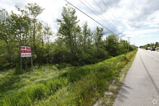
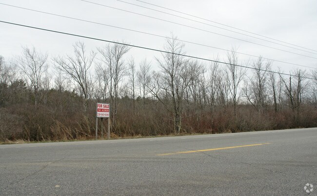
Property Record
135 Harold L Dow Hwy, Eliot, ME 03903
NEARBY LISTINGS FOR SALE OR LEASE
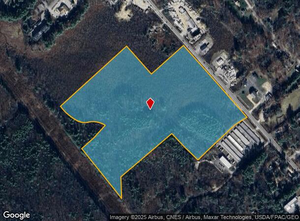
Property Detail
135 Harold L Dow Hwy
ELIO-000023-000008
York
Commercialacreage
Maine
A
45 AC
23031C0707G
York County
2024
Portland/South Portland
2024
Portland-South Portland, ME
037000
DEMOGRAPHICS near 135 Harold L Dow Hwy
1 Mile
3 Mile
5 Mile
2024 Total Population
1,230
13,995
41,758
2029 Population
1,289
14,679
43,762
Pop Growth 2024-2029
+ 4.80%
+ 4.89%
+ 4.80%
Average Age
45
44
45
2024 Total Households
518
6,195
18,639
HH Growth 2024-2029
+ 4.83%
+ 4.83%
+ 4.76%
Median Household Inc
$81,818
$81,742
$98,418
Avg Household Size
2.40
2.20
2.20
2024 Avg HH Vehicles
2.00
2.00
2.00
Median Home Value
$385,670
$400,307
$490,855
Median Year Built
1981
1980
1967
Nearby Places
Map Layers
Map Styles
 Street
 Aerial
- Restaurants
- Banks
- Shops
- Fitness
- Groceries
PUBLIC TRANSPORTATION
COMMUTER RAIL
Dover (Downeaster - Amtrak)
DRIVE
WALK
Distance
Dover (Downeaster - Amtrak)
17 min
8.6 mi
AIRPORT
Portsmouth International at Pease
DRIVE
WALK
Distance
Portsmouth International at Pease
13 min
6.6 mi
Freight Ports
Portland, ME
DRIVE
WALK
Distance
Portland, ME
60 min
50.8 mi
Nearby Properties
Address
Land Use
TOTAL SIZE
Lot Size
Zoning
Address
Land Use
TOTAL SIZE
Lot Size
Zoning
58.25 AC
COMM
Address
Land Use
TOTAL SIZE
Lot Size
Zoning
98.73 AC
C/I
Address
Land Use
TOTAL SIZE
Lot Size
Zoning
1,575 SF
52.95 AC
COMM
Address
Land Use
TOTAL SIZE
Lot Size
Zoning
22.33 AC
MU-N
Address
Land Use
TOTAL SIZE
Lot Size
Zoning
0.67 AC
VD
Address
Land Use
TOTAL SIZE
Lot Size
Zoning
19.26 AC
G1
Address
Land Use
TOTAL SIZE
Lot Size
Zoning
11.30 AC
G1
Address
Land Use
TOTAL SIZE
Lot Size
Zoning
15.94 AC
G1
Address
Land Use
TOTAL SIZE
Lot Size
Zoning
48.95 AC
WIND
Address
Land Use
TOTAL SIZE
Lot Size
Zoning
3.78 AC
COMM
Address
Land Use
TOTAL SIZE
Lot Size
Zoning
64.76 AC
WIND
Address
Land Use
TOTAL SIZE
Lot Size
Zoning
18.49 AC
GRB
Address
Land Use
TOTAL SIZE
Lot Size
Zoning
23.29 AC
G1
Address
Land Use
TOTAL SIZE
Lot Size
Zoning
3.97 AC
SD
Address
Land Use
TOTAL SIZE
Lot Size
Zoning
84,273 SF
13.61 AC
C-1
Address
Land Use
TOTAL SIZE
Lot Size
Zoning
9,060 SF
7.02 AC
IND
Address
Land Use
TOTAL SIZE
Lot Size
Zoning
39,780 SF
8.82 AC
OR
Address
Land Use
TOTAL SIZE
Lot Size
Zoning
5.45 AC
OFF
Address
Land Use
TOTAL SIZE
Lot Size
Zoning
117,028 SF
12.25 AC
G1
Address
Land Use
TOTAL SIZE
Lot Size
Zoning
238,513 SF
31.02 AC
COMM
Address
Land Use
TOTAL SIZE
Lot Size
Zoning
81,964 SF
6.99 AC
OR
Address
Land Use
TOTAL SIZE
Lot Size
Zoning
40,736 SF
14.82 AC
C-1
Address
Land Use
TOTAL SIZE
Lot Size
Zoning
101,643 SF
8.41 AC
OFF
Address
Land Use
TOTAL SIZE
Lot Size
Zoning
63,087 SF
1.83 AC
G1
Address
Land Use
TOTAL SIZE
Lot Size
Zoning
92,943 SF
8.55 AC
C-1
Address
Land Use
TOTAL SIZE
Lot Size
Zoning
201,109 SF
35.12 AC
WI
Address
Land Use
TOTAL SIZE
Lot Size
Zoning
10.78 AC
GRB
Address
Land Use
TOTAL SIZE
Lot Size
Zoning
275,051 SF
19.38 AC
COMM
Address
Land Use
TOTAL SIZE
Lot Size
Zoning
6.82 AC
GRB
Address
Land Use
TOTAL SIZE
Lot Size
Zoning
72,105 SF
PDA
The World's #1 Commercial Real Estate Marketplace
Connect with us
© 2025 CoStar Group
The information above has been obtained from sources believed reliable. While we do not doubt its accuracy we have not verified it and make no guarantee, warranty or representation about it. It is your responsibility to independently confirm its accuracy and completeness. Any projections, opinions, assumptions, or estimates used are for example only and do not represent the current or future performance of the property. The value of this transaction to you depends on tax and other factors which should be evaluated by your tax, financial, and legal advisors. You and your advisors should conduct a careful, independent investigation of the property to determine to your satisfaction the suitability of the property for your needs.