Property Record
135 Mitchell Blvd, San Rafael, CA 94903
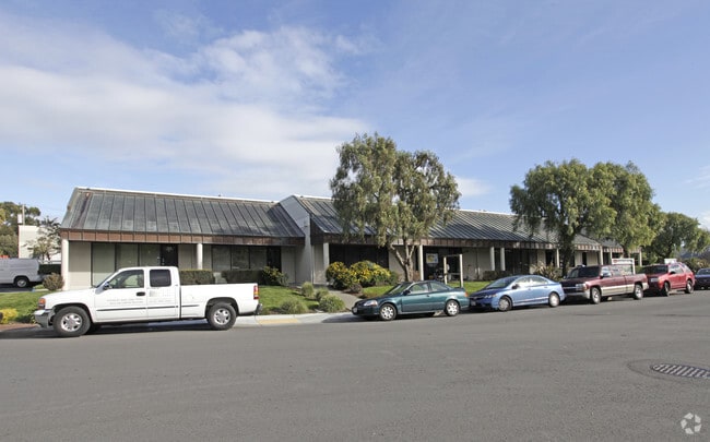


Property Detail
135 Mitchell Blvd
155-152-14
MARIN
Industrialgeneral
California
AE The base floodplain where base flood elevations are provided. AE Zones are now used on new format FIRMs instead of A1-A30 Zones.
1.82 AC
2025
San Rafael/Larkspur
2025
North Bay/Santa Rosa
108100
San Rafael, CA
28,763 SF
NEARBY LISTINGS FOR SALE OR LEASE
DEMOGRAPHICS near 135 Mitchell Blvd
1 mile
3 mile
5 mile
2025 Total Population
9,176
55,623
132,875
2030 Population
9,031
54,964
131,184
Pop Growth 2025-2030
(1.58%)
(1.18%)
(1.27%)
Average Age
45
45
45
2025 Total Households
3,768
22,418
52,166
HH Growth 2025-2030
(1.62%)
(1.24%)
(1.28%)
Median Household Inc
$113,898
$124,923
$126,616
Avg Household Size
2.30
2.40
2.40
2025 Avg HH Vehicles
2.00
2.00
2.00
Median Home Value
$895,203
$1,074,838
$1,090,683
Median Year Built
1975
1966
1965
Nearby Places
Map Layers
Map Styles
 Street
 Aerial
Layers
 Traffic
 Biking
Places
Listings with unknown addresses are not visible on the map
- Restaurants
- Banks
- Shops
- Fitness
- Groceries
PUBLIC TRANSPORTATION
COMMUTER RAIL
Drive
Walk
Distance
5 min
2.2 mi
Drive
Walk
Distance
8 min
3.7 mi
AIRPORT
San Francisco International
Drive
Walk
Distance
San Francisco International
56 min
35.2 mi
Metro Oakland International
Drive
Walk
Distance
Metro Oakland International
49 min
35.4 mi
SALE & LEASE HISTORY
LISTING DATE
SALE/LEASE

May 15, 2024
For Lease
Nearby Properties
Address
Land Use
TOTAL SIZE
Lot Size
Zoning
Address
Land Use
TOTAL SIZE
Lot Size
Zoning
283,663 SF
27.98 AC
Address
Land Use
TOTAL SIZE
Lot Size
Zoning
23.79 AC
Address
Land Use
TOTAL SIZE
Lot Size
Zoning
221,660 SF
9.69 AC
PC
Address
Land Use
TOTAL SIZE
Lot Size
Zoning
16.43 AC
Address
Land Use
TOTAL SIZE
Lot Size
Zoning
146,832 SF
5.50 AC
Address
Land Use
TOTAL SIZE
Lot Size
Zoning
167,392 SF
12.79 AC
Address
Land Use
TOTAL SIZE
Lot Size
Zoning
68,081 SF
3.41 AC
Address
Land Use
TOTAL SIZE
Lot Size
Zoning
147,502 SF
1.02 AC
Address
Land Use
TOTAL SIZE
Lot Size
Zoning
132,040 SF
11.74 AC
Address
Land Use
TOTAL SIZE
Lot Size
Zoning
11.63 AC
Address
Land Use
TOTAL SIZE
Lot Size
Zoning
75,888 SF
10.99 AC
Address
Land Use
TOTAL SIZE
Lot Size
Zoning
195,460 SF
6.10 AC
Address
Land Use
TOTAL SIZE
Lot Size
Zoning
Address
Land Use
TOTAL SIZE
Lot Size
Zoning
177,460 SF
13 AC
Address
Land Use
TOTAL SIZE
Lot Size
Zoning
11,830 SF
0.65 AC
Address
Land Use
TOTAL SIZE
Lot Size
Zoning
85,066 SF
1.29 AC
Address
Land Use
TOTAL SIZE
Lot Size
Zoning
192,037 SF
511.90 AC
Address
Land Use
TOTAL SIZE
Lot Size
Zoning
139,073 SF
8.98 AC
Address
Land Use
TOTAL SIZE
Lot Size
Zoning
33,641 SF
1.60 AC
Address
Land Use
TOTAL SIZE
Lot Size
Zoning
45,142 SF
2.32 AC
Address
Land Use
TOTAL SIZE
Lot Size
Zoning
6.39 AC
Address
Land Use
TOTAL SIZE
Lot Size
Zoning
142,341 SF
5.83 AC
Address
Land Use
TOTAL SIZE
Lot Size
Zoning
94,625 SF
8.96 AC
Address
Land Use
TOTAL SIZE
Lot Size
Zoning
132,813 SF
6.75 AC
Address
Land Use
TOTAL SIZE
Lot Size
Zoning
77,030 SF
3.34 AC
Address
Land Use
TOTAL SIZE
Lot Size
Zoning
124,196 SF
9.77 AC
Address
Land Use
TOTAL SIZE
Lot Size
Zoning
71,268 SF
5.52 AC
Address
Land Use
TOTAL SIZE
Lot Size
Zoning
7.24 AC
Address
Land Use
TOTAL SIZE
Lot Size
Zoning
The World's #1 Commercial Real Estate Marketplace
Connect with us
© 2026 CoStar Group
The information above has been obtained from sources believed reliable. While we do not doubt its accuracy we have not verified it and make no guarantee, warranty or representation about it. It is your responsibility to independently confirm its accuracy and completeness. Any projections, opinions, assumptions, or estimates used are for example only and do not represent the current or future performance of the property. The value of this transaction to you depends on tax and other factors which should be evaluated by your tax, financial, and legal advisors. You and your advisors should conduct a careful, independent investigation of the property to determine to your satisfaction the suitability of the property for your needs.