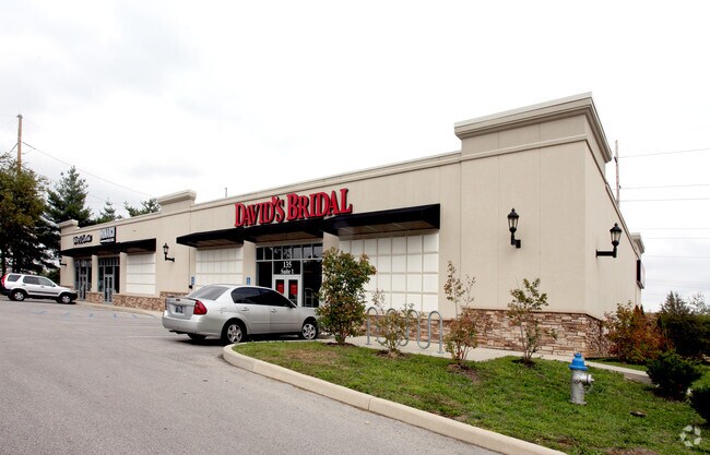
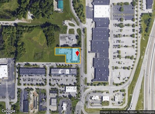
Property Record
135 N Gates Dr, Bloomington, IN 47404

NEARBY LISTINGS FOR SALE OR LEASE
Property Detail
135 N Gates Dr
Bloomington, IN
Whitehall Park
53-04-36-404-003.000-012
WHITEHALL PARK LOT 8A .95A
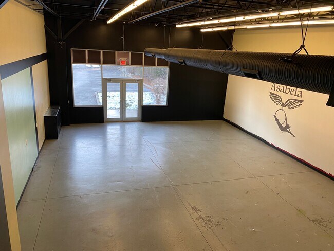
Storebuilding
Monroe
X
Indiana
18105C0137D
8a
2024
0.95 AC
2024
Bloomington/Terre Haute
001301
Other Market Areas
9,750 SF
DEMOGRAPHICS near 135 N Gates Dr
1 Mile
3 Mile
5 Mile
2024 Total Population
4,908
48,800
104,061
2029 Population
4,911
48,786
103,756
Pop Growth 2024-2029
+ 0.06%
(0.03%)
(0.29%)
Average Age
38
34
35
2024 Total Households
2,376
22,582
43,658
HH Growth 2024-2029
+ 0.08%
(0.08%)
(0.34%)
Median Household Inc
$39,927
$37,875
$46,709
Avg Household Size
2.00
2.00
2.10
2024 Avg HH Vehicles
1.00
2.00
2.00
Median Home Value
$103,717
$175,396
$229,339
Median Year Built
1990
1986
1987
Nearby Places
Map Layers
Map Styles
 Street
 Aerial
- Restaurants
- Banks
- Shops
- Fitness
- Groceries
SALE & LEASE HISTORY
LISTING DATE
SALE/LEASE

Sep 26, 2018
For Lease
Sep 15, 2021
For Sale
Nov 29, 2018
For Sale
Jul 23, 2019
For Lease
Jul 14, 2020
For Sale
Nearby Properties
Address
Land Use
TOTAL SIZE
Lot Size
Zoning
Address
Land Use
TOTAL SIZE
Lot Size
Zoning
442,250 SF
37.15 AC
Address
Land Use
TOTAL SIZE
Lot Size
Zoning
7,804 SF
7.22 AC
Address
Land Use
TOTAL SIZE
Lot Size
Zoning
496,556 SF
1.73 AC
Address
Land Use
TOTAL SIZE
Lot Size
Zoning
13,910 SF
3.86 AC
Address
Land Use
TOTAL SIZE
Lot Size
Zoning
261,278 SF
4.62 AC
Address
Land Use
TOTAL SIZE
Lot Size
Zoning
318,600 SF
43.80 AC
IL
Address
Land Use
TOTAL SIZE
Lot Size
Zoning
10,573 SF
3.28 AC
Address
Land Use
TOTAL SIZE
Lot Size
Zoning
8,064 SF
1.29 AC
Address
Land Use
TOTAL SIZE
Lot Size
Zoning
14,964 SF
12.34 AC
Address
Land Use
TOTAL SIZE
Lot Size
Zoning
19,128 SF
24.44 AC
Address
Land Use
TOTAL SIZE
Lot Size
Zoning
60,434 SF
29.85 AC
IG
Address
Land Use
TOTAL SIZE
Lot Size
Zoning
169,170 SF
0.72 AC
Address
Land Use
TOTAL SIZE
Lot Size
Zoning
8,190 SF
4.22 AC
Address
Land Use
TOTAL SIZE
Lot Size
Zoning
134,566 SF
0.60 AC
Address
Land Use
TOTAL SIZE
Lot Size
Zoning
7,500 SF
0.40 AC
Address
Land Use
TOTAL SIZE
Lot Size
Zoning
181,798 SF
0.80 AC
Address
Land Use
TOTAL SIZE
Lot Size
Zoning
32,737 SF
0.93 AC
Address
Land Use
TOTAL SIZE
Lot Size
Zoning
18,772 SF
2.69 AC
Address
Land Use
TOTAL SIZE
Lot Size
Zoning
53,005 SF
10.03 AC
PUD
Address
Land Use
TOTAL SIZE
Lot Size
Zoning
14,376 SF
11.03 AC
Address
Land Use
TOTAL SIZE
Lot Size
Zoning
576 SF
13 AC
Address
Land Use
TOTAL SIZE
Lot Size
Zoning
269,822 SF
27.95 AC
Address
Land Use
TOTAL SIZE
Lot Size
Zoning
38,208 SF
8.03 AC
Address
Land Use
TOTAL SIZE
Lot Size
Zoning
1,120 SF
11.95 AC
Address
Land Use
TOTAL SIZE
Lot Size
Zoning
64,798 SF
18.32 AC
RE1
Address
Land Use
TOTAL SIZE
Lot Size
Zoning
19,623 SF
8.21 AC
Address
Land Use
TOTAL SIZE
Lot Size
Zoning
10,573 SF
1.30 AC
Address
Land Use
TOTAL SIZE
Lot Size
Zoning
78,474 SF
0.35 AC
Address
Land Use
TOTAL SIZE
Lot Size
Zoning
119,952 SF
0.82 AC
Address
Land Use
TOTAL SIZE
Lot Size
Zoning
6,120 SF
36.03 AC
The World's #1 Commercial Real Estate Marketplace
Connect with us
© 2025 CoStar Group
The information above has been obtained from sources believed reliable. While we do not doubt its accuracy we have not verified it and make no guarantee, warranty or representation about it. It is your responsibility to independently confirm its accuracy and completeness. Any projections, opinions, assumptions, or estimates used are for example only and do not represent the current or future performance of the property. The value of this transaction to you depends on tax and other factors which should be evaluated by your tax, financial, and legal advisors. You and your advisors should conduct a careful, independent investigation of the property to determine to your satisfaction the suitability of the property for your needs.