Property Record
135 Providence Pike, Putnam, CT 06260

Property Detail
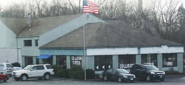
135 Providence Pike
PUTN-000027-000000-000021
Northeastern Ct
Commercialbuilding
Connecticut
HC
21
B and X Area of moderate flood hazard, usually the area between the limits of the 100-year and 500-year floods.
4 AC
2025
Windham County
2025
Hartford
903200
Willimantic, CT
13,990 SF
NEARBY LISTINGS FOR SALE OR LEASE
-
-
View all Putnam listings for sale on LoopNet.com
DEMOGRAPHICS near 135 Providence Pike
1 mile
3 mile
5 mile
2025 Total Population
400
11,233
20,881
2030 Population
409
11,507
21,394
Pop Growth 2025-2030
+ 2.25%
+ 2.44%
+ 2.46%
Average Age
47
44
43
2025 Total Households
160
4,852
8,620
HH Growth 2025-2030
+ 2.50%
+ 2.58%
+ 2.60%
Median Household Inc
$97,595
$74,703
$86,738
Avg Household Size
2.40
2.30
2.30
2025 Avg HH Vehicles
2.00
2.00
2.00
Median Home Value
$364,102
$269,353
$291,518
Median Year Built
1965
1958
1964
Nearby Places
Map Layers
Map Styles
 Street
 Aerial
Layers
 Traffic
 Biking
Places
Listings with unknown addresses are not visible on the map
- Restaurants
- Banks
- Shops
- Fitness
- Groceries
PUBLIC TRANSPORTATION
AIRPORT
Worcester Regional
Drive
Walk
Distance
Worcester Regional
42 min
28.0 mi
Rhode Island Tf Green International
Drive
Walk
Distance
Rhode Island Tf Green International
54 min
33.9 mi
Freight Ports
Port of Davisville, RI
Drive
Walk
Distance
Port of Davisville, RI
64 min
43.1 mi
Nearby Properties
Address
Land Use
TOTAL SIZE
Lot Size
Zoning
Address
Land Use
TOTAL SIZE
Lot Size
Zoning
13.76 AC
M/OD
Address
Land Use
TOTAL SIZE
Lot Size
Zoning
199,059 SF
31.65 AC
R-10
Address
Land Use
TOTAL SIZE
Lot Size
Zoning
104,330 SF
15 AC
R-10
Address
Land Use
TOTAL SIZE
Lot Size
Zoning
37,203 SF
7.21 AC
P
Address
Land Use
TOTAL SIZE
Lot Size
Zoning
17.41 AC
GC
Address
Land Use
TOTAL SIZE
Lot Size
Zoning
142,599 SF
17.59 AC
HC
Address
Land Use
TOTAL SIZE
Lot Size
Zoning
131,792 SF
18.69 AC
I
Address
Land Use
TOTAL SIZE
Lot Size
Zoning
68,227 SF
55 AC
AG-2
Address
Land Use
TOTAL SIZE
Lot Size
Zoning
4,212 SF
8.25 AC
R-10
Address
Land Use
TOTAL SIZE
Lot Size
Zoning
92,080 SF
7.10 AC
I
Address
Land Use
TOTAL SIZE
Lot Size
Zoning
7,009 SF
15.70 AC
TCDD
Address
Land Use
TOTAL SIZE
Lot Size
Zoning
49,195 SF
8.57 AC
AG-2
Address
Land Use
TOTAL SIZE
Lot Size
Zoning
10.08 AC
R-10
Address
Land Use
TOTAL SIZE
Lot Size
Zoning
70,608 SF
5.70 AC
HC
Address
Land Use
TOTAL SIZE
Lot Size
Zoning
101,136 SF
15.07 AC
HC
Address
Land Use
TOTAL SIZE
Lot Size
Zoning
38.20 AC
RRAD
Address
Land Use
TOTAL SIZE
Lot Size
Zoning
31,860 SF
7.69 AC
HC
Address
Land Use
TOTAL SIZE
Lot Size
Zoning
68,754 SF
9.10 AC
I
Address
Land Use
TOTAL SIZE
Lot Size
Zoning
80,010 SF
9 AC
I
Address
Land Use
TOTAL SIZE
Lot Size
Zoning
28,990 SF
17 AC
R-40
Address
Land Use
TOTAL SIZE
Lot Size
Zoning
61,373 SF
121.12 AC
TCVD
Address
Land Use
TOTAL SIZE
Lot Size
Zoning
72,281 SF
2.84 AC
R-10
Address
Land Use
TOTAL SIZE
Lot Size
Zoning
55,120 SF
7.46 AC
I
Address
Land Use
TOTAL SIZE
Lot Size
Zoning
13.06 AC
I
Address
Land Use
TOTAL SIZE
Lot Size
Zoning
64,209 SF
4.91 AC
R-7
Address
Land Use
TOTAL SIZE
Lot Size
Zoning
63,561 SF
6.04 AC
I
Address
Land Use
TOTAL SIZE
Lot Size
Zoning
3.03 AC
M/OD
Address
Land Use
TOTAL SIZE
Lot Size
Zoning
62,624 SF
14.25 AC
I
Address
Land Use
TOTAL SIZE
Lot Size
Zoning
13.20 AC
R-40
Address
Land Use
TOTAL SIZE
Lot Size
Zoning
46,091 SF
4.78 AC
I
The World's #1 Commercial Real Estate Marketplace
Connect with us
© 2026 CoStar Group
The information above has been obtained from sources believed reliable. While we do not doubt its accuracy we have not verified it and make no guarantee, warranty or representation about it. It is your responsibility to independently confirm its accuracy and completeness. Any projections, opinions, assumptions, or estimates used are for example only and do not represent the current or future performance of the property. The value of this transaction to you depends on tax and other factors which should be evaluated by your tax, financial, and legal advisors. You and your advisors should conduct a careful, independent investigation of the property to determine to your satisfaction the suitability of the property for your needs.