Property Record
135 Spring Forest Dr, Mebane, NC 27302
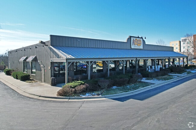


Property Detail
135 Spring Forest Dr
163587
DEERFIELD CROSSING AND TH LT 14 10-17C-14
Restaurantbuilding
Orange
B 2
North Carolina
B and X Area of moderate flood hazard, usually the area between the limits of the 100-year and 500-year floods.
14
2025
2.75 AC
2025
SE Alamance County
021205
Greensboro/Winston-Salem
9,945 SF
Burlington, NC
NEARBY LISTINGS FOR SALE OR LEASE
-
-
View all Mebane listings for sale on LoopNet.com
DEMOGRAPHICS near 135 Spring Forest Dr
1 mile
3 mile
5 mile
2025 Total Population
4,145
22,103
45,410
2030 Population
4,368
23,341
48,029
Pop Growth 2025-2030
+ 5.38%
+ 5.60%
+ 5.77%
Average Age
38
39
40
2025 Total Households
1,735
8,957
18,424
HH Growth 2025-2030
+ 5.59%
+ 5.79%
+ 5.93%
Median Household Inc
$86,523
$79,988
$76,627
Avg Household Size
2.30
2.40
2.40
2025 Avg HH Vehicles
2.00
2.00
2.00
Median Home Value
$343,625
$327,882
$302,502
Median Year Built
2005
1999
1996
Nearby Places
Map Layers
Map Styles
 Street
 Aerial
Layers
 Traffic
 Biking
Places
Listings with unknown addresses are not visible on the map
- Restaurants
- Banks
- Shops
- Fitness
- Groceries
PUBLIC TRANSPORTATION
COMMUTER RAIL
Burlington Station (Piedmont - North Carolina by Train (NC Train))
Drive
Walk
Distance
Burlington Station (Piedmont - North Carolina by Train (NC Train))
14 min
9.4 mi
AIRPORT
Raleigh-Durham International
Drive
Walk
Distance
Raleigh-Durham International
49 min
37.8 mi
Nearby Properties
Address
Land Use
TOTAL SIZE
Lot Size
Zoning
Address
Land Use
TOTAL SIZE
Lot Size
Zoning
18,778 SF
167.10 AC
R20
Address
Land Use
TOTAL SIZE
Lot Size
Zoning
22,500 SF
100.73 AC
Address
Land Use
TOTAL SIZE
Lot Size
Zoning
919,840 SF
85.58 AC
Address
Land Use
TOTAL SIZE
Lot Size
Zoning
9,728 SF
184.66 AC
M 2
Address
Land Use
TOTAL SIZE
Lot Size
Zoning
36,234 SF
13 AC
CR
Address
Land Use
TOTAL SIZE
Lot Size
Zoning
54,882 SF
52 AC
Address
Land Use
TOTAL SIZE
Lot Size
Zoning
8,024 SF
20.22 AC
R6
Address
Land Use
TOTAL SIZE
Lot Size
Zoning
27,803 SF
21.86 AC
R20
Address
Land Use
TOTAL SIZE
Lot Size
Zoning
223,391 SF
81.89 AC
R 20
Address
Land Use
TOTAL SIZE
Lot Size
Zoning
198,228 SF
25.26 AC
Address
Land Use
TOTAL SIZE
Lot Size
Zoning
367,187 SF
23.75 AC
M2
Address
Land Use
TOTAL SIZE
Lot Size
Zoning
26,916 SF
14.76 AC
PUD
Address
Land Use
TOTAL SIZE
Lot Size
Zoning
476,857 SF
27.47 AC
M 2
Address
Land Use
TOTAL SIZE
Lot Size
Zoning
169,091 SF
6.76 AC
B1
Address
Land Use
TOTAL SIZE
Lot Size
Zoning
296,940 SF
33.78 AC
Address
Land Use
TOTAL SIZE
Lot Size
Zoning
231,346 SF
37.07 AC
M 2
Address
Land Use
TOTAL SIZE
Lot Size
Zoning
37,242 SF
10.50 AC
CR
Address
Land Use
TOTAL SIZE
Lot Size
Zoning
47,648 SF
18.48 AC
R8
Address
Land Use
TOTAL SIZE
Lot Size
Zoning
26,970 SF
13.72 AC
B 2
Address
Land Use
TOTAL SIZE
Lot Size
Zoning
248,000 SF
21.77 AC
Address
Land Use
TOTAL SIZE
Lot Size
Zoning
180,000 SF
78.86 AC
M 2
Address
Land Use
TOTAL SIZE
Lot Size
Zoning
76,224 SF
12.22 AC
Address
Land Use
TOTAL SIZE
Lot Size
Zoning
29,400 SF
9.02 AC
B2
Address
Land Use
TOTAL SIZE
Lot Size
Zoning
316,832 SF
41.84 AC
M 1
Address
Land Use
TOTAL SIZE
Lot Size
Zoning
183,630 SF
10 AC
M2
Address
Land Use
TOTAL SIZE
Lot Size
Zoning
750 SF
65.26 AC
M 2
Address
Land Use
TOTAL SIZE
Lot Size
Zoning
134,000 SF
23.33 AC
Address
Land Use
TOTAL SIZE
Lot Size
Zoning
59,564 SF
21.33 AC
R20
Address
Land Use
TOTAL SIZE
Lot Size
Zoning
41,811 SF
40.31 AC
ME
Address
Land Use
TOTAL SIZE
Lot Size
Zoning
134,540 SF
16.31 AC
M 2
The World's #1 Commercial Real Estate Marketplace
Connect with us
© 2026 CoStar Group
The information above has been obtained from sources believed reliable. While we do not doubt its accuracy we have not verified it and make no guarantee, warranty or representation about it. It is your responsibility to independently confirm its accuracy and completeness. Any projections, opinions, assumptions, or estimates used are for example only and do not represent the current or future performance of the property. The value of this transaction to you depends on tax and other factors which should be evaluated by your tax, financial, and legal advisors. You and your advisors should conduct a careful, independent investigation of the property to determine to your satisfaction the suitability of the property for your needs.