Property Record
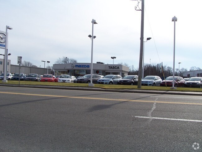
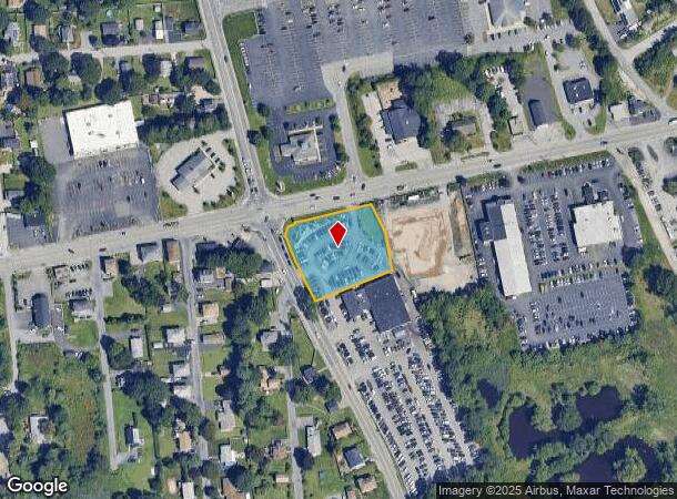
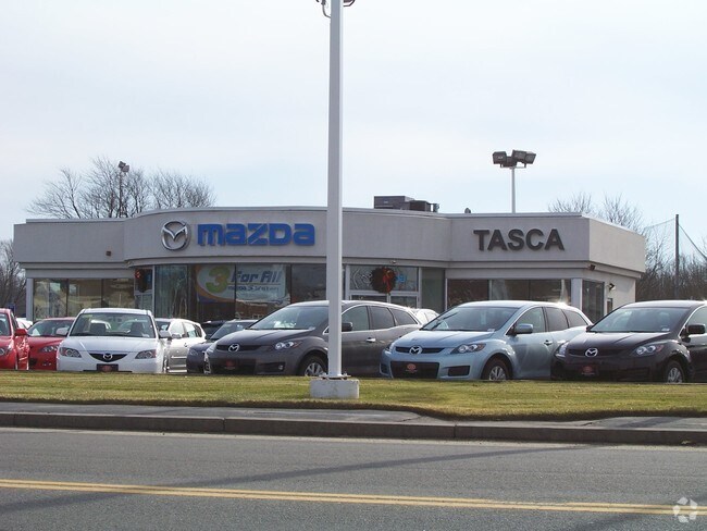
135 Taunton Ave, Seekonk, MA 02771
NEARBY LISTINGS FOR SALE OR LEASE
Property Detail
135 Taunton Ave
SEEK-000140-000000-000820
Bristol
Vehiclerentalsvehiclesales
Massachusetts
X
820
44007C0329H
1.07 AC
2025
Attleboro/New Bedford
2025
Boston
632200
Providence-Warwick, RI-MA
2,848 SF
DEMOGRAPHICS near 135 Taunton Ave
1 Mile
3 Mile
5 Mile
2024 Total Population
4,400
63,404
266,185
2029 Population
4,365
63,207
263,860
Pop Growth 2024-2029
(0.80%)
(0.31%)
(0.87%)
Average Age
44
42
39
2024 Total Households
1,931
27,513
107,747
HH Growth 2024-2029
(0.88%)
(0.40%)
(0.83%)
Median Household Inc
$77,349
$72,831
$63,546
Avg Household Size
2.30
2.20
2.30
2024 Avg HH Vehicles
2.00
2.00
1.00
Median Home Value
$363,037
$348,520
$316,457
Median Year Built
1951
1954
1949
Nearby Places
Map Layers
Map Styles
 Street
 Aerial
- Restaurants
- Banks
- Shops
- Fitness
- Groceries
PUBLIC TRANSPORTATION
COMMUTER RAIL
Providence (Providence/Stoughton Line - Massachusetts Bay Transportation Authority Commuter Rail (Purple Line))
DRIVE
WALK
Distance
Providence (Providence/Stoughton Line - Massachusetts Bay Transportation Authority Commuter Rail (Purple Line))
8 min
4.8 mi
DRIVE
WALK
Distance
10 min
5.2 mi
AIRPORT
Rhode Island Tf Green International
DRIVE
WALK
Distance
Rhode Island Tf Green International
22 min
11.7 mi
Worcester Regional
DRIVE
WALK
Distance
Worcester Regional
66 min
49.0 mi
Freight Ports
Port of Davisville, RI
DRIVE
WALK
Distance
Port of Davisville, RI
38 min
24.1 mi
Nearby Properties
Address
Land Use
TOTAL SIZE
Lot Size
Zoning
Address
Land Use
TOTAL SIZE
Lot Size
Zoning
317,728 SF
28.20 AC
O1
Address
Land Use
TOTAL SIZE
Lot Size
Zoning
79.57 AC
O1
Address
Land Use
TOTAL SIZE
Lot Size
Zoning
4.21 AC
I-2
Address
Land Use
TOTAL SIZE
Lot Size
Zoning
140,769 SF
5.37 AC
PS
Address
Land Use
TOTAL SIZE
Lot Size
Zoning
255,438 SF
174 SF
I-1-75
Address
Land Use
TOTAL SIZE
Lot Size
Zoning
Address
Land Use
TOTAL SIZE
Lot Size
Zoning
15.20 AC
R5
Address
Land Use
TOTAL SIZE
Lot Size
Zoning
38.09 AC
CD
Address
Land Use
TOTAL SIZE
Lot Size
Zoning
455.47 AC
I3
Address
Land Use
TOTAL SIZE
Lot Size
Zoning
139.58 AC
O1
Address
Land Use
TOTAL SIZE
Lot Size
Zoning
225,067 SF
40.70 AC
HB
Address
Land Use
TOTAL SIZE
Lot Size
Zoning
6.48 AC
R-1
Address
Land Use
TOTAL SIZE
Lot Size
Zoning
8.05 AC
C1
Address
Land Use
TOTAL SIZE
Lot Size
Zoning
Address
Land Use
TOTAL SIZE
Lot Size
Zoning
18.01 AC
C3
Address
Land Use
TOTAL SIZE
Lot Size
Zoning
4.62 AC
R5
Address
Land Use
TOTAL SIZE
Lot Size
Zoning
12.67 AC
R5
Address
Land Use
TOTAL SIZE
Lot Size
Zoning
170,345 SF
3.76 AC
R6
Address
Land Use
TOTAL SIZE
Lot Size
Zoning
171,290 SF
27.80 AC
R2
Address
Land Use
TOTAL SIZE
Lot Size
Zoning
225,458 SF
24.95 AC
I1
Address
Land Use
TOTAL SIZE
Lot Size
Zoning
6.89 AC
RS
Address
Land Use
TOTAL SIZE
Lot Size
Zoning
339,222 SF
32.67 AC
PA
Address
Land Use
TOTAL SIZE
Lot Size
Zoning
223,374 SF
14 AC
O1
Address
Land Use
TOTAL SIZE
Lot Size
Zoning
200,200 SF
11.64 AC
I1
Address
Land Use
TOTAL SIZE
Lot Size
Zoning
87,544 SF
5.05 AC
KP
Address
Land Use
TOTAL SIZE
Lot Size
Zoning
7.44 AC
R5
Address
Land Use
TOTAL SIZE
Lot Size
Zoning
105,859 SF
16.08 AC
HB
Address
Land Use
TOTAL SIZE
Lot Size
Zoning
105,859 SF
16.08 AC
HB
Address
Land Use
TOTAL SIZE
Lot Size
Zoning
63,475 SF
0.66 AC
Address
Land Use
TOTAL SIZE
Lot Size
Zoning
139,692 SF
15.92 AC
HB
The World's #1 Commercial Real Estate Marketplace
Connect with us
© 2025 CoStar Group
The information above has been obtained from sources believed reliable. While we do not doubt its accuracy we have not verified it and make no guarantee, warranty or representation about it. It is your responsibility to independently confirm its accuracy and completeness. Any projections, opinions, assumptions, or estimates used are for example only and do not represent the current or future performance of the property. The value of this transaction to you depends on tax and other factors which should be evaluated by your tax, financial, and legal advisors. You and your advisors should conduct a careful, independent investigation of the property to determine to your satisfaction the suitability of the property for your needs.