Property Record
135 W Dimond Blvd, Anchorage, AK 99515
NEARBY LISTINGS FOR SALE OR LEASE
Property Detail
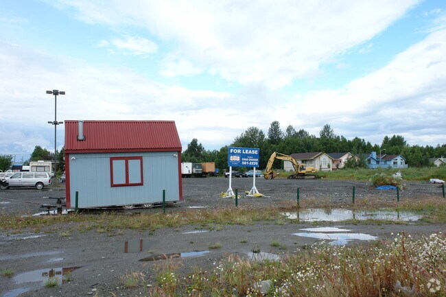
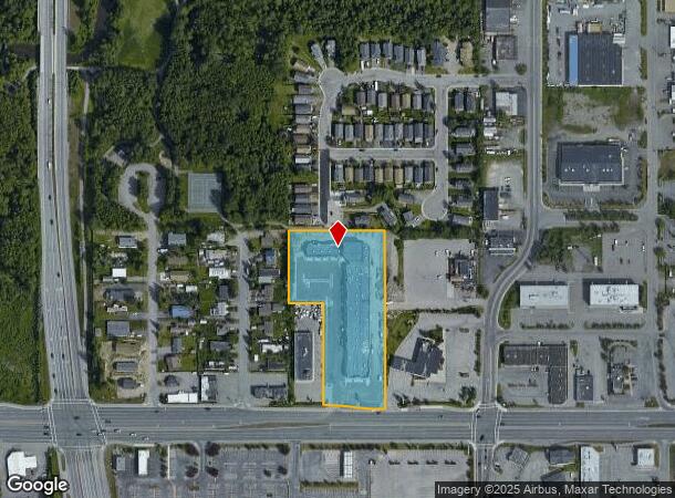
135 W Dimond Blvd
01307154000
Martens Indl Add 01 02A-1
Regionalshoppingcenterormallwithanchorstore
MARTENS INDUSTRIAL #1 TR 2A-1
X
Anchorage
0200050744D
Alaska
2024
3.63 AC
2025
W Tudor/Dimond-15
002502
Anchorage
47,693 SF
Anchorage, AK
DEMOGRAPHICS near 135 W Dimond Blvd
1 Mile
3 Mile
5 Mile
2024 Total Population
9,499
93,103
172,421
2029 Population
9,351
91,436
169,744
Pop Growth 2024-2029
(1.56%)
(1.79%)
(1.55%)
Average Age
37
37
38
2024 Total Households
3,649
35,497
67,613
HH Growth 2024-2029
(1.89%)
(1.85%)
(1.57%)
Median Household Inc
$74,907
$91,569
$90,553
Avg Household Size
2.50
2.50
2.40
2024 Avg HH Vehicles
2.00
2.00
2.00
Median Home Value
$260,827
$332,914
$352,226
Median Year Built
1983
1983
1980
Nearby Places
Map Layers
Map Styles
 Street
 Aerial
- Restaurants
- Banks
- Shops
- Fitness
- Groceries
PUBLIC TRANSPORTATION
AIRPORT
Ted Stevens Anchorage International
DRIVE
WALK
Distance
Ted Stevens Anchorage International
12 min
6.0 mi
Merrill Field
DRIVE
WALK
Distance
Merrill Field
15 min
7.1 mi
Freight Ports
Port of Anchorage
DRIVE
WALK
Distance
Port of Anchorage
15 min
7.2 mi
Nearby Properties
Address
Land Use
TOTAL SIZE
Lot Size
Zoning
Address
Land Use
TOTAL SIZE
Lot Size
Zoning
117,702 SF
9.85 AC
B3SL
Address
Land Use
TOTAL SIZE
Lot Size
Zoning
134,626 SF
16.91 AC
PLI
Address
Land Use
TOTAL SIZE
Lot Size
Zoning
381,477 SF
33.30 AC
B3
Address
Land Use
TOTAL SIZE
Lot Size
Zoning
267,442 SF
61.04 AC
PLI
Address
Land Use
TOTAL SIZE
Lot Size
Zoning
61,127 SF
3.04 AC
B3
Address
Land Use
TOTAL SIZE
Lot Size
Zoning
121,359 SF
4.35 AC
B3SL
Address
Land Use
TOTAL SIZE
Lot Size
Zoning
56,747 SF
6.89 AC
B3SL
Address
Land Use
TOTAL SIZE
Lot Size
Zoning
66,354 SF
44.23 AC
I2
Address
Land Use
TOTAL SIZE
Lot Size
Zoning
242,189 SF
21.83 AC
I2
Address
Land Use
TOTAL SIZE
Lot Size
Zoning
168,640 SF
3.38 AC
I2
Address
Land Use
TOTAL SIZE
Lot Size
Zoning
69 AC
PR
Address
Land Use
TOTAL SIZE
Lot Size
Zoning
112,874 SF
6.61 AC
ROSL
Address
Land Use
TOTAL SIZE
Lot Size
Zoning
217,754 SF
14.42 AC
I1
Address
Land Use
TOTAL SIZE
Lot Size
Zoning
103,442 SF
3.50 AC
B3
Address
Land Use
TOTAL SIZE
Lot Size
Zoning
150,075 SF
29.17 AC
PLI
Address
Land Use
TOTAL SIZE
Lot Size
Zoning
164,774 SF
29.26 AC
PLI
Address
Land Use
TOTAL SIZE
Lot Size
Zoning
31,780 SF
16.44 AC
R3
Address
Land Use
TOTAL SIZE
Lot Size
Zoning
116,420 SF
14.86 AC
B3
Address
Land Use
TOTAL SIZE
Lot Size
Zoning
57,211 SF
4.88 AC
B3
Address
Land Use
TOTAL SIZE
Lot Size
Zoning
154,455 SF
16.38 AC
I1
Address
Land Use
TOTAL SIZE
Lot Size
Zoning
36,178 SF
2.19 AC
I1
Address
Land Use
TOTAL SIZE
Lot Size
Zoning
59,908 SF
5.54 AC
I1
Address
Land Use
TOTAL SIZE
Lot Size
Zoning
29,850 SF
9.44 AC
PLI
Address
Land Use
TOTAL SIZE
Lot Size
Zoning
13,657 SF
12.35 AC
R3
Address
Land Use
TOTAL SIZE
Lot Size
Zoning
79,808 SF
19.54 AC
I2
Address
Land Use
TOTAL SIZE
Lot Size
Zoning
61,674 SF
5 AC
B3SL
Address
Land Use
TOTAL SIZE
Lot Size
Zoning
32,247 SF
2.21 AC
B3
Address
Land Use
TOTAL SIZE
Lot Size
Zoning
170,381 SF
10.70 AC
I2
Address
Land Use
TOTAL SIZE
Lot Size
Zoning
151,322 SF
9.18 AC
I1
Address
Land Use
TOTAL SIZE
Lot Size
Zoning
178,437 SF
16.02 AC
B3SL
The World's #1 Commercial Real Estate Marketplace
Connect with us
© 2026 CoStar Group
The information above has been obtained from sources believed reliable. While we do not doubt its accuracy we have not verified it and make no guarantee, warranty or representation about it. It is your responsibility to independently confirm its accuracy and completeness. Any projections, opinions, assumptions, or estimates used are for example only and do not represent the current or future performance of the property. The value of this transaction to you depends on tax and other factors which should be evaluated by your tax, financial, and legal advisors. You and your advisors should conduct a careful, independent investigation of the property to determine to your satisfaction the suitability of the property for your needs.