Property Record
135 Will Dr, Canton, MA 02021
Property Detail
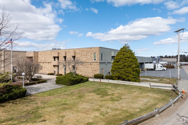
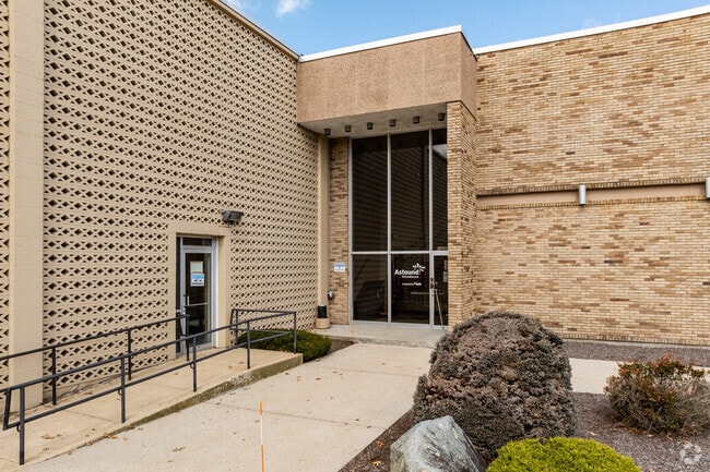
135 Will Dr
Warehouse
NORFOLK
6
Massachusetts
AE The base floodplain where base flood elevations are provided. AE Zones are now used on new format FIRMs instead of A1-A30 Zones.
10 AC
2025
Route 1 South
2025
Boston
415101
Boston-Cambridge-Newton, MA-NH
417,014 SF
CANT-000057-000000-000073
NEARBY LISTINGS FOR SALE OR LEASE
DEMOGRAPHICS near 135 Will Dr
1 mile
3 mile
5 mile
2025 Total Population
8,761
52,421
129,247
2030 Population
8,972
53,652
131,943
Pop Growth 2025-2030
+ 2.41%
+ 2.35%
+ 2.09%
Average Age
44
43
42
2025 Total Households
3,932
20,442
48,983
HH Growth 2025-2030
+ 2.62%
+ 2.52%
+ 2.16%
Median Household Inc
$84,763
$115,531
$110,673
Avg Household Size
2.20
2.50
2.60
2025 Avg HH Vehicles
2.00
2.00
2.00
Median Home Value
$539,348
$680,906
$665,896
Median Year Built
1973
1969
1968
Nearby Places
Map Layers
Map Styles
 Street
 Aerial
Layers
 Traffic
 Biking
Places
Listings with unknown addresses are not visible on the map
- Restaurants
- Banks
- Shops
- Fitness
- Groceries
SALE & LEASE HISTORY
LISTING DATE
SALE/LEASE

Sep 30, 2020
For Lease
Sep 25, 2016
For Lease
Jul 12, 2023
For Lease
Dec 16, 2021
For Lease
Nearby Properties
Address
Land Use
TOTAL SIZE
Lot Size
Zoning
Address
Land Use
TOTAL SIZE
Lot Size
Zoning
543,189 SF
22.90 AC
6
Address
Land Use
TOTAL SIZE
Lot Size
Zoning
403,163 SF
24.58 AC
I
Address
Land Use
TOTAL SIZE
Lot Size
Zoning
56,088 SF
23.94 AC
I
Address
Land Use
TOTAL SIZE
Lot Size
Zoning
154,871 SF
34.30 AC
10
Address
Land Use
TOTAL SIZE
Lot Size
Zoning
198,120 SF
51 AC
3
Address
Land Use
TOTAL SIZE
Lot Size
Zoning
214,600 SF
20.30 AC
RU
Address
Land Use
TOTAL SIZE
Lot Size
Zoning
160,716 SF
18.87 AC
11
Address
Land Use
TOTAL SIZE
Lot Size
Zoning
7.27 AC
GB
Address
Land Use
TOTAL SIZE
Lot Size
Zoning
130,356 SF
14.70 AC
9
Address
Land Use
TOTAL SIZE
Lot Size
Zoning
12.24 AC
I
Address
Land Use
TOTAL SIZE
Lot Size
Zoning
70,216 SF
6.86 AC
7
Address
Land Use
TOTAL SIZE
Lot Size
Zoning
298,820 SF
19.65 AC
6
Address
Land Use
TOTAL SIZE
Lot Size
Zoning
140,489 SF
36.47 AC
11
Address
Land Use
TOTAL SIZE
Lot Size
Zoning
77,791 SF
2.24 AC
3
Address
Land Use
TOTAL SIZE
Lot Size
Zoning
133,125 SF
16.13 AC
7
Address
Land Use
TOTAL SIZE
Lot Size
Zoning
128,760 SF
19.51 AC
6
Address
Land Use
TOTAL SIZE
Lot Size
Zoning
66,139 SF
20.30 AC
9
Address
Land Use
TOTAL SIZE
Lot Size
Zoning
94,356 SF
10 AC
6
Address
Land Use
TOTAL SIZE
Lot Size
Zoning
107,467 SF
19.59 AC
Address
Land Use
TOTAL SIZE
Lot Size
Zoning
93,330 SF
13.90 AC
6
Address
Land Use
TOTAL SIZE
Lot Size
Zoning
102,480 SF
12.30 AC
6
Address
Land Use
TOTAL SIZE
Lot Size
Zoning
168,224 SF
11.83 AC
6
Address
Land Use
TOTAL SIZE
Lot Size
Zoning
77,212 SF
2.40 AC
5
Address
Land Use
TOTAL SIZE
Lot Size
Zoning
87,655 SF
3.39 AC
GB
Address
Land Use
TOTAL SIZE
Lot Size
Zoning
109,800 SF
12.60 AC
6
Address
Land Use
TOTAL SIZE
Lot Size
Zoning
101,098 SF
6.50 AC
6
Address
Land Use
TOTAL SIZE
Lot Size
Zoning
80,315 SF
9.31 AC
6
Address
Land Use
TOTAL SIZE
Lot Size
Zoning
65,607 SF
16.90 AC
5
Address
Land Use
TOTAL SIZE
Lot Size
Zoning
142,562 SF
6.98 AC
I
The World's #1 Commercial Real Estate Marketplace
Connect with us
© 2026 CoStar Group
The information above has been obtained from sources believed reliable. While we do not doubt its accuracy we have not verified it and make no guarantee, warranty or representation about it. It is your responsibility to independently confirm its accuracy and completeness. Any projections, opinions, assumptions, or estimates used are for example only and do not represent the current or future performance of the property. The value of this transaction to you depends on tax and other factors which should be evaluated by your tax, financial, and legal advisors. You and your advisors should conduct a careful, independent investigation of the property to determine to your satisfaction the suitability of the property for your needs.