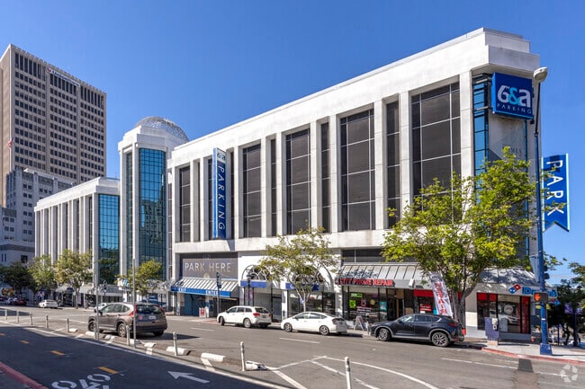
Property Record
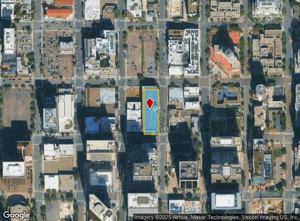
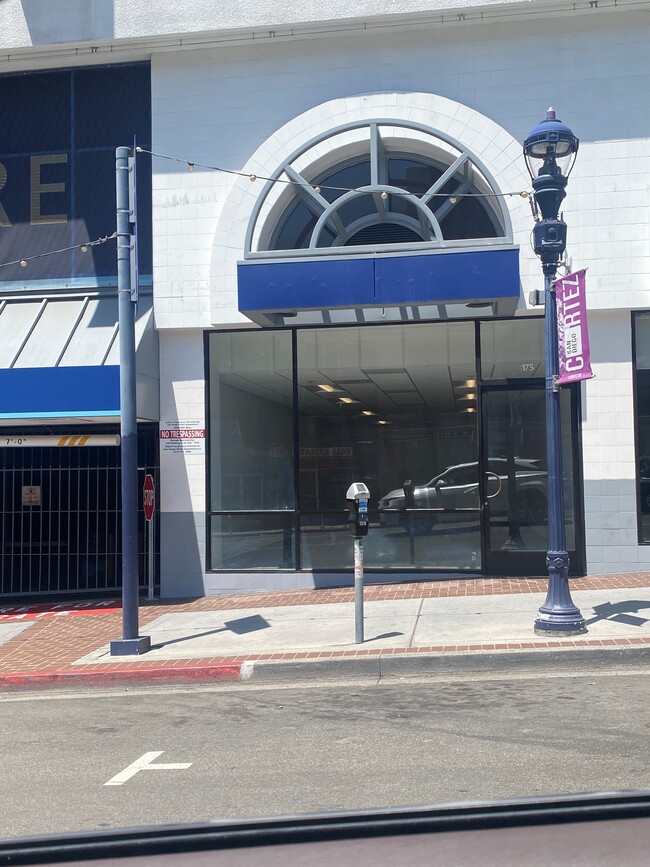
1350 6Th Ave, San Diego, CA 92101

Current Lease Availabilities
NEARBY LISTINGS FOR SALE OR LEASE
Property Detail
1350 6Th Ave
San Diego-Chula Vista-Carlsbad, CA
Hortons Add Lockling
533-453-09
BLK 191 LOTS G THRU L LOTS 1&2 BLK 4 MAP 150& TR DB0013PG522
Storesoffices
San Diego
X
California
06073C1881H
1-2,g
2025
0.65 AC
2025
Downtown
005301
San Diego
99,999 SF
DEMOGRAPHICS near 1350 6Th Ave
1 mile
3 mile
5 mile
2024 Total Population
54,470
197,819
486,301
2029 Population
55,218
198,250
485,673
Pop Growth 2024-2029
+ 1.37%
+ 0.22%
(0.13%)
Average Age
43
40
38
2024 Total Households
31,582
94,186
198,174
HH Growth 2024-2029
+ 1.49%
+ 0.33%
(0.02%)
Median Household Inc
$80,321
$82,221
$75,044
Avg Household Size
1.50
1.90
2.20
2024 Avg HH Vehicles
1.00
1.00
2.00
Median Home Value
$808,572
$877,159
$792,343
Median Year Built
2003
1978
1974
Nearby Places
Map Layers
Map Styles
 Street
 Aerial
Transit
 Traffic
 Biking
Places
Listings with unknown addresses are not visible on the map
- Restaurants
- Banks
- Shops
- Fitness
- Groceries
PUBLIC TRANSPORTATION
TRANSIT/SUBWAY
5th Avenue (Blue Line - San Diego Metropolitan Transit System Trolley (San Diego Trolley), Orange Line - San Diego Metropolitan Transit System Trolley (San Diego Trolley))
Drive
Walk
Distance
5th Avenue (Blue Line - San Diego Metropolitan Transit System Trolley (San Diego Trolley), Orange Line - San Diego Metropolitan Transit System Trolley (San Diego Trolley))
2 min
5 min
0.2 mi
Civic Center (Blue Line - San Diego Metropolitan Transit System Trolley (San Diego Trolley), Orange Line - San Diego Metropolitan Transit System Trolley (San Diego Trolley))
Drive
Walk
Distance
Civic Center (Blue Line - San Diego Metropolitan Transit System Trolley (San Diego Trolley), Orange Line - San Diego Metropolitan Transit System Trolley (San Diego Trolley))
1 min
7 min
0.3 mi
City College (Blue Line - San Diego Metropolitan Transit System Trolley (San Diego Trolley), Orange Line - San Diego Metropolitan Transit System Trolley (San Diego Trolley))
Drive
Walk
Distance
City College (Blue Line - San Diego Metropolitan Transit System Trolley (San Diego Trolley), Orange Line - San Diego Metropolitan Transit System Trolley (San Diego Trolley))
2 min
12 min
0.6 mi
County Center/Little Italy (Blue Line - San Diego Metropolitan Transit System Trolley (San Diego Trolley))
Drive
Walk
Distance
County Center/Little Italy (Blue Line - San Diego Metropolitan Transit System Trolley (San Diego Trolley))
2 min
14 min
0.7 mi
America Plaza (Blue Line - San Diego Metropolitan Transit System Trolley (San Diego Trolley), Orange Line - San Diego Metropolitan Transit System Trolley (San Diego Trolley))
Drive
Walk
Distance
America Plaza (Blue Line - San Diego Metropolitan Transit System Trolley (San Diego Trolley), Orange Line - San Diego Metropolitan Transit System Trolley (San Diego Trolley))
2 min
14 min
0.7 mi
COMMUTER RAIL
San Diego (Santa Fe Depot) (Coaster - San Diego North County Transit District (Coaster/Sprinter/Breeze))
Drive
Walk
Distance
San Diego (Santa Fe Depot) (Coaster - San Diego North County Transit District (Coaster/Sprinter/Breeze))
3 min
15 min
0.8 mi
Old Town Transit Center (Coaster - San Diego North County Transit District (Coaster/Sprinter/Breeze))
Drive
Walk
Distance
Old Town Transit Center (Coaster - San Diego North County Transit District (Coaster/Sprinter/Breeze))
6 min
3.7 mi
AIRPORT
San Diego International
Drive
Walk
Distance
San Diego International
7 min
3.1 mi
Nearby Properties
Address
Land Use
TOTAL SIZE
Lot Size
Zoning
Address
Land Use
TOTAL SIZE
Lot Size
Zoning
8.75 AC
60
Address
Land Use
TOTAL SIZE
Lot Size
Zoning
10.72 AC
M
Address
Land Use
TOTAL SIZE
Lot Size
Zoning
12.79 AC
C
Address
Land Use
TOTAL SIZE
Lot Size
Zoning
5.99 AC
C
Address
Land Use
TOTAL SIZE
Lot Size
Zoning
3.24 AC
C
Address
Land Use
TOTAL SIZE
Lot Size
Zoning
0.33 AC
CCPD-NC
Address
Land Use
TOTAL SIZE
Lot Size
Zoning
1.38 AC
CCPD-R
Address
Land Use
TOTAL SIZE
Lot Size
Zoning
125.69 AC
M
Address
Land Use
TOTAL SIZE
Lot Size
Zoning
7.27 AC
HM
Address
Land Use
TOTAL SIZE
Lot Size
Zoning
1.25 AC
CCPD-BP
Address
Land Use
TOTAL SIZE
Lot Size
Zoning
37.33 AC
C
Address
Land Use
TOTAL SIZE
Lot Size
Zoning
9,999 SF
1.18 AC
C
Address
Land Use
TOTAL SIZE
Lot Size
Zoning
107.28 AC
UNZONED
Address
Land Use
TOTAL SIZE
Lot Size
Zoning
17.25 AC
CCPD-BP
Address
Land Use
TOTAL SIZE
Lot Size
Zoning
1.14 AC
CCPD-NC
Address
Land Use
TOTAL SIZE
Lot Size
Zoning
496,552 SF
27.12 AC
M
Address
Land Use
TOTAL SIZE
Lot Size
Zoning
0.21 AC
CCPD-R
Address
Land Use
TOTAL SIZE
Lot Size
Zoning
10,000 SF
0.21 AC
CCPD-NC
Address
Land Use
TOTAL SIZE
Lot Size
Zoning
1.38 AC
CCPD-CORE
Address
Land Use
TOTAL SIZE
Lot Size
Zoning
12.63 AC
R4
Address
Land Use
TOTAL SIZE
Lot Size
Zoning
18.97 AC
C
Address
Land Use
TOTAL SIZE
Lot Size
Zoning
2.53 AC
EMX-1
Address
Land Use
TOTAL SIZE
Lot Size
Zoning
CCPD-ER
Address
Land Use
TOTAL SIZE
Lot Size
Zoning
1.51 AC
CC-3-9
Address
Land Use
TOTAL SIZE
Lot Size
Zoning
0.57 AC
CCPD-NC
Address
Land Use
TOTAL SIZE
Lot Size
Zoning
0.77 AC
CCPD-NC
Address
Land Use
TOTAL SIZE
Lot Size
Zoning
1.38 AC
CCPD-R
Address
Land Use
TOTAL SIZE
Lot Size
Zoning
1.10 AC
GQPD-GASLA
Address
Land Use
TOTAL SIZE
Lot Size
Zoning
RM-4-10
Address
Land Use
TOTAL SIZE
Lot Size
Zoning
6.96 AC
MVPD-MVR-4
The World's #1 Commercial Real Estate Marketplace
Connect with us
© 2026 CoStar Group
The information above has been obtained from sources believed reliable. While we do not doubt its accuracy we have not verified it and make no guarantee, warranty or representation about it. It is your responsibility to independently confirm its accuracy and completeness. Any projections, opinions, assumptions, or estimates used are for example only and do not represent the current or future performance of the property. The value of this transaction to you depends on tax and other factors which should be evaluated by your tax, financial, and legal advisors. You and your advisors should conduct a careful, independent investigation of the property to determine to your satisfaction the suitability of the property for your needs.