Property Record
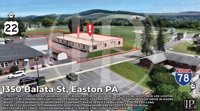
1350 Balata St, Easton, PA 18042
This Property Is For Sale
NEARBY LISTINGS FOR SALE OR LEASE
Property Detail
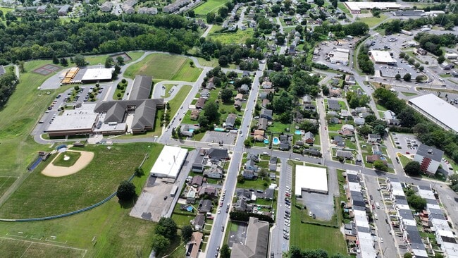
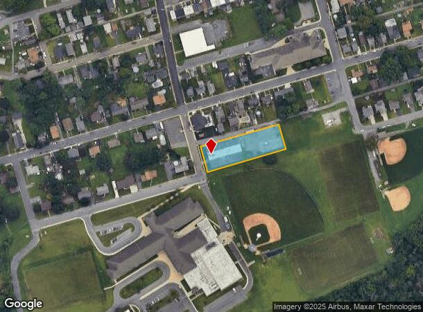
1350 Balata St
Manufacturinglight
Northampton
X
Pennsylvania
42095C0286E
0.92 AC
2025
Lehigh Valley
2025
Philadelphia
017300
Allentown-Bethlehem-Easton, PA-NJ
12,702 SF
M9NW1C-12-9-0837
DEMOGRAPHICS near 1350 Balata St
1 Mile
3 Mile
5 Mile
2024 Total Population
11,271
75,683
138,479
2029 Population
11,476
78,109
143,910
Pop Growth 2024-2029
+ 1.82%
+ 3.21%
+ 3.92%
Average Age
41
41
42
2024 Total Households
4,546
28,283
52,497
HH Growth 2024-2029
+ 2.05%
+ 3.32%
+ 4.12%
Median Household Inc
$82,460
$81,994
$91,106
Avg Household Size
2.40
2.40
2.50
2024 Avg HH Vehicles
2.00
2.00
2.00
Median Home Value
$237,883
$269,830
$311,121
Median Year Built
1956
1955
1970
Nearby Places
- Restaurants
- Banks
- Shops
- Fitness
- Groceries
PUBLIC TRANSPORTATION
AIRPORT
Lehigh Valley International
DRIVE
WALK
Distance
Lehigh Valley International
22 min
13.2 mi
Freight Ports
Port of Philadelphia
DRIVE
WALK
Distance
Port of Philadelphia
98 min
60.1 mi
Nearby Properties
Address
Land Use
TOTAL SIZE
Lot Size
Zoning
Address
Land Use
TOTAL SIZE
Lot Size
Zoning
87,508 SF
40.79 AC
CCE
Address
Land Use
TOTAL SIZE
Lot Size
Zoning
127,731 SF
56.29 AC
R12
Address
Land Use
TOTAL SIZE
Lot Size
Zoning
6,966 SF
8.86 AC
RMD
Address
Land Use
TOTAL SIZE
Lot Size
Zoning
84,805 SF
12.20 AC
CHDD
Address
Land Use
TOTAL SIZE
Lot Size
Zoning
56,276 SF
14.91 AC
RR
Address
Land Use
TOTAL SIZE
Lot Size
Zoning
162,960 SF
16.26 AC
HDR
Address
Land Use
TOTAL SIZE
Lot Size
Zoning
176,397 SF
45.38 AC
HI
Address
Land Use
TOTAL SIZE
Lot Size
Zoning
26,714 SF
33.71 AC
RI
Address
Land Use
TOTAL SIZE
Lot Size
Zoning
430,201 SF
17.30 AC
I
Address
Land Use
TOTAL SIZE
Lot Size
Zoning
94,794 SF
17.51 AC
GB
Address
Land Use
TOTAL SIZE
Lot Size
Zoning
21.80 AC
I-1
Address
Land Use
TOTAL SIZE
Lot Size
Zoning
107,028 SF
3.31 AC
R2
Address
Land Use
TOTAL SIZE
Lot Size
Zoning
319,578 SF
27.91 AC
I
Address
Land Use
TOTAL SIZE
Lot Size
Zoning
137,060 SF
16.16 AC
OB
Address
Land Use
TOTAL SIZE
Lot Size
Zoning
3,055 SF
7.06 AC
OB
Address
Land Use
TOTAL SIZE
Lot Size
Zoning
97,066 SF
14.02 AC
MDB
Address
Land Use
TOTAL SIZE
Lot Size
Zoning
2 AC
B-4
Address
Land Use
TOTAL SIZE
Lot Size
Zoning
73,506 SF
6.32 AC
OB
Address
Land Use
TOTAL SIZE
Lot Size
Zoning
43,122 SF
2.35 AC
RDD
Address
Land Use
TOTAL SIZE
Lot Size
Zoning
94,967 SF
29.12 AC
HI
Address
Land Use
TOTAL SIZE
Lot Size
Zoning
77,178 SF
16.19 AC
GC
Address
Land Use
TOTAL SIZE
Lot Size
Zoning
39,772 SF
6.02 AC
CR
Address
Land Use
TOTAL SIZE
Lot Size
Zoning
183,401 SF
10.71 AC
OB
Address
Land Use
TOTAL SIZE
Lot Size
Zoning
57,188 SF
23.88 AC
LI
Address
Land Use
TOTAL SIZE
Lot Size
Zoning
31.65 AC
RA-3
Address
Land Use
TOTAL SIZE
Lot Size
Zoning
47,585 SF
3.74 AC
OB
Address
Land Use
TOTAL SIZE
Lot Size
Zoning
1.04 AC
I-1
Address
Land Use
TOTAL SIZE
Lot Size
Zoning
184,061 SF
25.75 AC
I
Address
Land Use
TOTAL SIZE
Lot Size
Zoning
66,375 SF
5.36 AC
OB
Address
Land Use
TOTAL SIZE
Lot Size
Zoning
156,202 SF
1.25 AC
R2
The World's #1 Commercial Real Estate Marketplace
Connect with us
© 2025 CoStar Group
The information above has been obtained from sources believed reliable. While we do not doubt its accuracy we have not verified it and make no guarantee, warranty or representation about it. It is your responsibility to independently confirm its accuracy and completeness. Any projections, opinions, assumptions, or estimates used are for example only and do not represent the current or future performance of the property. The value of this transaction to you depends on tax and other factors which should be evaluated by your tax, financial, and legal advisors. You and your advisors should conduct a careful, independent investigation of the property to determine to your satisfaction the suitability of the property for your needs.