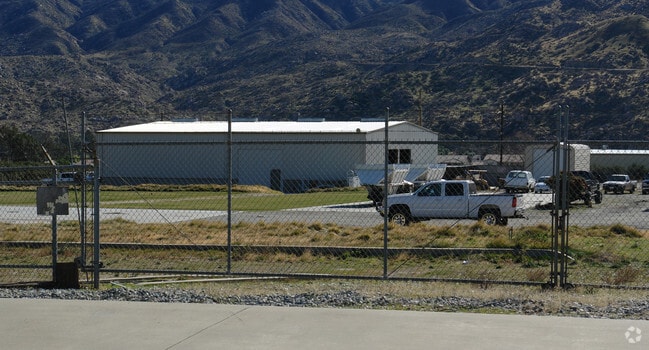
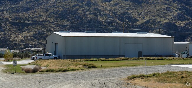
Property Record
1350 E Barbour St, Banning, CA 92220


Property Detail
1350 E Barbour St
Riverside-San Bernardino-Ontario, CA
4.63 ACRES NET IN PAR 1 PM 182/029 PM 27635
541-330-004
Riverside
Lightindustrial
California
C and X Area of minimal flood hazard, usually depicted on FIRMs as above the 500-year flood level.
1
2024
4.63 AC
2025
Beaumont/Hemet
044300
Inland Empire (California)
10,000 SF
NEARBY LISTINGS FOR SALE OR LEASE
DEMOGRAPHICS near 1350 E Barbour St
1 mile
3 mile
5 mile
2025 Total Population
5,402
21,414
37,698
2030 Population
5,488
22,047
39,113
Pop Growth 2025-2030
+ 1.59%
+ 2.96%
+ 3.75%
Average Age
36
37
43
2025 Total Households
1,270
6,333
13,286
HH Growth 2025-2030
+ 0.71%
+ 2.67%
+ 3.13%
Median Household Inc
$60,082
$61,651
$64,074
Avg Household Size
3.30
3.10
2.70
2025 Avg HH Vehicles
2.00
2.00
2.00
Median Home Value
$297,350
$328,335
$368,994
Median Year Built
1969
1970
1984
Nearby Places
Map Layers
Map Styles
 Street
 Aerial
Transit
 Traffic
 Biking
Places
Listings with unknown addresses are not visible on the map
- Restaurants
- Banks
- Shops
- Fitness
- Groceries
PUBLIC TRANSPORTATION
AIRPORT
Palm Springs International
Drive
Walk
Distance
Palm Springs International
33 min
26.6 mi
Freight Ports
Port of Long Beach
Drive
Walk
Distance
Port of Long Beach
112 min
87.6 mi
Nearby Properties
Address
Land Use
TOTAL SIZE
Lot Size
Zoning
Address
Land Use
TOTAL SIZE
Lot Size
Zoning
1,000,000 SF
63.69 AC
Address
Land Use
TOTAL SIZE
Lot Size
Zoning
1,083,737 SF
39.13 AC
Address
Land Use
TOTAL SIZE
Lot Size
Zoning
35.82 AC
Address
Land Use
TOTAL SIZE
Lot Size
Zoning
83,989 SF
39.10 AC
M1
Address
Land Use
TOTAL SIZE
Lot Size
Zoning
67,643 SF
4.34 AC
CPS
Address
Land Use
TOTAL SIZE
Lot Size
Zoning
54,131 SF
3.23 AC
M1
Address
Land Use
TOTAL SIZE
Lot Size
Zoning
82,587 SF
6.78 AC
Address
Land Use
TOTAL SIZE
Lot Size
Zoning
39,250 SF
1.38 AC
C2
Address
Land Use
TOTAL SIZE
Lot Size
Zoning
909 SF
8.17 AC
RA
Address
Land Use
TOTAL SIZE
Lot Size
Zoning
54,455 SF
5.53 AC
R3
Address
Land Use
TOTAL SIZE
Lot Size
Zoning
17,272 SF
1.99 AC
Address
Land Use
TOTAL SIZE
Lot Size
Zoning
119,400 SF
8.21 AC
M
Address
Land Use
TOTAL SIZE
Lot Size
Zoning
50,000 SF
7.13 AC
CM
Address
Land Use
TOTAL SIZE
Lot Size
Zoning
32,520 SF
2.01 AC
Address
Land Use
TOTAL SIZE
Lot Size
Zoning
102,760 SF
13.29 AC
Address
Land Use
TOTAL SIZE
Lot Size
Zoning
864 SF
4.30 AC
M
Address
Land Use
TOTAL SIZE
Lot Size
Zoning
29,928 SF
2.98 AC
Address
Land Use
TOTAL SIZE
Lot Size
Zoning
20,304 SF
0.91 AC
RA
Address
Land Use
TOTAL SIZE
Lot Size
Zoning
93,469 SF
7.46 AC
Address
Land Use
TOTAL SIZE
Lot Size
Zoning
15,000 SF
0.99 AC
Address
Land Use
TOTAL SIZE
Lot Size
Zoning
15.29 AC
W2
Address
Land Use
TOTAL SIZE
Lot Size
Zoning
15.25 AC
W2
Address
Land Use
TOTAL SIZE
Lot Size
Zoning
4.57 AC
Address
Land Use
TOTAL SIZE
Lot Size
Zoning
51,600 SF
2.47 AC
M
Address
Land Use
TOTAL SIZE
Lot Size
Zoning
20,000 SF
2.87 AC
Address
Land Use
TOTAL SIZE
Lot Size
Zoning
18,461 SF
1.16 AC
R3
The World's #1 Commercial Real Estate Marketplace
Connect with us
© 2026 CoStar Group
The information above has been obtained from sources believed reliable. While we do not doubt its accuracy we have not verified it and make no guarantee, warranty or representation about it. It is your responsibility to independently confirm its accuracy and completeness. Any projections, opinions, assumptions, or estimates used are for example only and do not represent the current or future performance of the property. The value of this transaction to you depends on tax and other factors which should be evaluated by your tax, financial, and legal advisors. You and your advisors should conduct a careful, independent investigation of the property to determine to your satisfaction the suitability of the property for your needs.