Property Record
1350 S 74Th Ave W, Tulsa, OK 74127
NEARBY LISTINGS FOR SALE OR LEASE
Property Detail
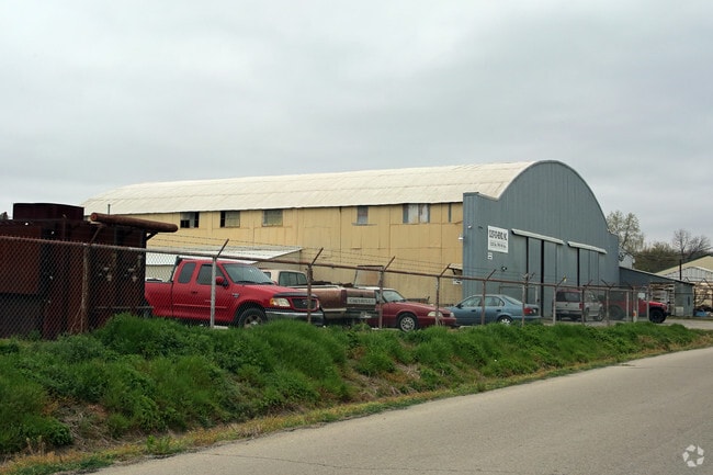
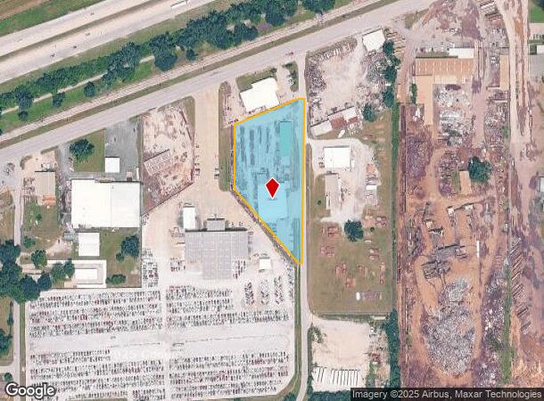
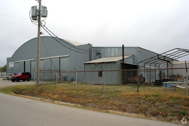
1350 S 74Th Ave W
99207-92-07-11130
Unplatted
Lightindustrial
BEG 325.77W & 537.23N SECR NW TH W20 NW351.70 N227.20 NE240.61 E20 S580.50 POB LESS E4.23 FOR RD SEC 7 19 12 2.318ACS
X
Tulsa
40113C1240K
Oklahoma
2025
2.38 AC
2025
West Tulsa
940005
Tulsa
13,620 SF
Tulsa, OK
DEMOGRAPHICS near 1350 S 74Th Ave W
1 Mile
3 Mile
5 Mile
2024 Total Population
2,999
20,010
64,661
2029 Population
3,184
20,934
67,284
Pop Growth 2024-2029
+ 6.17%
+ 4.62%
+ 4.06%
Average Age
38
40
40
2024 Total Households
1,254
8,093
27,402
HH Growth 2024-2029
+ 6.14%
+ 4.71%
+ 4.35%
Median Household Inc
$41,770
$50,651
$51,716
Avg Household Size
2.40
2.40
2.20
2024 Avg HH Vehicles
2.00
2.00
2.00
Median Home Value
$81,117
$120,839
$143,665
Median Year Built
1967
1960
1969
Nearby Places
Map Layers
Map Styles
 Street
 Aerial
- Restaurants
- Banks
- Shops
- Fitness
- Groceries
PUBLIC TRANSPORTATION
AIRPORT
Tulsa International
DRIVE
WALK
Distance
Tulsa International
21 min
13.9 mi
Freight Ports
Tulsa Port Of Catoosa
DRIVE
WALK
Distance
Tulsa Port Of Catoosa
31 min
23.2 mi
Nearby Properties
Address
Land Use
TOTAL SIZE
Lot Size
Zoning
Address
Land Use
TOTAL SIZE
Lot Size
Zoning
Address
Land Use
TOTAL SIZE
Lot Size
Zoning
92,076 SF
81.28 AC
IM
Address
Land Use
TOTAL SIZE
Lot Size
Zoning
174,776 SF
9.46 AC
RM2
Address
Land Use
TOTAL SIZE
Lot Size
Zoning
101,827 SF
30.64 AC
RS1
Address
Land Use
TOTAL SIZE
Lot Size
Zoning
45,993 SF
9.16 AC
IH
Address
Land Use
TOTAL SIZE
Lot Size
Zoning
15,747 SF
2.50 AC
CM
Address
Land Use
TOTAL SIZE
Lot Size
Zoning
32,827 SF
4.22 AC
CS
Address
Land Use
TOTAL SIZE
Lot Size
Zoning
22,078 SF
5.08 AC
CS
Address
Land Use
TOTAL SIZE
Lot Size
Zoning
108,279 SF
6.38 AC
AG
Address
Land Use
TOTAL SIZE
Lot Size
Zoning
28,240 SF
147.33 AC
NCU
Address
Land Use
TOTAL SIZE
Lot Size
Zoning
21,170 SF
0.17 AC
CH
Address
Land Use
TOTAL SIZE
Lot Size
Zoning
81,444 SF
1.19 AC
RS3
Address
Land Use
TOTAL SIZE
Lot Size
Zoning
27,222 SF
10.49 AC
IL
Address
Land Use
TOTAL SIZE
Lot Size
Zoning
46,452 SF
9.64 AC
CS
Address
Land Use
TOTAL SIZE
Lot Size
Zoning
108,900 SF
6.82 AC
IM
Address
Land Use
TOTAL SIZE
Lot Size
Zoning
51,678 SF
5.14 AC
RS1
Address
Land Use
TOTAL SIZE
Lot Size
Zoning
44,238 SF
9.11 AC
IH
Address
Land Use
TOTAL SIZE
Lot Size
Zoning
197,063 SF
11.23 AC
RM2
Address
Land Use
TOTAL SIZE
Lot Size
Zoning
70,910 SF
6.73 AC
IM
Address
Land Use
TOTAL SIZE
Lot Size
Zoning
631,551 SF
47.19 AC
IM
Address
Land Use
TOTAL SIZE
Lot Size
Zoning
31,783 SF
9.65 AC
RS3
Address
Land Use
TOTAL SIZE
Lot Size
Zoning
207,138 SF
14.17 AC
CG
Address
Land Use
TOTAL SIZE
Lot Size
Zoning
17,012 SF
3.32 AC
CS
Address
Land Use
TOTAL SIZE
Lot Size
Zoning
27,426 SF
9 AC
RE
Address
Land Use
TOTAL SIZE
Lot Size
Zoning
25,685 SF
5.04 AC
Address
Land Use
TOTAL SIZE
Lot Size
Zoning
28,347 SF
2.07 AC
RS
Address
Land Use
TOTAL SIZE
Lot Size
Zoning
24,233 SF
1.50 AC
RM2
Address
Land Use
TOTAL SIZE
Lot Size
Zoning
11,988 SF
0.43 AC
CH
Address
Land Use
TOTAL SIZE
Lot Size
Zoning
17,801 SF
21.15 AC
IM
The World's #1 Commercial Real Estate Marketplace
Connect with us
© 2025 CoStar Group
The information above has been obtained from sources believed reliable. While we do not doubt its accuracy we have not verified it and make no guarantee, warranty or representation about it. It is your responsibility to independently confirm its accuracy and completeness. Any projections, opinions, assumptions, or estimates used are for example only and do not represent the current or future performance of the property. The value of this transaction to you depends on tax and other factors which should be evaluated by your tax, financial, and legal advisors. You and your advisors should conduct a careful, independent investigation of the property to determine to your satisfaction the suitability of the property for your needs.