Property Record
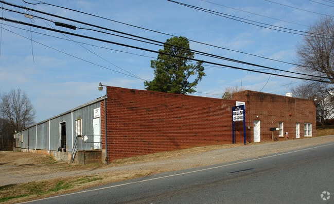
1350 W Nc 10 Hwy, Newton, NC 28658


NEARBY LISTINGS FOR SALE OR LEASE
Property Detail
1350 W Nc 10 Hwy
Hickory-Lenoir-Morganton, NC
F E Yount
3730196133730000
LOT 8-18 PT 7 PL 3-124
Autorepair
Catawba
X
North Carolina
3710373000J
8-18
2024
1.94 AC
2025
Catawba County
011200
Charlotte
19,978 SF
DEMOGRAPHICS near 1350 W Nc 10 Hwy
1 Mile
3 Mile
5 Mile
2024 Total Population
3,533
18,132
37,549
2029 Population
3,718
18,988
39,276
Pop Growth 2024-2029
+ 5.24%
+ 4.72%
+ 4.60%
Average Age
40
41
41
2024 Total Households
1,427
7,163
14,825
HH Growth 2024-2029
+ 5.26%
+ 4.69%
+ 4.54%
Median Household Inc
$74,317
$61,633
$58,397
Avg Household Size
2.30
2.40
2.40
2024 Avg HH Vehicles
2.00
2.00
2.00
Median Home Value
$147,290
$167,994
$175,842
Median Year Built
1972
1978
1983
Nearby Places
Map Layers
Map Styles
 Street
 Aerial
- Restaurants
- Banks
- Shops
- Fitness
- Groceries
PUBLIC TRANSPORTATION
AIRPORT
Charlotte/Douglas International
DRIVE
WALK
Distance
Charlotte/Douglas International
65 min
41.8 mi
Concord-Padgett Regional
DRIVE
WALK
Distance
Concord-Padgett Regional
64 min
47.2 mi
Nearby Properties
Address
Land Use
TOTAL SIZE
Lot Size
Zoning
Address
Land Use
TOTAL SIZE
Lot Size
Zoning
125,462 SF
18.74 AC
PD-O&I
Address
Land Use
TOTAL SIZE
Lot Size
Zoning
6,751 SF
85.40 AC
PD-CCRC
Address
Land Use
TOTAL SIZE
Lot Size
Zoning
1,937 SF
62 AC
PD-CCRC
Address
Land Use
TOTAL SIZE
Lot Size
Zoning
222,605 SF
20.66 AC
EM-1
Address
Land Use
TOTAL SIZE
Lot Size
Zoning
188,250 SF
32.34 AC
EM-1
Address
Land Use
TOTAL SIZE
Lot Size
Zoning
218,009 SF
90.48 AC
M-1
Address
Land Use
TOTAL SIZE
Lot Size
Zoning
174,666 SF
50.07 AC
M-1
Address
Land Use
TOTAL SIZE
Lot Size
Zoning
103,090 SF
36.13 AC
R-9
Address
Land Use
TOTAL SIZE
Lot Size
Zoning
124,940 SF
33.32 AC
M-1
Address
Land Use
TOTAL SIZE
Lot Size
Zoning
270,125 SF
19.98 AC
EM-1
Address
Land Use
TOTAL SIZE
Lot Size
Zoning
222,786 SF
14.02 AC
EM-1
Address
Land Use
TOTAL SIZE
Lot Size
Zoning
226,704 SF
24.60 AC
EM-1
Address
Land Use
TOTAL SIZE
Lot Size
Zoning
67,085 SF
15.80 AC
PD-SC-M
Address
Land Use
TOTAL SIZE
Lot Size
Zoning
7,680 SF
9.22 AC
PD-H
Address
Land Use
TOTAL SIZE
Lot Size
Zoning
20.90 AC
M-1
Address
Land Use
TOTAL SIZE
Lot Size
Zoning
234,094 SF
15.22 AC
EM-1
Address
Land Use
TOTAL SIZE
Lot Size
Zoning
15.43 AC
R-20
Address
Land Use
TOTAL SIZE
Lot Size
Zoning
156,161 SF
17.22 AC
M-1
Address
Land Use
TOTAL SIZE
Lot Size
Zoning
136,903 SF
43.43 AC
EM-1
Address
Land Use
TOTAL SIZE
Lot Size
Zoning
10.85 AC
R-7
Address
Land Use
TOTAL SIZE
Lot Size
Zoning
249,849 SF
20.99 AC
M-1
Address
Land Use
TOTAL SIZE
Lot Size
Zoning
143,979 SF
11.68 AC
IND
Address
Land Use
TOTAL SIZE
Lot Size
Zoning
129,433 SF
15.57 AC
EM-1
Address
Land Use
TOTAL SIZE
Lot Size
Zoning
144,886 SF
12.53 AC
M-1
Address
Land Use
TOTAL SIZE
Lot Size
Zoning
95,380 SF
7.97 AC
B-2
Address
Land Use
TOTAL SIZE
Lot Size
Zoning
142,720 SF
30.23 AC
M-1
Address
Land Use
TOTAL SIZE
Lot Size
Zoning
6,706 SF
10.58 AC
PD-H
Address
Land Use
TOTAL SIZE
Lot Size
Zoning
47.79 AC
R-20A
Address
Land Use
TOTAL SIZE
Lot Size
Zoning
6,293 SF
5.04 AC
PD-H
Address
Land Use
TOTAL SIZE
Lot Size
Zoning
178,270 SF
21.29 AC
PD-IP
The World's #1 Commercial Real Estate Marketplace
Connect with us
© 2025 CoStar Group
The information above has been obtained from sources believed reliable. While we do not doubt its accuracy we have not verified it and make no guarantee, warranty or representation about it. It is your responsibility to independently confirm its accuracy and completeness. Any projections, opinions, assumptions, or estimates used are for example only and do not represent the current or future performance of the property. The value of this transaction to you depends on tax and other factors which should be evaluated by your tax, financial, and legal advisors. You and your advisors should conduct a careful, independent investigation of the property to determine to your satisfaction the suitability of the property for your needs.