Property Record
1350 Westpark Way, Euless, TX 76040
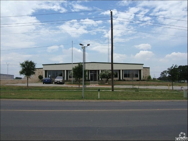


Property Detail
1350 Westpark Way
Dallas-Fort Worth-Arlington, TX
INTERNATIONAL REG IND CO BLOCK E LOT 6R
41484045
Tarrant
Industrialgeneral
Texas
B and X Area of moderate flood hazard, usually the area between the limits of the 100-year and 500-year floods.
6r
2024
1.88 AC
2025
W DFW Air/Grapevine
113511
Dallas/Ft Worth
24,385 SF
NEARBY LISTINGS FOR SALE OR LEASE
DEMOGRAPHICS near 1350 Westpark Way
1 mile
3 mile
5 mile
2025 Total Population
10,253
103,185
286,072
2030 Population
10,796
109,062
300,938
Pop Growth 2025-2030
+ 5.30%
+ 5.70%
+ 5.20%
Average Age
38
38
38
2025 Total Households
3,965
41,557
120,720
HH Growth 2025-2030
+ 5.37%
+ 5.74%
+ 5.28%
Median Household Inc
$74,248
$75,411
$76,871
Avg Household Size
2.50
2.40
2.30
2025 Avg HH Vehicles
2.00
2.00
2.00
Median Home Value
$312,841
$345,564
$363,100
Median Year Built
1980
1982
1985
Nearby Places
Map Layers
Map Styles
 Street
 Aerial
Transit
 Traffic
 Biking
Places
Listings with unknown addresses are not visible on the map
- Restaurants
- Banks
- Shops
- Fitness
- Groceries
PUBLIC TRANSPORTATION
COMMUTER RAIL
Drive
Walk
Distance
6 min
2.6 mi
Drive
Walk
Distance
12 min
5.6 mi
AIRPORT
Dallas-Fort Worth International
Drive
Walk
Distance
Dallas-Fort Worth International
18 min
10.3 mi
Dallas Love Field
Drive
Walk
Distance
Dallas Love Field
29 min
19.0 mi
Nearby Properties
Address
Land Use
TOTAL SIZE
Lot Size
Zoning
Address
Land Use
TOTAL SIZE
Lot Size
Zoning
415,563 SF
25.40 AC
Address
Land Use
TOTAL SIZE
Lot Size
Zoning
521,200 SF
7.99 AC
Address
Land Use
TOTAL SIZE
Lot Size
Zoning
548,095 SF
7.19 AC
Address
Land Use
TOTAL SIZE
Lot Size
Zoning
363,849 SF
8.08 AC
Address
Land Use
TOTAL SIZE
Lot Size
Zoning
290,680 SF
26.31 AC
Address
Land Use
TOTAL SIZE
Lot Size
Zoning
356,000 SF
39.44 AC
Address
Land Use
TOTAL SIZE
Lot Size
Zoning
1,544,748 SF
76.25 AC
Address
Land Use
TOTAL SIZE
Lot Size
Zoning
282,665 SF
14.29 AC
Address
Land Use
TOTAL SIZE
Lot Size
Zoning
260,590 SF
15.30 AC
Address
Land Use
TOTAL SIZE
Lot Size
Zoning
172,000 SF
6.34 AC
Address
Land Use
TOTAL SIZE
Lot Size
Zoning
345,216 SF
21.64 AC
Address
Land Use
TOTAL SIZE
Lot Size
Zoning
223,131 SF
12.50 AC
Address
Land Use
TOTAL SIZE
Lot Size
Zoning
79,244 SF
54.50 AC
Address
Land Use
TOTAL SIZE
Lot Size
Zoning
269,700 SF
48.40 AC
Address
Land Use
TOTAL SIZE
Lot Size
Zoning
236,701 SF
15.96 AC
Address
Land Use
TOTAL SIZE
Lot Size
Zoning
211,449 SF
11.30 AC
Address
Land Use
TOTAL SIZE
Lot Size
Zoning
208,238 SF
12.55 AC
Address
Land Use
TOTAL SIZE
Lot Size
Zoning
235,583 SF
9.16 AC
Address
Land Use
TOTAL SIZE
Lot Size
Zoning
346,112 SF
15.89 AC
Address
Land Use
TOTAL SIZE
Lot Size
Zoning
266,000 SF
0.56 AC
Address
Land Use
TOTAL SIZE
Lot Size
Zoning
186,377 SF
20.59 AC
Address
Land Use
TOTAL SIZE
Lot Size
Zoning
210,801 SF
9.30 AC
Address
Land Use
TOTAL SIZE
Lot Size
Zoning
187,382 SF
5.96 AC
Address
Land Use
TOTAL SIZE
Lot Size
Zoning
161,332 SF
8.56 AC
Address
Land Use
TOTAL SIZE
Lot Size
Zoning
201,121 SF
8.96 AC
Address
Land Use
TOTAL SIZE
Lot Size
Zoning
210,072 SF
16.84 AC
Address
Land Use
TOTAL SIZE
Lot Size
Zoning
225,117 SF
12.29 AC
Address
Land Use
TOTAL SIZE
Lot Size
Zoning
212,947 SF
10.28 AC
Address
Land Use
TOTAL SIZE
Lot Size
Zoning
170,141 SF
9.18 AC
Address
Land Use
TOTAL SIZE
Lot Size
Zoning
160,608 SF
8.29 AC
The World's #1 Commercial Real Estate Marketplace
Connect with us
© 2026 CoStar Group
The information above has been obtained from sources believed reliable. While we do not doubt its accuracy we have not verified it and make no guarantee, warranty or representation about it. It is your responsibility to independently confirm its accuracy and completeness. Any projections, opinions, assumptions, or estimates used are for example only and do not represent the current or future performance of the property. The value of this transaction to you depends on tax and other factors which should be evaluated by your tax, financial, and legal advisors. You and your advisors should conduct a careful, independent investigation of the property to determine to your satisfaction the suitability of the property for your needs.