Property Record
13510 Se 145Th Ave, Clackamas, OR 97015
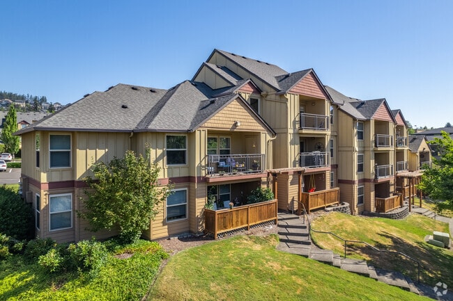

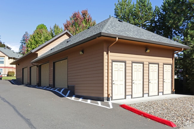
Property Detail
13510 Se 145Th Ave
01362153
1997-29 PARTITION PLAT PT PARCEL 2
Multifamilydwelling
CLACKAMAS
VA
Oregon
B and X Area of moderate flood hazard, usually the area between the limits of the 100-year and 500-year floods.
2
2025
6.16 AC
2025
Rock Creek
022109
Portland
3,414 SF
Portland-Vancouver-Hillsboro, OR-WA
NEARBY LISTINGS FOR SALE OR LEASE
-
-
View all Clackamas listings for sale on LoopNet.com
DEMOGRAPHICS near 13510 Se 145Th Ave
1 mile
3 mile
5 mile
2025 Total Population
16,657
59,453
177,963
2030 Population
16,787
60,283
178,105
Pop Growth 2025-2030
+ 0.78%
+ 1.40%
+ 0.08%
Average Age
39
40
41
2025 Total Households
5,555
20,451
63,239
HH Growth 2025-2030
+ 0.77%
+ 1.36%
(0.07%)
Median Household Inc
$107,578
$106,245
$92,602
Avg Household Size
3.00
2.80
2.70
2025 Avg HH Vehicles
2.00
2.00
2.00
Median Home Value
$643,162
$690,919
$568,104
Median Year Built
2002
1996
1986
Nearby Places
Map Layers
Map Styles
 Street
 Aerial
Transit
 Traffic
 Biking
Places
Listings with unknown addresses are not visible on the map
- Restaurants
- Banks
- Shops
- Fitness
- Groceries
PUBLIC TRANSPORTATION
COMMUTER RAIL
Oregon City Amtrak (Amtrak Cascades - Amtrak)
Drive
Walk
Distance
Oregon City Amtrak (Amtrak Cascades - Amtrak)
15 min
7.5 mi
AIRPORT
Portland International
Drive
Walk
Distance
Portland International
26 min
15.5 mi
Freight Ports
Port of Portland
Drive
Walk
Distance
Port of Portland
30 min
18.8 mi
Nearby Properties
Address
Land Use
TOTAL SIZE
Lot Size
Zoning
Address
Land Use
TOTAL SIZE
Lot Size
Zoning
40.94 AC
IPU
Address
Land Use
TOTAL SIZE
Lot Size
Zoning
28.83 AC
RCO
Address
Land Use
TOTAL SIZE
Lot Size
Zoning
4,654 SF
73.99 AC
LI
Address
Land Use
TOTAL SIZE
Lot Size
Zoning
45 AC
GI
Address
Land Use
TOTAL SIZE
Lot Size
Zoning
Address
Land Use
TOTAL SIZE
Lot Size
Zoning
6.92 AC
MCC
Address
Land Use
TOTAL SIZE
Lot Size
Zoning
2,232 SF
15.74 AC
MUC
Address
Land Use
TOTAL SIZE
Lot Size
Zoning
12.06 AC
MCC
Address
Land Use
TOTAL SIZE
Lot Size
Zoning
9 AC
MUE
Address
Land Use
TOTAL SIZE
Lot Size
Zoning
22.99 AC
LI
Address
Land Use
TOTAL SIZE
Lot Size
Zoning
24 AC
LI
Address
Land Use
TOTAL SIZE
Lot Size
Zoning
8 AC
MURM1
Address
Land Use
TOTAL SIZE
Lot Size
Zoning
20 AC
RTL
Address
Land Use
TOTAL SIZE
Lot Size
Zoning
2,089 SF
4.30 AC
MURM2
Address
Land Use
TOTAL SIZE
Lot Size
Zoning
6 AC
GI
Address
Land Use
TOTAL SIZE
Lot Size
Zoning
500 SF
9 AC
RCHDR
Address
Land Use
TOTAL SIZE
Lot Size
Zoning
12 AC
LI
Address
Land Use
TOTAL SIZE
Lot Size
Zoning
1,032 SF
5.50 AC
MR2
Address
Land Use
TOTAL SIZE
Lot Size
Zoning
7.25 AC
LI
Address
Land Use
TOTAL SIZE
Lot Size
Zoning
3,342 SF
9.34 AC
MUE
Address
Land Use
TOTAL SIZE
Lot Size
Zoning
3.10 AC
RCO
Address
Land Use
TOTAL SIZE
Lot Size
Zoning
17.04 AC
GI
Address
Land Use
TOTAL SIZE
Lot Size
Zoning
10.11 AC
MR2
Address
Land Use
TOTAL SIZE
Lot Size
Zoning
2,510 SF
16.02 AC
GI
Address
Land Use
TOTAL SIZE
Lot Size
Zoning
9 AC
PMU1
Address
Land Use
TOTAL SIZE
Lot Size
Zoning
11.69 AC
OC
Address
Land Use
TOTAL SIZE
Lot Size
Zoning
4.83 AC
MCC
Address
Land Use
TOTAL SIZE
Lot Size
Zoning
4,180 SF
7.65 AC
MURM2
Address
Land Use
TOTAL SIZE
Lot Size
Zoning
5.66 AC
MCC
Address
Land Use
TOTAL SIZE
Lot Size
Zoning
1 AC
MURX
The World's #1 Commercial Real Estate Marketplace
Connect with us
© 2026 CoStar Group
The information above has been obtained from sources believed reliable. While we do not doubt its accuracy we have not verified it and make no guarantee, warranty or representation about it. It is your responsibility to independently confirm its accuracy and completeness. Any projections, opinions, assumptions, or estimates used are for example only and do not represent the current or future performance of the property. The value of this transaction to you depends on tax and other factors which should be evaluated by your tax, financial, and legal advisors. You and your advisors should conduct a careful, independent investigation of the property to determine to your satisfaction the suitability of the property for your needs.