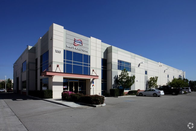
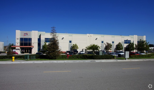
Property Record
1353 Walker Ln, Corona, CA 92879


Current Lease Availabilities
Property Detail
1353 Walker Ln
Riverside-San Bernardino-Ontario, CA
.78 ACRES NET IN PAR 18 PM 209/051 PM 31258
115-200-057
Riverside
Lightindustrial
California
C and X Area of minimal flood hazard, usually depicted on FIRMs as above the 500-year flood level.
18
2024
0.78 AC
2025
Corona/Eastvale
041602
Inland Empire (California)
13,362 SF
NEARBY LISTINGS FOR SALE OR LEASE
DEMOGRAPHICS near 1353 Walker Ln
1 mile
3 mile
5 mile
2025 Total Population
11,360
114,659
249,033
2030 Population
11,537
116,562
253,317
Pop Growth 2025-2030
+ 1.56%
+ 1.66%
+ 1.72%
Average Age
35
37
38
2025 Total Households
3,046
33,484
71,956
HH Growth 2025-2030
+ 1.41%
+ 1.19%
+ 1.23%
Median Household Inc
$87,863
$94,973
$105,926
Avg Household Size
3.60
3.20
3.30
2025 Avg HH Vehicles
2.00
2.00
2.00
Median Home Value
$593,263
$701,232
$719,896
Median Year Built
1980
1985
1986
Nearby Places
Map Layers
Map Styles
 Street
 Aerial
Transit
 Traffic
 Biking
Places
Listings with unknown addresses are not visible on the map
- Restaurants
- Banks
- Shops
- Fitness
- Groceries
PUBLIC TRANSPORTATION
COMMUTER RAIL
North Main Corona (91 Line - Southern California Regional Rail Authority (Metrolink), Inland Empire-Orange County Line - Southern California Regional Rail Authority (Metrolink))
Drive
Walk
Distance
North Main Corona (91 Line - Southern California Regional Rail Authority (Metrolink), Inland Empire-Orange County Line - Southern California Regional Rail Authority (Metrolink))
5 min
2.1 mi
Riverside-La Sierra (91 Line - Southern California Regional Rail Authority (Metrolink), Inland Empire-Orange County Line - Southern California Regional Rail Authority (Metrolink))
Drive
Walk
Distance
Riverside-La Sierra (91 Line - Southern California Regional Rail Authority (Metrolink), Inland Empire-Orange County Line - Southern California Regional Rail Authority (Metrolink))
10 min
5.2 mi
AIRPORT
Ontario International
Drive
Walk
Distance
Ontario International
24 min
16.6 mi
John Wayne/Orange County
Drive
Walk
Distance
John Wayne/Orange County
39 min
30.2 mi
Long Beach (Daugherty Field)
Drive
Walk
Distance
Long Beach (Daugherty Field)
56 min
44.7 mi
Freight Ports
Port of Long Beach
Drive
Walk
Distance
Port of Long Beach
62 min
44.3 mi
Nearby Properties
Address
Land Use
TOTAL SIZE
Lot Size
Zoning
Address
Land Use
TOTAL SIZE
Lot Size
Zoning
32,924 SF
24.04 AC
Address
Land Use
TOTAL SIZE
Lot Size
Zoning
12.69 AC
Address
Land Use
TOTAL SIZE
Lot Size
Zoning
335,820 SF
15.18 AC
Address
Land Use
TOTAL SIZE
Lot Size
Zoning
205,235 SF
10.30 AC
Address
Land Use
TOTAL SIZE
Lot Size
Zoning
71,440 SF
14.37 AC
Address
Land Use
TOTAL SIZE
Lot Size
Zoning
289,297 SF
13.28 AC
M3
Address
Land Use
TOTAL SIZE
Lot Size
Zoning
186,190 SF
9.79 AC
Address
Land Use
TOTAL SIZE
Lot Size
Zoning
164,712 SF
10 AC
R3
Address
Land Use
TOTAL SIZE
Lot Size
Zoning
173,676 SF
10.96 AC
R3
Address
Land Use
TOTAL SIZE
Lot Size
Zoning
24,144 SF
13.34 AC
R3
Address
Land Use
TOTAL SIZE
Lot Size
Zoning
182,066 SF
9.31 AC
Address
Land Use
TOTAL SIZE
Lot Size
Zoning
152,369 SF
5.38 AC
Address
Land Use
TOTAL SIZE
Lot Size
Zoning
8.80 AC
R3
Address
Land Use
TOTAL SIZE
Lot Size
Zoning
150,404 SF
8.02 AC
Address
Land Use
TOTAL SIZE
Lot Size
Zoning
421,898 SF
3 AC
Address
Land Use
TOTAL SIZE
Lot Size
Zoning
217,299 SF
7.41 AC
Address
Land Use
TOTAL SIZE
Lot Size
Zoning
141,280 SF
9.31 AC
Address
Land Use
TOTAL SIZE
Lot Size
Zoning
115,545 SF
5.97 AC
Address
Land Use
TOTAL SIZE
Lot Size
Zoning
171,707 SF
8.55 AC
Address
Land Use
TOTAL SIZE
Lot Size
Zoning
149,389 SF
6.72 AC
Address
Land Use
TOTAL SIZE
Lot Size
Zoning
359,304 SF
8.86 AC
R3
Address
Land Use
TOTAL SIZE
Lot Size
Zoning
152,756 SF
7.07 AC
Address
Land Use
TOTAL SIZE
Lot Size
Zoning
159,517 SF
7.81 AC
Address
Land Use
TOTAL SIZE
Lot Size
Zoning
52,928 SF
9.69 AC
Address
Land Use
TOTAL SIZE
Lot Size
Zoning
138,800 SF
10 AC
M4
Address
Land Use
TOTAL SIZE
Lot Size
Zoning
140,216 SF
6.43 AC
Address
Land Use
TOTAL SIZE
Lot Size
Zoning
145,424 SF
7.23 AC
Address
Land Use
TOTAL SIZE
Lot Size
Zoning
111,862 SF
9.98 AC
A
The World's #1 Commercial Real Estate Marketplace
Connect with us
© 2026 CoStar Group
The information above has been obtained from sources believed reliable. While we do not doubt its accuracy we have not verified it and make no guarantee, warranty or representation about it. It is your responsibility to independently confirm its accuracy and completeness. Any projections, opinions, assumptions, or estimates used are for example only and do not represent the current or future performance of the property. The value of this transaction to you depends on tax and other factors which should be evaluated by your tax, financial, and legal advisors. You and your advisors should conduct a careful, independent investigation of the property to determine to your satisfaction the suitability of the property for your needs.