Property Record
13532 Wortham Bend Rd, Waco, TX 76708


Property Detail
13532 Wortham Bend Rd
Waco, TX
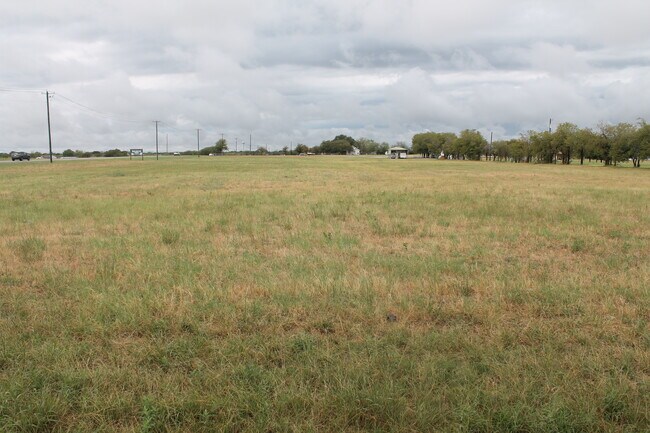
RABAGO M ACRES 10.416, LAND ACCT, MH ONLY ON PID: 342752
18-003300-027603-0
MCLENNAN
Agriculturalland
Texas
B and X Area of moderate flood hazard, usually the area between the limits of the 100-year and 500-year floods.
10.42 AC
2025
Waco
2025
Other Market Areas
004102
NEARBY LISTINGS FOR SALE OR LEASE
DEMOGRAPHICS near 13532 Wortham Bend Rd
1 mile
3 mile
5 mile
2025 Total Population
258
10,552
16,666
2030 Population
265
10,973
17,301
Pop Growth 2025-2030
+ 2.71%
+ 3.99%
+ 3.81%
Average Age
42
37
38
2025 Total Households
96
3,629
5,748
HH Growth 2025-2030
+ 3.13%
+ 3.97%
+ 3.79%
Median Household Inc
$119,642
$105,391
$102,991
Avg Household Size
2.60
2.90
2.90
2025 Avg HH Vehicles
2.00
2.00
2.00
Median Home Value
$411,111
$318,352
$324,627
Median Year Built
1990
2003
2003
Nearby Places
Map Layers
Map Styles
 Street
 Aerial
Layers
 Traffic
 Biking
Places
Listings with unknown addresses are not visible on the map
- Restaurants
- Banks
- Shops
- Fitness
- Groceries
PUBLIC TRANSPORTATION
AIRPORT
Waco Regional
Drive
Walk
Distance
Waco Regional
10 min
4.9 mi
Freight Ports
Port of Houston
Drive
Walk
Distance
Port of Houston
234 min
198.7 mi
SALE & LEASE HISTORY
LISTING DATE
SALE/LEASE

Sep 15, 2023
For Sale
Nearby Properties
Address
Land Use
TOTAL SIZE
Lot Size
Zoning
Address
Land Use
TOTAL SIZE
Lot Size
Zoning
319,291 SF
51.81 AC
R1B
Address
Land Use
TOTAL SIZE
Lot Size
Zoning
155,710 SF
86.36 AC
R
Address
Land Use
TOTAL SIZE
Lot Size
Zoning
123,654 SF
23.58 AC
R
Address
Land Use
TOTAL SIZE
Lot Size
Zoning
163,937 SF
11.09 AC
R1B
Address
Land Use
TOTAL SIZE
Lot Size
Zoning
72,347 SF
12.60 AC
R
Address
Land Use
TOTAL SIZE
Lot Size
Zoning
83,212 SF
4.92 AC
Address
Land Use
TOTAL SIZE
Lot Size
Zoning
18,724 SF
1.91 AC
C-2
Address
Land Use
TOTAL SIZE
Lot Size
Zoning
0.65 AC
R1B
Address
Land Use
TOTAL SIZE
Lot Size
Zoning
12,874 SF
1.55 AC
Address
Land Use
TOTAL SIZE
Lot Size
Zoning
10,750 SF
9.79 AC
R1B
Address
Land Use
TOTAL SIZE
Lot Size
Zoning
13,400 SF
1.51 AC
C-2
Address
Land Use
TOTAL SIZE
Lot Size
Zoning
53,050 SF
3.72 AC
R
Address
Land Use
TOTAL SIZE
Lot Size
Zoning
12,700 SF
2.12 AC
C-2
Address
Land Use
TOTAL SIZE
Lot Size
Zoning
10,080 SF
1.39 AC
O-3
Address
Land Use
TOTAL SIZE
Lot Size
Zoning
10,302 SF
1.70 AC
C-2
Address
Land Use
TOTAL SIZE
Lot Size
Zoning
3,798 SF
0.91 AC
Address
Land Use
TOTAL SIZE
Lot Size
Zoning
6,704 SF
1.34 AC
C-2
Address
Land Use
TOTAL SIZE
Lot Size
Zoning
8,981 SF
15.97 AC
R
Address
Land Use
TOTAL SIZE
Lot Size
Zoning
8,979 SF
2.23 AC
Address
Land Use
TOTAL SIZE
Lot Size
Zoning
9,156 SF
1.47 AC
Address
Land Use
TOTAL SIZE
Lot Size
Zoning
10,472 SF
1.48 AC
Address
Land Use
TOTAL SIZE
Lot Size
Zoning
14,688 SF
9.27 AC
R
Address
Land Use
TOTAL SIZE
Lot Size
Zoning
13,503 SF
0.31 AC
R
Address
Land Use
TOTAL SIZE
Lot Size
Zoning
36,604 SF
8.16 AC
Address
Land Use
TOTAL SIZE
Lot Size
Zoning
3,120 SF
1.95 AC
PUD
Address
Land Use
TOTAL SIZE
Lot Size
Zoning
6,856 SF
7.11 AC
Address
Land Use
TOTAL SIZE
Lot Size
Zoning
5,148 SF
66.91 AC
R
Address
Land Use
TOTAL SIZE
Lot Size
Zoning
4,420 SF
16.66 AC
R
Address
Land Use
TOTAL SIZE
Lot Size
Zoning
3,430 SF
1.24 AC
C-2
Address
Land Use
TOTAL SIZE
Lot Size
Zoning
4,710 SF
29.16 AC
R
The World's #1 Commercial Real Estate Marketplace
Connect with us
© 2026 CoStar Group
The information above has been obtained from sources believed reliable. While we do not doubt its accuracy we have not verified it and make no guarantee, warranty or representation about it. It is your responsibility to independently confirm its accuracy and completeness. Any projections, opinions, assumptions, or estimates used are for example only and do not represent the current or future performance of the property. The value of this transaction to you depends on tax and other factors which should be evaluated by your tax, financial, and legal advisors. You and your advisors should conduct a careful, independent investigation of the property to determine to your satisfaction the suitability of the property for your needs.