Property Record
13555 S Memorial Dr E, Bixby, OK 74008


Save to a Folder
{{folder.Name}}
{{folder.ListingIds.length}} Properties
{{folder.ListingIds.length}} Property
Create a New Folder
Property Detail
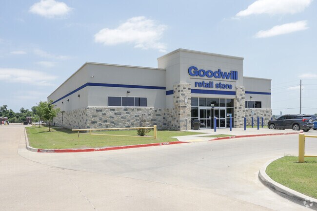
13555 S Memorial Dr E
57613-73-12-56130
LT 1 BLK 1
Storebuilding
TULSA
CS
Oklahoma
AE The base floodplain where base flood elevations are provided. AE Zones are now used on new format FIRMs instead of A1-A30 Zones.
1
0
1.76 AC
2025
South Tulsa
007803
Tulsa
12,156 SF
Tulsa, OK
NEARBY LISTINGS FOR SALE OR LEASE
DEMOGRAPHICS near 13555 S Memorial Dr E
1 mile
3 mile
5 mile
2025 Total Population
4,634
35,132
89,689
2030 Population
4,884
36,613
93,169
Pop Growth 2025-2030
+ 5.39%
+ 4.22%
+ 3.88%
Average Age
36
39
39
2025 Total Households
1,651
12,653
32,696
HH Growth 2025-2030
+ 5.33%
+ 4.13%
+ 3.86%
Median Household Inc
$83,369
$105,655
$109,114
Avg Household Size
2.80
2.80
2.70
2025 Avg HH Vehicles
2.00
2.00
2.00
Median Home Value
$296,178
$370,813
$359,510
Median Year Built
2003
2000
1996
Nearby Places
Map Layers
Map Styles
 Street
 Aerial
Layers
 Traffic
 Biking
Places
Listings with unknown addresses are not visible on the map
- Restaurants
- Banks
- Shops
- Fitness
- Groceries
PUBLIC TRANSPORTATION
AIRPORT
Tulsa International
Drive
Walk
Distance
Tulsa International
31 min
21.3 mi
Freight Ports
Tulsa Port Of Catoosa
Drive
Walk
Distance
Tulsa Port Of Catoosa
34 min
25.1 mi
Nearby Properties
Address
Land Use
TOTAL SIZE
Lot Size
Zoning
Address
Land Use
TOTAL SIZE
Lot Size
Zoning
815,589 SF
181.73 AC
AG
Address
Land Use
TOTAL SIZE
Lot Size
Zoning
134,232 SF
28.52 AC
R2
Address
Land Use
TOTAL SIZE
Lot Size
Zoning
25,761 SF
15.66 AC
CG
Address
Land Use
TOTAL SIZE
Lot Size
Zoning
2,281,674 SF
147.83 AC
AG
Address
Land Use
TOTAL SIZE
Lot Size
Zoning
10,745 SF
56.52 AC
RS2
Address
Land Use
TOTAL SIZE
Lot Size
Zoning
27,256 SF
31.19 AC
CS
Address
Land Use
TOTAL SIZE
Lot Size
Zoning
36,440 SF
75.39 AC
AG
Address
Land Use
TOTAL SIZE
Lot Size
Zoning
18,161 SF
4.36 AC
AG
Address
Land Use
TOTAL SIZE
Lot Size
Zoning
30,000 SF
5.13 AC
CS
Address
Land Use
TOTAL SIZE
Lot Size
Zoning
30,000 SF
5.06 AC
Address
Land Use
TOTAL SIZE
Lot Size
Zoning
219,987 SF
6.97 AC
RM3
Address
Land Use
TOTAL SIZE
Lot Size
Zoning
31,798 SF
4.42 AC
AG
Address
Land Use
TOTAL SIZE
Lot Size
Zoning
237,090 SF
19.84 AC
AG
Address
Land Use
TOTAL SIZE
Lot Size
Zoning
243,504 SF
13.97 AC
RM3
Address
Land Use
TOTAL SIZE
Lot Size
Zoning
22,760 SF
11.76 AC
AG
Address
Land Use
TOTAL SIZE
Lot Size
Zoning
17,776 SF
0.75 AC
CH
Address
Land Use
TOTAL SIZE
Lot Size
Zoning
23,375 SF
5.91 AC
CS
Address
Land Use
TOTAL SIZE
Lot Size
Zoning
37,009 SF
4.18 AC
RS1
Address
Land Use
TOTAL SIZE
Lot Size
Zoning
24,750 SF
80 AC
AG
Address
Land Use
TOTAL SIZE
Lot Size
Zoning
58,112 SF
41.58 AC
AG
Address
Land Use
TOTAL SIZE
Lot Size
Zoning
285,981 SF
68.60 AC
RM2
Address
Land Use
TOTAL SIZE
Lot Size
Zoning
36,312 SF
3.50 AC
CG
Address
Land Use
TOTAL SIZE
Lot Size
Zoning
42.46 AC
NCU
Address
Land Use
TOTAL SIZE
Lot Size
Zoning
377,500 SF
2.92 AC
CS
Address
Land Use
TOTAL SIZE
Lot Size
Zoning
118,477 SF
10.92 AC
RS3
Address
Land Use
TOTAL SIZE
Lot Size
Zoning
218,699 SF
20.92 AC
CS
Address
Land Use
TOTAL SIZE
Lot Size
Zoning
13,870 SF
9.49 AC
RS3
Address
Land Use
TOTAL SIZE
Lot Size
Zoning
30,000 SF
20.13 AC
CS
Address
Land Use
TOTAL SIZE
Lot Size
Zoning
10,086 SF
0.82 AC
CH
The World's #1 Commercial Real Estate Marketplace
Connect with us
© 2026 CoStar Group
The information above has been obtained from sources believed reliable. While we do not doubt its accuracy we have not verified it and make no guarantee, warranty or representation about it. It is your responsibility to independently confirm its accuracy and completeness. Any projections, opinions, assumptions, or estimates used are for example only and do not represent the current or future performance of the property. The value of this transaction to you depends on tax and other factors which should be evaluated by your tax, financial, and legal advisors. You and your advisors should conduct a careful, independent investigation of the property to determine to your satisfaction the suitability of the property for your needs.