Property Record
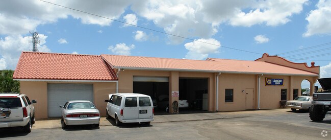
13575 N Us Highway 441, Lady Lake, FL 32159


NEARBY LISTINGS FOR SALE OR LEASE
Property Detail
13575 N Us Highway 441
The Villages, FL
Commercial Highlands
D01A037
S/LY 1/2 OF S/LY 1/2 LOT 6 AND LOTS 7 & 8 BLK 38 COMMERCIAL HIGHLANDS PB 3 PG 47 AND BEG AT THE MOST N/LY COR OF LOT 6 BLK 38 COMMERCIAL HIGHLANDS RUN S 41 DEG 1410E E 37.5 FT TO TO POB CONT S 41 DEG 1410E 112.5 FT N 48 DEG 4550E 1 *** CONTINUED ON T
Commercialacreage
Sumter
X
Florida
12119C0079D
6,7,8
2025
0.80 AC
2025
Ocala
030408
Other Market Areas
690 SF
DEMOGRAPHICS near 13575 N Us Highway 441
1 Mile
3 Mile
5 Mile
2024 Total Population
6,472
41,602
94,013
2029 Population
7,814
50,021
113,941
Pop Growth 2024-2029
+ 20.74%
+ 20.24%
+ 21.20%
Average Age
70
68
65
2024 Total Households
3,692
23,630
50,792
HH Growth 2024-2029
+ 20.48%
+ 20.54%
+ 21.78%
Median Household Inc
$59,837
$55,097
$61,317
Avg Household Size
1.70
1.70
1.80
2024 Avg HH Vehicles
1.00
1.00
1.00
Median Home Value
$261,060
$248,192
$268,419
Median Year Built
1996
1997
2001
Nearby Places
Map Layers
Map Styles
 Street
 Aerial
- Restaurants
- Banks
- Shops
- Fitness
- Groceries
Nearby Properties
Address
Land Use
TOTAL SIZE
Lot Size
Zoning
Address
Land Use
TOTAL SIZE
Lot Size
Zoning
404,584 SF
29.32 AC
MF12
Address
Land Use
TOTAL SIZE
Lot Size
Zoning
344,318 SF
25.73 AC
MF18
Address
Land Use
TOTAL SIZE
Lot Size
Zoning
344,823 SF
17.53 AC
Address
Land Use
TOTAL SIZE
Lot Size
Zoning
122,427 SF
11.40 AC
PUD
Address
Land Use
TOTAL SIZE
Lot Size
Zoning
58,955 SF
6.85 AC
Address
Land Use
TOTAL SIZE
Lot Size
Zoning
171,544 SF
15.78 AC
CP
Address
Land Use
TOTAL SIZE
Lot Size
Zoning
71,467 SF
9.31 AC
Address
Land Use
TOTAL SIZE
Lot Size
Zoning
30,641 SF
103.82 AC
CT
Address
Land Use
TOTAL SIZE
Lot Size
Zoning
165,197 SF
16.74 AC
HC
Address
Land Use
TOTAL SIZE
Lot Size
Zoning
28,844 SF
12.90 AC
Address
Land Use
TOTAL SIZE
Lot Size
Zoning
60,998 SF
5 AC
Address
Land Use
TOTAL SIZE
Lot Size
Zoning
94,208 SF
12.72 AC
CP
Address
Land Use
TOTAL SIZE
Lot Size
Zoning
90,064 SF
8.12 AC
A
Address
Land Use
TOTAL SIZE
Lot Size
Zoning
194,309 SF
26.11 AC
PUD
Address
Land Use
TOTAL SIZE
Lot Size
Zoning
101,064 SF
7.64 AC
CP
Address
Land Use
TOTAL SIZE
Lot Size
Zoning
77,922 SF
7.31 AC
Address
Land Use
TOTAL SIZE
Lot Size
Zoning
78,586 SF
1.61 AC
CP
Address
Land Use
TOTAL SIZE
Lot Size
Zoning
45,553 SF
12.86 AC
Address
Land Use
TOTAL SIZE
Lot Size
Zoning
91,762 SF
3.24 AC
Address
Land Use
TOTAL SIZE
Lot Size
Zoning
69,101 SF
9.69 AC
CP
Address
Land Use
TOTAL SIZE
Lot Size
Zoning
169,950 SF
18.74 AC
A
Address
Land Use
TOTAL SIZE
Lot Size
Zoning
101,154 SF
19.35 AC
PFD
Address
Land Use
TOTAL SIZE
Lot Size
Zoning
103,632 SF
9.59 AC
Address
Land Use
TOTAL SIZE
Lot Size
Zoning
43,686 SF
1.23 AC
CP
Address
Land Use
TOTAL SIZE
Lot Size
Zoning
67,350 SF
1.52 AC
CP
Address
Land Use
TOTAL SIZE
Lot Size
Zoning
12,456 SF
88.51 AC
C1
Address
Land Use
TOTAL SIZE
Lot Size
Zoning
73,894 SF
2.34 AC
CP
Address
Land Use
TOTAL SIZE
Lot Size
Zoning
137,926 SF
14.29 AC
Address
Land Use
TOTAL SIZE
Lot Size
Zoning
77,450 SF
8.97 AC
A
Address
Land Use
TOTAL SIZE
Lot Size
Zoning
84,048 SF
7.02 AC
The World's #1 Commercial Real Estate Marketplace
Connect with us
© 2026 CoStar Group
The information above has been obtained from sources believed reliable. While we do not doubt its accuracy we have not verified it and make no guarantee, warranty or representation about it. It is your responsibility to independently confirm its accuracy and completeness. Any projections, opinions, assumptions, or estimates used are for example only and do not represent the current or future performance of the property. The value of this transaction to you depends on tax and other factors which should be evaluated by your tax, financial, and legal advisors. You and your advisors should conduct a careful, independent investigation of the property to determine to your satisfaction the suitability of the property for your needs.