Property Record
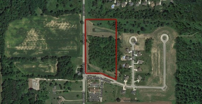
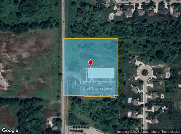
13575 S Airport Rd, Lansing, MI 48906
NEARBY LISTINGS FOR SALE OR LEASE
-
-
View all Lansing listings for lease on LoopNet.com
Property Detail
13575 S Airport Rd
050-018-300-009-00
E 1/2 OF SW 1/4 SEC 18 T5NR2W
Gymhealthspa
Clinton
X
Michigan
26065C0025D
6.73 AC
0
Outlying Clinton County
2025
West Michigan
010300
Lansing-East Lansing, MI
26,110 SF
DEMOGRAPHICS near 13575 S Airport Rd
1 Mile
3 Mile
5 Mile
2024 Total Population
3,341
17,268
39,671
2029 Population
3,393
17,674
40,158
Pop Growth 2024-2029
+ 1.56%
+ 2.35%
+ 1.23%
Average Age
41
41
41
2024 Total Households
1,237
6,509
15,785
HH Growth 2024-2029
+ 1.54%
+ 2.35%
+ 1.15%
Median Household Inc
$105,904
$98,353
$78,995
Avg Household Size
2.70
2.60
2.50
2024 Avg HH Vehicles
2.00
2.00
2.00
Median Home Value
$341,541
$310,319
$220,738
Median Year Built
1989
1991
1973
Nearby Places
Map Layers
Map Styles
 Street
 Aerial
- Restaurants
- Banks
- Shops
- Fitness
- Groceries
PUBLIC TRANSPORTATION
AIRPORT
Capital Region International
DRIVE
WALK
Distance
Capital Region International
9 min
4.7 mi
Freight Ports
Port of Toledo
DRIVE
WALK
Distance
Port of Toledo
157 min
124.2 mi
SALE & LEASE HISTORY
LISTING DATE
SALE/LEASE

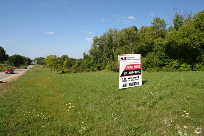
Sep 24, 2016
For Sale
Mar 28, 2017
For Lease
Nearby Properties
Address
Land Use
TOTAL SIZE
Lot Size
Zoning
Address
Land Use
TOTAL SIZE
Lot Size
Zoning
4,312 SF
30.47 AC
M3
Address
Land Use
TOTAL SIZE
Lot Size
Zoning
5,180 SF
16.94 AC
M2
Address
Land Use
TOTAL SIZE
Lot Size
Zoning
3,252 SF
10.16 AC
M3
Address
Land Use
TOTAL SIZE
Lot Size
Zoning
218,000 SF
15.60 AC
LI
Address
Land Use
TOTAL SIZE
Lot Size
Zoning
4,976 SF
6.23 AC
MF-N
Address
Land Use
TOTAL SIZE
Lot Size
Zoning
142,400 SF
16.75 AC
LI
Address
Land Use
TOTAL SIZE
Lot Size
Zoning
8,270 SF
13.15 AC
M3
Address
Land Use
TOTAL SIZE
Lot Size
Zoning
14,276 SF
6.42 AC
M3
Address
Land Use
TOTAL SIZE
Lot Size
Zoning
210,000 SF
14.33 AC
LI
Address
Land Use
TOTAL SIZE
Lot Size
Zoning
10,992 SF
10.43 AC
M3
Address
Land Use
TOTAL SIZE
Lot Size
Zoning
56,579 SF
8.48 AC
BSC
Address
Land Use
TOTAL SIZE
Lot Size
Zoning
4,464 SF
8.29 AC
MF
Address
Land Use
TOTAL SIZE
Lot Size
Zoning
39,372 SF
5.86 AC
BSC
Address
Land Use
TOTAL SIZE
Lot Size
Zoning
19,000 SF
CB
Address
Land Use
TOTAL SIZE
Lot Size
Zoning
8,247 SF
3.75 AC
BC
Address
Land Use
TOTAL SIZE
Lot Size
Zoning
15,576 SF
5.75 AC
M3
Address
Land Use
TOTAL SIZE
Lot Size
Zoning
17,490 SF
3.48 AC
BC
Address
Land Use
TOTAL SIZE
Lot Size
Zoning
22,413 SF
3.32 AC
M4
Address
Land Use
TOTAL SIZE
Lot Size
Zoning
5,536 SF
95.10 AC
PQ
Address
Land Use
TOTAL SIZE
Lot Size
Zoning
12,915 SF
0.95 AC
BL
Address
Land Use
TOTAL SIZE
Lot Size
Zoning
32,906 SF
4.72 AC
BC
Address
Land Use
TOTAL SIZE
Lot Size
Zoning
6,155 SF
4.19 AC
PO
Address
Land Use
TOTAL SIZE
Lot Size
Zoning
1,912 SF
6.61 AC
M3
Address
Land Use
TOTAL SIZE
Lot Size
Zoning
24,840 SF
2.16 AC
LI
Address
Land Use
TOTAL SIZE
Lot Size
Zoning
5,126 SF
1.59 AC
BSC
Address
Land Use
TOTAL SIZE
Lot Size
Zoning
89.93 AC
AG
Address
Land Use
TOTAL SIZE
Lot Size
Zoning
10,582 SF
1.43 AC
BC
Address
Land Use
TOTAL SIZE
Lot Size
Zoning
6,144 SF
15.50 AC
BC
Address
Land Use
TOTAL SIZE
Lot Size
Zoning
106 AC
POD
The World's #1 Commercial Real Estate Marketplace
Connect with us
© 2026 CoStar Group
The information above has been obtained from sources believed reliable. While we do not doubt its accuracy we have not verified it and make no guarantee, warranty or representation about it. It is your responsibility to independently confirm its accuracy and completeness. Any projections, opinions, assumptions, or estimates used are for example only and do not represent the current or future performance of the property. The value of this transaction to you depends on tax and other factors which should be evaluated by your tax, financial, and legal advisors. You and your advisors should conduct a careful, independent investigation of the property to determine to your satisfaction the suitability of the property for your needs.