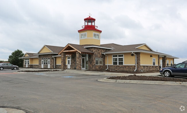
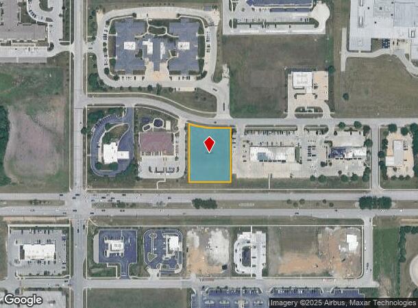
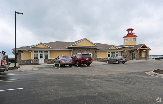
Property Record
14200 W Ns # Ns St, Olathe, KS 66062
NEARBY LISTINGS FOR SALE OR LEASE
Property Detail
14200 W Ns # Ns St
Kansas City, MO-KS
Greenwood Plaza Shopping Center First Pl
DP29270000-0002
GREENWOOD PLAZA SHOPPING CENTER FIRST PLAT LT 2 EX BG NW CR LT 2 E & SE CUR RT 167.38 SE CUR LF 75.46 S 259.52 TO S/L W 230.33 TO SW CR N 329.86 TO POB OLC 187 2
Commercialnec
Johnson
X
Kansas
20091C0081G
2
2024
1.04 AC
2024
South Johnson County
053507
Kansas City
DEMOGRAPHICS near 14200 W Ns # Ns St
1 Mile
3 Mile
5 Mile
2024 Total Population
11,031
96,536
228,874
2029 Population
11,446
99,947
238,256
Pop Growth 2024-2029
+ 3.76%
+ 3.53%
+ 4.10%
Average Age
39
38
38
2024 Total Households
4,197
36,209
86,975
HH Growth 2024-2029
+ 3.86%
+ 3.64%
+ 4.23%
Median Household Inc
$118,976
$97,251
$98,813
Avg Household Size
2.60
2.60
2.60
2024 Avg HH Vehicles
2.00
2.00
2.00
Median Home Value
$379,571
$325,467
$332,221
Median Year Built
2000
1992
1992
Nearby Places
- Restaurants
- Banks
- Shops
- Fitness
- Groceries
PUBLIC TRANSPORTATION
AIRPORT
Kansas City International
DRIVE
WALK
Distance
Kansas City International
50 min
38.1 mi
Freight Ports
Tulsa Port Of Catoosa
DRIVE
WALK
Distance
Tulsa Port Of Catoosa
250 min
223.1 mi
Nearby Properties
Address
Land Use
TOTAL SIZE
Lot Size
Zoning
Address
Land Use
TOTAL SIZE
Lot Size
Zoning
312,726 SF
13.73 AC
RP-4
Address
Land Use
TOTAL SIZE
Lot Size
Zoning
482,713 SF
77.78 AC
AG
Address
Land Use
TOTAL SIZE
Lot Size
Zoning
211,054 SF
77.48 AC
R-1
Address
Land Use
TOTAL SIZE
Lot Size
Zoning
287,599 SF
38.50 AC
R-1
Address
Land Use
TOTAL SIZE
Lot Size
Zoning
323,377 SF
15.55 AC
R-1
Address
Land Use
TOTAL SIZE
Lot Size
Zoning
606,171 SF
31 AC
BP2
Address
Land Use
TOTAL SIZE
Lot Size
Zoning
202,726 SF
9.37 AC
R-1
Address
Land Use
TOTAL SIZE
Lot Size
Zoning
40,647 SF
7.40 AC
R-4
Address
Land Use
TOTAL SIZE
Lot Size
Zoning
189,226 SF
29.81 AC
R-1
Address
Land Use
TOTAL SIZE
Lot Size
Zoning
129,325 SF
4.50 AC
R-1
Address
Land Use
TOTAL SIZE
Lot Size
Zoning
135,551 SF
12.36 AC
R-1
Address
Land Use
TOTAL SIZE
Lot Size
Zoning
89,226 SF
4.37 AC
R-1
Address
Land Use
TOTAL SIZE
Lot Size
Zoning
107,857 SF
10.94 AC
C-2
Address
Land Use
TOTAL SIZE
Lot Size
Zoning
146,832 SF
30 AC
R-1
Address
Land Use
TOTAL SIZE
Lot Size
Zoning
53,359 SF
41.55 AC
R-1
Address
Land Use
TOTAL SIZE
Lot Size
Zoning
150,122 SF
17.48 AC
R-1
Address
Land Use
TOTAL SIZE
Lot Size
Zoning
81,820 SF
15.16 AC
R-1
Address
Land Use
TOTAL SIZE
Lot Size
Zoning
157,344 SF
12.69 AC
R-1
Address
Land Use
TOTAL SIZE
Lot Size
Zoning
61,479 SF
8.14 AC
C-2
Address
Land Use
TOTAL SIZE
Lot Size
Zoning
130,605 SF
18.01 AC
R-1
Address
Land Use
TOTAL SIZE
Lot Size
Zoning
249,780 SF
15.75 AC
BP2
Address
Land Use
TOTAL SIZE
Lot Size
Zoning
32,992 SF
3.85 AC
R-4
Address
Land Use
TOTAL SIZE
Lot Size
Zoning
267,668 SF
17.36 AC
BP2
Address
Land Use
TOTAL SIZE
Lot Size
Zoning
44,738 SF
10.21 AC
CP-2
Address
Land Use
TOTAL SIZE
Lot Size
Zoning
72,253 SF
24.46 AC
R-1
Address
Land Use
TOTAL SIZE
Lot Size
Zoning
9,424 SF
5.15 AC
R-4
Address
Land Use
TOTAL SIZE
Lot Size
Zoning
117,084 SF
10.69 AC
R-1
Address
Land Use
TOTAL SIZE
Lot Size
Zoning
52,863 SF
10.81 AC
R-1A
Address
Land Use
TOTAL SIZE
Lot Size
Zoning
122,720 SF
27.39 AC
R-1
Address
Land Use
TOTAL SIZE
Lot Size
Zoning
115,263 SF
23.66 AC
R-1
The World's #1 Commercial Real Estate Marketplace
Connect with us
© 2025 CoStar Group
The information above has been obtained from sources believed reliable. While we do not doubt its accuracy we have not verified it and make no guarantee, warranty or representation about it. It is your responsibility to independently confirm its accuracy and completeness. Any projections, opinions, assumptions, or estimates used are for example only and do not represent the current or future performance of the property. The value of this transaction to you depends on tax and other factors which should be evaluated by your tax, financial, and legal advisors. You and your advisors should conduct a careful, independent investigation of the property to determine to your satisfaction the suitability of the property for your needs.