Property Record
136 Andover St, Danvers, MA 01923
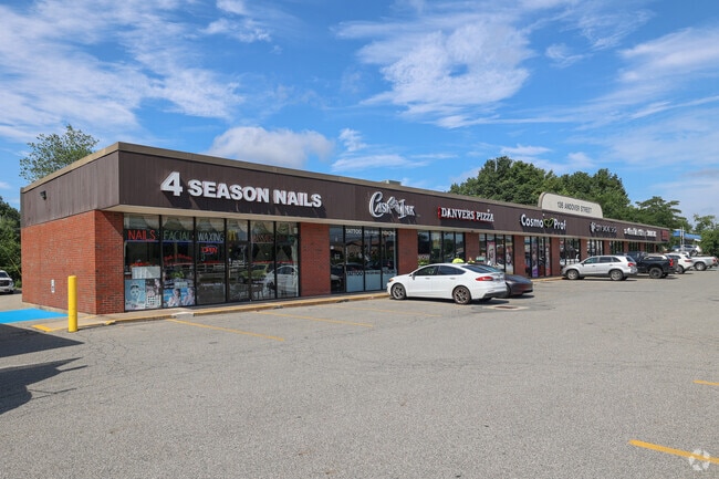

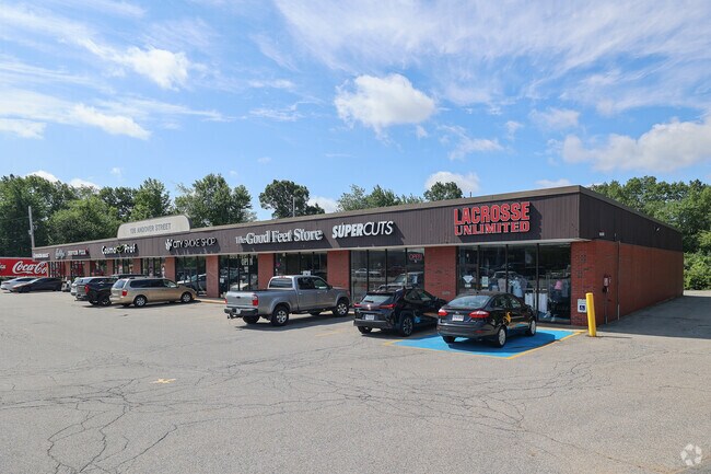
Property Detail
136 Andover St
DANV-000055-000000-000007
Essex
Regionalshoppingcenterormallwithanchorstore
Massachusetts
R114
7
AE The base floodplain where base flood elevations are provided. AE Zones are now used on new format FIRMs instead of A1-A30 Zones.
2.40 AC
2025
Danvers/Beverly
2025
Boston
211402
Boston-Cambridge-Newton, MA-NH
16,444 SF
NEARBY LISTINGS FOR SALE OR LEASE
DEMOGRAPHICS near 136 Andover St
1 mile
3 mile
5 mile
2025 Total Population
9,129
67,478
190,362
2030 Population
9,400
69,194
195,055
Pop Growth 2025-2030
+ 2.97%
+ 2.54%
+ 2.47%
Average Age
51
45
43
2025 Total Households
4,602
27,588
77,301
HH Growth 2025-2030
+ 3.39%
+ 2.56%
+ 2.41%
Median Household Inc
$82,585
$102,268
$102,473
Avg Household Size
1.90
2.30
2.40
2025 Avg HH Vehicles
1.00
2.00
2.00
Median Home Value
$500,723
$666,796
$682,846
Median Year Built
1987
1968
1962
Nearby Places
Map Layers
Map Styles
 Street
 Aerial
Transit
 Traffic
 Biking
Places
Listings with unknown addresses are not visible on the map
- Restaurants
- Banks
- Shops
- Fitness
- Groceries
PUBLIC TRANSPORTATION
COMMUTER RAIL
Salem (Newburyport/Rockport Line - Massachusetts Bay Transportation Authority Commuter Rail (Purple Line))
Drive
Walk
Distance
Salem (Newburyport/Rockport Line - Massachusetts Bay Transportation Authority Commuter Rail (Purple Line))
12 min
5.0 mi
North Beverly (Newburyport/Rockport Line - Massachusetts Bay Transportation Authority Commuter Rail (Purple Line))
Drive
Walk
Distance
North Beverly (Newburyport/Rockport Line - Massachusetts Bay Transportation Authority Commuter Rail (Purple Line))
10 min
5.2 mi
AIRPORT
General Edward Lawrence Logan International
Drive
Walk
Distance
General Edward Lawrence Logan International
28 min
17.1 mi
Manchester Boston Regional
Drive
Walk
Distance
Manchester Boston Regional
68 min
43.1 mi
Freight Ports
Port of Boston
Drive
Walk
Distance
Port of Boston
31 min
19.7 mi
SALE & LEASE HISTORY
LISTING DATE
SALE/LEASE

Nov 20, 2017
For Lease
Nearby Properties
Address
Land Use
TOTAL SIZE
Lot Size
Zoning
Address
Land Use
TOTAL SIZE
Lot Size
Zoning
747,237 SF
36.70 AC
HW
Address
Land Use
TOTAL SIZE
Lot Size
Zoning
10,368 SF
33.83 AC
R3
Address
Land Use
TOTAL SIZE
Lot Size
Zoning
252,965 SF
56.44 AC
R3
Address
Land Use
TOTAL SIZE
Lot Size
Zoning
17 AC
R4
Address
Land Use
TOTAL SIZE
Lot Size
Zoning
198.74 AC
R3
Address
Land Use
TOTAL SIZE
Lot Size
Zoning
49 AC
I2
Address
Land Use
TOTAL SIZE
Lot Size
Zoning
17.60 AC
R1A
Address
Land Use
TOTAL SIZE
Lot Size
Zoning
13.04 AC
HC
Address
Land Use
TOTAL SIZE
Lot Size
Zoning
9.71 AC
BR
Address
Land Use
TOTAL SIZE
Lot Size
Zoning
49.85 AC
R1B
Address
Land Use
TOTAL SIZE
Lot Size
Zoning
65.79 AC
I1
Address
Land Use
TOTAL SIZE
Lot Size
Zoning
40.20 AC
R1B
Address
Land Use
TOTAL SIZE
Lot Size
Zoning
206.65 AC
R1B
Address
Land Use
TOTAL SIZE
Lot Size
Zoning
54,302 SF
83.70 AC
R3
Address
Land Use
TOTAL SIZE
Lot Size
Zoning
18.72 AC
R1
Address
Land Use
TOTAL SIZE
Lot Size
Zoning
11.08 AC
R4
Address
Land Use
TOTAL SIZE
Lot Size
Zoning
249,587 SF
5.79 AC
DDD
Address
Land Use
TOTAL SIZE
Lot Size
Zoning
59.99 AC
IP
Address
Land Use
TOTAL SIZE
Lot Size
Zoning
25.72 AC
IP
Address
Land Use
TOTAL SIZE
Lot Size
Zoning
408,207 SF
37.12 AC
C3
Address
Land Use
TOTAL SIZE
Lot Size
Zoning
28.30 AC
IP
Address
Land Use
TOTAL SIZE
Lot Size
Zoning
93,789 SF
8.22 AC
HW
Address
Land Use
TOTAL SIZE
Lot Size
Zoning
111.24 AC
R3
Address
Land Use
TOTAL SIZE
Lot Size
Zoning
177,782 SF
12.21 AC
I2
Address
Land Use
TOTAL SIZE
Lot Size
Zoning
24.37 AC
C3
Address
Land Use
TOTAL SIZE
Lot Size
Zoning
20.78 AC
C3
Address
Land Use
TOTAL SIZE
Lot Size
Zoning
19.10 AC
R114
Address
Land Use
TOTAL SIZE
Lot Size
Zoning
15.32 AC
HC
Address
Land Use
TOTAL SIZE
Lot Size
Zoning
71.68 AC
R3
Address
Land Use
TOTAL SIZE
Lot Size
Zoning
15.16 AC
I2
The World's #1 Commercial Real Estate Marketplace
Connect with us
© 2026 CoStar Group
The information above has been obtained from sources believed reliable. While we do not doubt its accuracy we have not verified it and make no guarantee, warranty or representation about it. It is your responsibility to independently confirm its accuracy and completeness. Any projections, opinions, assumptions, or estimates used are for example only and do not represent the current or future performance of the property. The value of this transaction to you depends on tax and other factors which should be evaluated by your tax, financial, and legal advisors. You and your advisors should conduct a careful, independent investigation of the property to determine to your satisfaction the suitability of the property for your needs.