Property Record
136 Chaffee Rd S, Jacksonville, FL 32220
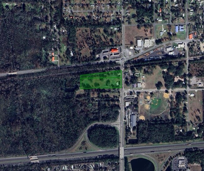

This Property Is For Sale
NEARBY LISTINGS FOR SALE OR LEASE
Property Detail
136 Chaffee Rd S
001830-0000
Section Land
Sfr
24-2S-24E 3.886 PT SE1/4 OF NE1/4 RECD O/R 15403-1218 (EX PT RECD O/R 8940-453)
AE
Duval
12031C0330H
Florida
2025
3.76 AC
2026
Northwest Jacksonville
011901
Jacksonville (Florida)
856 SF
Jacksonville, FL
DEMOGRAPHICS near 136 Chaffee Rd S
1 mile
3 mile
5 mile
2024 Total Population
2,697
24,999
56,460
2029 Population
2,768
26,453
59,238
Pop Growth 2024-2029
+ 2.63%
+ 5.82%
+ 4.92%
Average Age
41
39
39
2024 Total Households
991
8,711
20,269
HH Growth 2024-2029
+ 2.62%
+ 5.77%
+ 4.90%
Median Household Inc
$72,448
$78,268
$69,554
Avg Household Size
2.70
2.80
2.70
2024 Avg HH Vehicles
2.00
2.00
2.00
Median Home Value
$250,156
$245,402
$215,914
Median Year Built
1995
2002
1996
Nearby Places
Map Layers
Map Styles
 Street
 Aerial
Transit
 Traffic
 Biking
Places
Listings with unknown addresses are not visible on the map
- Restaurants
- Banks
- Shops
- Fitness
- Groceries
PUBLIC TRANSPORTATION
AIRPORT
Jacksonville International
Drive
Walk
Distance
Jacksonville International
32 min
22.3 mi
Freight Ports
Jacksonville Port
Drive
Walk
Distance
Jacksonville Port
24 min
16.1 mi
Nearby Properties
Address
Land Use
TOTAL SIZE
Lot Size
Zoning
Address
Land Use
TOTAL SIZE
Lot Size
Zoning
421,500 SF
43.21 AC
PUD
Address
Land Use
TOTAL SIZE
Lot Size
Zoning
505,748 SF
94.71 AC
IL
Address
Land Use
TOTAL SIZE
Lot Size
Zoning
273,608 SF
23.15 AC
PUD
Address
Land Use
TOTAL SIZE
Lot Size
Zoning
270,762 SF
39.15 AC
PUD
Address
Land Use
TOTAL SIZE
Lot Size
Zoning
509,686 SF
43.32 AC
IL
Address
Land Use
TOTAL SIZE
Lot Size
Zoning
481,686 SF
43.54 AC
IL
Address
Land Use
TOTAL SIZE
Lot Size
Zoning
89,150 SF
61.04 AC
RMD-MH
Address
Land Use
TOTAL SIZE
Lot Size
Zoning
2,288 SF
373.54 AC
PBF-1
Address
Land Use
TOTAL SIZE
Lot Size
Zoning
30,789 SF
2.10 AC
PUD
Address
Land Use
TOTAL SIZE
Lot Size
Zoning
54,700 SF
48.29 AC
RMD-MH
Address
Land Use
TOTAL SIZE
Lot Size
Zoning
160,778 SF
25.46 AC
IL
Address
Land Use
TOTAL SIZE
Lot Size
Zoning
108,217 SF
178.52 AC
PBF-1
Address
Land Use
TOTAL SIZE
Lot Size
Zoning
53,568 SF
39.09 AC
RMD-MH
Address
Land Use
TOTAL SIZE
Lot Size
Zoning
29,022 SF
3.17 AC
PUD
Address
Land Use
TOTAL SIZE
Lot Size
Zoning
41,628 SF
94.43 AC
RMD-MH
Address
Land Use
TOTAL SIZE
Lot Size
Zoning
33,424 SF
2.97 AC
PUD
Address
Land Use
TOTAL SIZE
Lot Size
Zoning
53,527 SF
10.89 AC
CCG-1
Address
Land Use
TOTAL SIZE
Lot Size
Zoning
53,405 SF
6.04 AC
PUD
Address
Land Use
TOTAL SIZE
Lot Size
Zoning
76,718 SF
8.89 AC
RR-ACRE
Address
Land Use
TOTAL SIZE
Lot Size
Zoning
36,354 SF
3.72 AC
CCG-1
Address
Land Use
TOTAL SIZE
Lot Size
Zoning
153,671 SF
27.09 AC
IL
Address
Land Use
TOTAL SIZE
Lot Size
Zoning
26,961 SF
1.36 AC
PUD
Address
Land Use
TOTAL SIZE
Lot Size
Zoning
806 SF
125.05 AC
PUD
Address
Land Use
TOTAL SIZE
Lot Size
Zoning
30,440 SF
25.01 AC
PUD
Address
Land Use
TOTAL SIZE
Lot Size
Zoning
12,384 SF
4.88 AC
RMD-MH
Address
Land Use
TOTAL SIZE
Lot Size
Zoning
35,821 SF
11.79 AC
IL
Address
Land Use
TOTAL SIZE
Lot Size
Zoning
14,722 SF
3.22 AC
CCG-2
Address
Land Use
TOTAL SIZE
Lot Size
Zoning
19,070 SF
8.06 AC
IL
Address
Land Use
TOTAL SIZE
Lot Size
Zoning
40,210 SF
6.61 AC
RLD-60
Address
Land Use
TOTAL SIZE
Lot Size
Zoning
55,356 SF
24.83 AC
PBF-3
The World's #1 Commercial Real Estate Marketplace
Connect with us
© 2026 CoStar Group
The information above has been obtained from sources believed reliable. While we do not doubt its accuracy we have not verified it and make no guarantee, warranty or representation about it. It is your responsibility to independently confirm its accuracy and completeness. Any projections, opinions, assumptions, or estimates used are for example only and do not represent the current or future performance of the property. The value of this transaction to you depends on tax and other factors which should be evaluated by your tax, financial, and legal advisors. You and your advisors should conduct a careful, independent investigation of the property to determine to your satisfaction the suitability of the property for your needs.