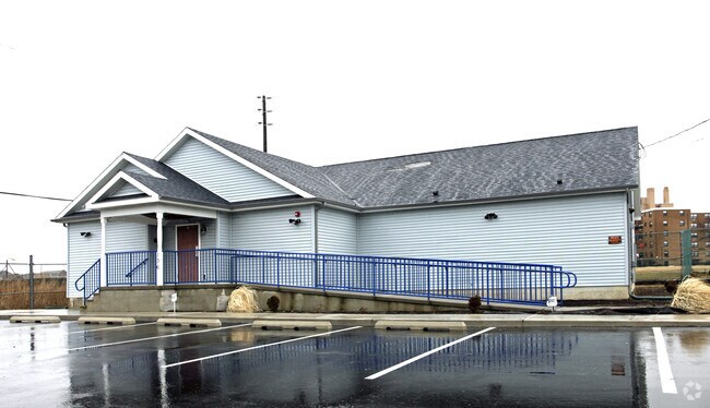
Property Record
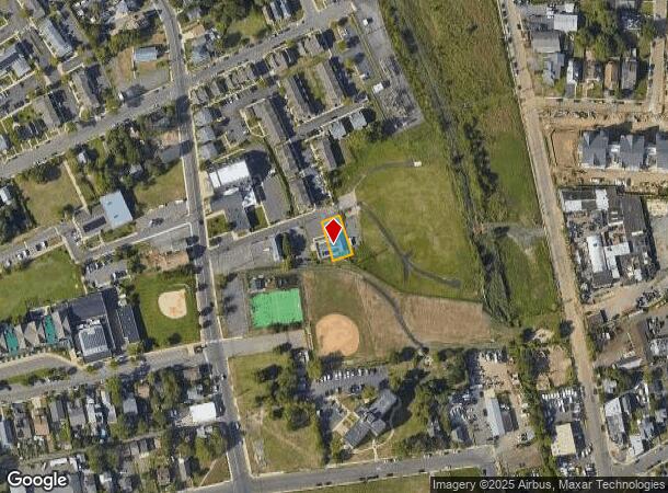
136 Cp Williams Pl, Long Branch, NJ 07740
NEARBY LISTINGS FOR SALE OR LEASE
Property Detail
136 Cp Williams Pl
27-00309-0000-00009
FACILITY NAME: CLUB
Religious
Monmouth
X
New Jersey
34025C0211F
9
0
0.13 AC
2025
Eastern Monmouth
805600
Northern New Jersey
2,310 SF
New York-Jersey City-White Plains, NY-NJ
DEMOGRAPHICS near 136 Cp Williams Pl
1 Mile
3 Mile
5 Mile
2024 Total Population
17,662
54,463
114,438
2029 Population
17,684
54,897
114,856
Pop Growth 2024-2029
+ 0.12%
+ 0.80%
+ 0.37%
Average Age
39
41
41
2024 Total Households
6,818
20,843
44,206
HH Growth 2024-2029
+ 0.44%
+ 0.99%
+ 0.31%
Median Household Inc
$56,954
$79,694
$96,691
Avg Household Size
2.40
2.40
2.50
2024 Avg HH Vehicles
1.00
2.00
2.00
Median Home Value
$389,867
$594,901
$643,562
Median Year Built
1975
1970
1969
Nearby Places
Map Layers
Map Styles
 Street
 Aerial
- Restaurants
- Banks
- Shops
- Fitness
- Groceries
PUBLIC TRANSPORTATION
COMMUTER RAIL
Long Branch (North Jersey Coast Line - NJ Transit Commuter Rail (NJ Transit))
DRIVE
WALK
Distance
Long Branch (North Jersey Coast Line - NJ Transit Commuter Rail (NJ Transit))
2 min
17 min
0.9 mi
Monmouth Park (North Jersey Coast Line - NJ Transit Commuter Rail (NJ Transit))
DRIVE
WALK
Distance
Monmouth Park (North Jersey Coast Line - NJ Transit Commuter Rail (NJ Transit))
5 min
2.4 mi
AIRPORT
Newark Liberty International
DRIVE
WALK
Distance
Newark Liberty International
60 min
49.0 mi
Freight Ports
New York Container Terminal
DRIVE
WALK
Distance
New York Container Terminal
54 min
41.1 mi
Nearby Properties
Address
Land Use
TOTAL SIZE
Lot Size
Zoning
Address
Land Use
TOTAL SIZE
Lot Size
Zoning
13.75 AC
M
Address
Land Use
TOTAL SIZE
Lot Size
Zoning
89,939 SF
51.49 AC
I
Address
Land Use
TOTAL SIZE
Lot Size
Zoning
279,346 SF
3.59 AC
P/VC
Address
Land Use
TOTAL SIZE
Lot Size
Zoning
267,887 SF
13.45 AC
HC
Address
Land Use
TOTAL SIZE
Lot Size
Zoning
136.40 AC
B2
Address
Land Use
TOTAL SIZE
Lot Size
Zoning
22,877 SF
10.35 AC
IC
Address
Land Use
TOTAL SIZE
Lot Size
Zoning
194,784 SF
2.88 AC
P/VC
Address
Land Use
TOTAL SIZE
Lot Size
Zoning
16,276 SF
162.59 AC
R-1
Address
Land Use
TOTAL SIZE
Lot Size
Zoning
2,446 SF
21.62 AC
R-5
Address
Land Use
TOTAL SIZE
Lot Size
Zoning
293,262 SF
28.40 AC
HC
Address
Land Use
TOTAL SIZE
Lot Size
Zoning
314,569 SF
22.05 AC
R-4
Address
Land Use
TOTAL SIZE
Lot Size
Zoning
79,391 SF
9.17 AC
C-4
Address
Land Use
TOTAL SIZE
Lot Size
Zoning
5,904 SF
29.80 AC
S-2
Address
Land Use
TOTAL SIZE
Lot Size
Zoning
2.19 AC
BG
Address
Land Use
TOTAL SIZE
Lot Size
Zoning
137,672 SF
2.79 AC
BS
Address
Land Use
TOTAL SIZE
Lot Size
Zoning
121,272 SF
3.93 AC
C-4
Address
Land Use
TOTAL SIZE
Lot Size
Zoning
14.23 AC
R-4
Address
Land Use
TOTAL SIZE
Lot Size
Zoning
77.36 AC
B2
Address
Land Use
TOTAL SIZE
Lot Size
Zoning
157,580 SF
14.95 AC
R-4
Address
Land Use
TOTAL SIZE
Lot Size
Zoning
0.13 AC
BS
Address
Land Use
TOTAL SIZE
Lot Size
Zoning
40.82 AC
I
Address
Land Use
TOTAL SIZE
Lot Size
Zoning
108,629 SF
12.05 AC
HC
Address
Land Use
TOTAL SIZE
Lot Size
Zoning
22,522 SF
6.25 AC
I
Address
Land Use
TOTAL SIZE
Lot Size
Zoning
10.47 AC
R-7
Address
Land Use
TOTAL SIZE
Lot Size
Zoning
73,032 SF
7.30 AC
B1
Address
Land Use
TOTAL SIZE
Lot Size
Zoning
59,104 SF
1.27 AC
P/VC
Address
Land Use
TOTAL SIZE
Lot Size
Zoning
1.31 AC
C-3
Address
Land Use
TOTAL SIZE
Lot Size
Zoning
139,048 SF
3.01 AC
C-4
Address
Land Use
TOTAL SIZE
Lot Size
Zoning
6 AC
R-5
Address
Land Use
TOTAL SIZE
Lot Size
Zoning
5,033 SF
16 AC
SH
The World's #1 Commercial Real Estate Marketplace
Connect with us
© 2025 CoStar Group
The information above has been obtained from sources believed reliable. While we do not doubt its accuracy we have not verified it and make no guarantee, warranty or representation about it. It is your responsibility to independently confirm its accuracy and completeness. Any projections, opinions, assumptions, or estimates used are for example only and do not represent the current or future performance of the property. The value of this transaction to you depends on tax and other factors which should be evaluated by your tax, financial, and legal advisors. You and your advisors should conduct a careful, independent investigation of the property to determine to your satisfaction the suitability of the property for your needs.