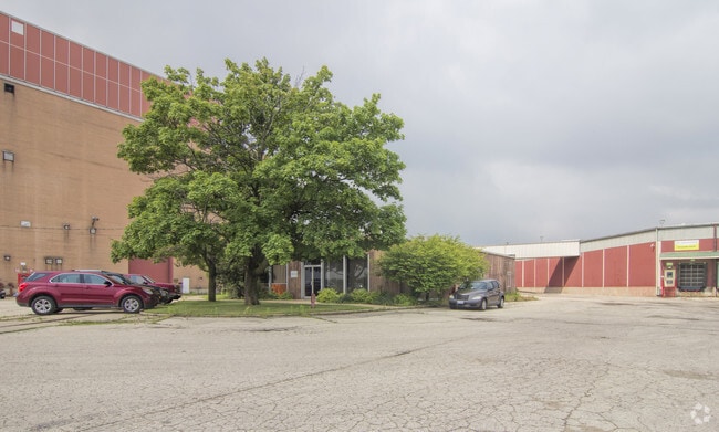
Property Record
136 Harrison Ave, Rockford, IL 61104

NEARBY LISTINGS FOR SALE OR LEASE
Property Detail
136 Harrison Ave
Rockford, IL
Indeck Energy Sub
11-34-451-008
INDECK ENERGY SUB PT SE1/4 SEC 34-44-1LOT 1
Industrialgeneral
Winnebago
AE
Illinois
17201C0376E
1
2024
19.30 AC
2024
I-39 Cor/Winnebago Cy
002100
Chicago
13,308 SF
DEMOGRAPHICS near 136 Harrison Ave
1 Mile
3 Mile
5 Mile
2024 Total Population
4,911
58,443
133,759
2029 Population
4,851
58,296
132,716
Pop Growth 2024-2029
(1.22%)
(0.25%)
(0.78%)
Average Age
36
36
38
2024 Total Households
1,850
22,889
53,483
HH Growth 2024-2029
(1.19%)
(0.33%)
(0.83%)
Median Household Inc
$28,423
$33,303
$42,638
Avg Household Size
2.60
2.40
2.40
2024 Avg HH Vehicles
1.00
1.00
2.00
Median Home Value
$61,980
$69,298
$90,337
Median Year Built
1954
1951
1957
Nearby Places
Map Layers
Map Styles
 Street
 Aerial
- Restaurants
- Banks
- Shops
- Fitness
- Groceries
PUBLIC TRANSPORTATION
AIRPORT
Chicago/Rockford International
DRIVE
WALK
Distance
Chicago/Rockford International
16 min
6.6 mi
Freight Ports
Port Milwaukee
DRIVE
WALK
Distance
Port Milwaukee
119 min
98.7 mi
SALE & LEASE HISTORY
LISTING DATE
SALE/LEASE

Sep 25, 2016
For Lease
Dec 07, 2016
For Sale
Nearby Properties
Address
Land Use
TOTAL SIZE
Lot Size
Zoning
Address
Land Use
TOTAL SIZE
Lot Size
Zoning
1,456,216 SF
103.10 AC
I1
Address
Land Use
TOTAL SIZE
Lot Size
Zoning
555,920 SF
37.99 AC
I2
Address
Land Use
TOTAL SIZE
Lot Size
Zoning
201,507 SF
C4
Address
Land Use
TOTAL SIZE
Lot Size
Zoning
291,074 SF
10.97 AC
I3
Address
Land Use
TOTAL SIZE
Lot Size
Zoning
189,455 SF
10.99 AC
I3
Address
Land Use
TOTAL SIZE
Lot Size
Zoning
115,095 SF
0.25 AC
C4
Address
Land Use
TOTAL SIZE
Lot Size
Zoning
117,360 SF
1.52 AC
R4
Address
Land Use
TOTAL SIZE
Lot Size
Zoning
111,491 SF
0.32 AC
C4
Address
Land Use
TOTAL SIZE
Lot Size
Zoning
173,193 SF
5.97 AC
I3
Address
Land Use
TOTAL SIZE
Lot Size
Zoning
79,318 SF
1.55 AC
C4
Address
Land Use
TOTAL SIZE
Lot Size
Zoning
43.23 AC
I1
Address
Land Use
TOTAL SIZE
Lot Size
Zoning
192,575 SF
46.19 AC
I1
Address
Land Use
TOTAL SIZE
Lot Size
Zoning
623,379 SF
35.15 AC
I3
Address
Land Use
TOTAL SIZE
Lot Size
Zoning
189,568 SF
12.68 AC
I1
Address
Land Use
TOTAL SIZE
Lot Size
Zoning
58,750 SF
11.25 AC
I1
Address
Land Use
TOTAL SIZE
Lot Size
Zoning
174,318 SF
17.97 AC
Address
Land Use
TOTAL SIZE
Lot Size
Zoning
2,975 SF
5.42 AC
I2
Address
Land Use
TOTAL SIZE
Lot Size
Zoning
212,574 SF
9.57 AC
I3
Address
Land Use
TOTAL SIZE
Lot Size
Zoning
108,233 SF
0.34 AC
C4
Address
Land Use
TOTAL SIZE
Lot Size
Zoning
158,754 SF
0.91 AC
C4
Address
Land Use
TOTAL SIZE
Lot Size
Zoning
39,184 SF
3.10 AC
C2
Address
Land Use
TOTAL SIZE
Lot Size
Zoning
150,351 SF
22.95 AC
I3
Address
Land Use
TOTAL SIZE
Lot Size
Zoning
77,936 SF
1.71 AC
C4
Address
Land Use
TOTAL SIZE
Lot Size
Zoning
10,970 SF
26.80 AC
R2
Address
Land Use
TOTAL SIZE
Lot Size
Zoning
151,360 SF
8.13 AC
I1
Address
Land Use
TOTAL SIZE
Lot Size
Zoning
584,794 SF
34.40 AC
I3
Address
Land Use
TOTAL SIZE
Lot Size
Zoning
239,792 SF
0.25 AC
C4
Address
Land Use
TOTAL SIZE
Lot Size
Zoning
85,575 SF
10.29 AC
C2
Address
Land Use
TOTAL SIZE
Lot Size
Zoning
299,238 SF
18.84 AC
I2
The World's #1 Commercial Real Estate Marketplace
Connect with us
© 2025 CoStar Group
The information above has been obtained from sources believed reliable. While we do not doubt its accuracy we have not verified it and make no guarantee, warranty or representation about it. It is your responsibility to independently confirm its accuracy and completeness. Any projections, opinions, assumptions, or estimates used are for example only and do not represent the current or future performance of the property. The value of this transaction to you depends on tax and other factors which should be evaluated by your tax, financial, and legal advisors. You and your advisors should conduct a careful, independent investigation of the property to determine to your satisfaction the suitability of the property for your needs.