Property Record
136 N One Dr, Saint Augustine, FL 32095


Property Detail
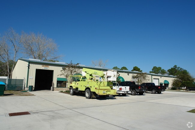
136 N One Dr
074350-0000
13-1 PT OF GRANTS TO HINDSMAN SABATE & CURTIS LYING E OF US 1 W OF UT 1A ST AUG PARK S OF BLOMGREN & N OF SHOWERMAN 273 X 801.17FT (EX PT OR2039/ 1231) (EX PT IN OR3703/126) OR743/303
Warehouse
Saint Johns
IW
Florida
B and X Area of moderate flood hazard, usually the area between the limits of the 100-year and 500-year floods.
5
2023
4.85 AC
2025
St Johns County
020606
Jacksonville (Florida)
12,479 SF
Jacksonville, FL
NEARBY LISTINGS FOR SALE OR LEASE
DEMOGRAPHICS near 136 N One Dr
1 mile
3 mile
5 mile
2025 Total Population
3,058
9,650
30,449
2030 Population
3,604
11,231
35,571
Pop Growth 2025-2030
+ 17.85%
+ 16.38%
+ 16.82%
Average Age
42
43
44
2025 Total Households
1,119
3,509
11,659
HH Growth 2025-2030
+ 18.41%
+ 16.87%
+ 17.23%
Median Household Inc
$117,045
$117,562
$116,864
Avg Household Size
2.50
2.60
2.50
2025 Avg HH Vehicles
2.00
2.00
2.00
Median Home Value
$289,156
$537,317
$575,886
Median Year Built
2005
2007
2010
Nearby Places
Map Layers
Map Styles
 Street
 Aerial
Transit
 Traffic
 Biking
Places
Listings with unknown addresses are not visible on the map
- Restaurants
- Banks
- Shops
- Fitness
- Groceries
PUBLIC TRANSPORTATION
AIRPORT
Jacksonville International
Drive
Walk
Distance
Jacksonville International
58 min
43.9 mi
Freight Ports
Jacksonville Port
Drive
Walk
Distance
Jacksonville Port
48 min
34.1 mi
Nearby Properties
Address
Land Use
TOTAL SIZE
Lot Size
Zoning
Address
Land Use
TOTAL SIZE
Lot Size
Zoning
198,608 SF
54.13 AC
AD
Address
Land Use
TOTAL SIZE
Lot Size
Zoning
102,311 SF
7.21 AC
PUD
Address
Land Use
TOTAL SIZE
Lot Size
Zoning
67,311 SF
7.28 AC
PUD
Address
Land Use
TOTAL SIZE
Lot Size
Zoning
268.05 AC
Address
Land Use
TOTAL SIZE
Lot Size
Zoning
20,790 SF
22.47 AC
Address
Land Use
TOTAL SIZE
Lot Size
Zoning
69,600 SF
24 AC
AD
Address
Land Use
TOTAL SIZE
Lot Size
Zoning
65.40 AC
Address
Land Use
TOTAL SIZE
Lot Size
Zoning
21,579 SF
3.96 AC
PUD
Address
Land Use
TOTAL SIZE
Lot Size
Zoning
703 SF
4.41 AC
Address
Land Use
TOTAL SIZE
Lot Size
Zoning
8,018 SF
5.26 AC
IW
Address
Land Use
TOTAL SIZE
Lot Size
Zoning
7,200 SF
4.73 AC
CI
Address
Land Use
TOTAL SIZE
Lot Size
Zoning
19,450 SF
6 AC
IW
Address
Land Use
TOTAL SIZE
Lot Size
Zoning
7,967 SF
12.90 AC
IW/OR
Address
Land Use
TOTAL SIZE
Lot Size
Zoning
33,170 SF
9.39 AC
AD
Address
Land Use
TOTAL SIZE
Lot Size
Zoning
11,139 SF
2.75 AC
CI
Address
Land Use
TOTAL SIZE
Lot Size
Zoning
44,150 SF
2.75 AC
Address
Land Use
TOTAL SIZE
Lot Size
Zoning
9,706 SF
0.69 AC
PUD
Address
Land Use
TOTAL SIZE
Lot Size
Zoning
9,350 SF
4.92 AC
IW
Address
Land Use
TOTAL SIZE
Lot Size
Zoning
14,024 SF
1.82 AC
Address
Land Use
TOTAL SIZE
Lot Size
Zoning
33.46 AC
OR
Address
Land Use
TOTAL SIZE
Lot Size
Zoning
123.97 AC
AD
Address
Land Use
TOTAL SIZE
Lot Size
Zoning
Address
Land Use
TOTAL SIZE
Lot Size
Zoning
5,346 SF
1.92 AC
PUD
Address
Land Use
TOTAL SIZE
Lot Size
Zoning
1,228 SF
1.93 AC
IW
Address
Land Use
TOTAL SIZE
Lot Size
Zoning
3.49 AC
IW
Address
Land Use
TOTAL SIZE
Lot Size
Zoning
Address
Land Use
TOTAL SIZE
Lot Size
Zoning
6,340 SF
1.88 AC
DRI
Address
Land Use
TOTAL SIZE
Lot Size
Zoning
12,868 SF
1.58 AC
DRI
Address
Land Use
TOTAL SIZE
Lot Size
Zoning
11,060 SF
5.59 AC
Address
Land Use
TOTAL SIZE
Lot Size
Zoning
1,544 SF
285.70 AC
OR
The World's #1 Commercial Real Estate Marketplace
Connect with us
© 2026 CoStar Group
The information above has been obtained from sources believed reliable. While we do not doubt its accuracy we have not verified it and make no guarantee, warranty or representation about it. It is your responsibility to independently confirm its accuracy and completeness. Any projections, opinions, assumptions, or estimates used are for example only and do not represent the current or future performance of the property. The value of this transaction to you depends on tax and other factors which should be evaluated by your tax, financial, and legal advisors. You and your advisors should conduct a careful, independent investigation of the property to determine to your satisfaction the suitability of the property for your needs.