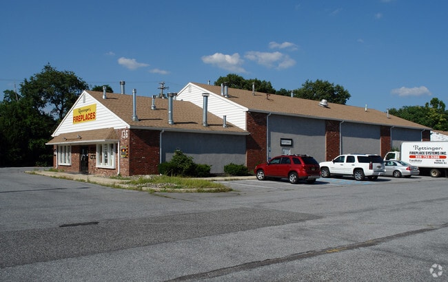
Property Record
136 Route 73, Voorhees, NJ 08043


NEARBY LISTINGS FOR SALE OR LEASE
Property Detail
136 Route 73
34-00229-0000-00004
ALSO LT 4-1
Commercialnec
Camden
X
New Jersey
34005C0358F
4
2024
5.49 AC
2025
Camden County
607504
Philadelphia
15,800 SF
Philadelphia-Camden-Wilmington, PA-NJ-DE-MD
DEMOGRAPHICS near 136 Route 73
1 Mile
3 Mile
5 Mile
2024 Total Population
4,847
46,129
154,688
2029 Population
4,788
46,244
155,276
Pop Growth 2024-2029
(1.22%)
+ 0.25%
+ 0.38%
Average Age
42
42
41
2024 Total Households
1,598
17,361
60,178
HH Growth 2024-2029
(1.31%)
+ 0.28%
+ 0.40%
Median Household Inc
$185,640
$108,008
$95,949
Avg Household Size
2.90
2.60
2.50
2024 Avg HH Vehicles
2.00
2.00
2.00
Median Home Value
$414,568
$338,913
$302,476
Median Year Built
1982
1981
1976
Nearby Places
Map Layers
Map Styles
 Street
 Aerial
- Restaurants
- Banks
- Shops
- Fitness
- Groceries
PUBLIC TRANSPORTATION
COMMUTER RAIL
Atco (Atlantic City Line - NJ Transit Commuter Rail (NJ Transit))
DRIVE
WALK
Distance
Atco (Atlantic City Line - NJ Transit Commuter Rail (NJ Transit))
11 min
6.2 mi
Lindenwold (NJT) (Atlantic City Line - NJ Transit Commuter Rail (NJ Transit))
DRIVE
WALK
Distance
Lindenwold (NJT) (Atlantic City Line - NJ Transit Commuter Rail (NJ Transit))
13 min
8.3 mi
AIRPORT
Philadelphia International
DRIVE
WALK
Distance
Philadelphia International
42 min
24.9 mi
Atlantic City International
DRIVE
WALK
Distance
Atlantic City International
69 min
37.7 mi
Trenton Mercer
DRIVE
WALK
Distance
Trenton Mercer
59 min
41.1 mi
Nearby Properties
Address
Land Use
TOTAL SIZE
Lot Size
Zoning
Address
Land Use
TOTAL SIZE
Lot Size
Zoning
58.91 AC
MB
Address
Land Use
TOTAL SIZE
Lot Size
Zoning
256,152 SF
58.91 AC
MB
Address
Land Use
TOTAL SIZE
Lot Size
Zoning
79.35 AC
CP
Address
Land Use
TOTAL SIZE
Lot Size
Zoning
1,896 SF
93.79 AC
LD
Address
Land Use
TOTAL SIZE
Lot Size
Zoning
270,246 SF
0.71 AC
RA
Address
Land Use
TOTAL SIZE
Lot Size
Zoning
16.61 AC
SH
Address
Land Use
TOTAL SIZE
Lot Size
Zoning
53.35 AC
LD
Address
Land Use
TOTAL SIZE
Lot Size
Zoning
4,177 SF
32.42 AC
SH
Address
Land Use
TOTAL SIZE
Lot Size
Zoning
114,852 SF
12.73 AC
GB2
Address
Land Use
TOTAL SIZE
Lot Size
Zoning
38.13 AC
CP
Address
Land Use
TOTAL SIZE
Lot Size
Zoning
186,464 SF
19.93 AC
MB
Address
Land Use
TOTAL SIZE
Lot Size
Zoning
44.34 AC
C1
Address
Land Use
TOTAL SIZE
Lot Size
Zoning
122,264 SF
5 AC
RR
Address
Land Use
TOTAL SIZE
Lot Size
Zoning
58,330 SF
5.08 AC
MB
Address
Land Use
TOTAL SIZE
Lot Size
Zoning
90,080 SF
5.22 AC
MB
Address
Land Use
TOTAL SIZE
Lot Size
Zoning
31.88 AC
MD
Address
Land Use
TOTAL SIZE
Lot Size
Zoning
31.80 AC
Address
Land Use
TOTAL SIZE
Lot Size
Zoning
11.73 AC
GB2
Address
Land Use
TOTAL SIZE
Lot Size
Zoning
77,224 SF
7.65 AC
RR
Address
Land Use
TOTAL SIZE
Lot Size
Zoning
3.43 AC
O3
Address
Land Use
TOTAL SIZE
Lot Size
Zoning
1.82 AC
MB
Address
Land Use
TOTAL SIZE
Lot Size
Zoning
165,328 SF
8.82 AC
GB2
Address
Land Use
TOTAL SIZE
Lot Size
Zoning
42,648 SF
4.36 AC
RR
Address
Land Use
TOTAL SIZE
Lot Size
Zoning
171,540 SF
0.02 AC
MB
Address
Land Use
TOTAL SIZE
Lot Size
Zoning
850,368 SF
8.52 AC
GB2
Address
Land Use
TOTAL SIZE
Lot Size
Zoning
20 AC
MF
Address
Land Use
TOTAL SIZE
Lot Size
Zoning
5.76 AC
O3
Address
Land Use
TOTAL SIZE
Lot Size
Zoning
118,180 SF
2.71 AC
MB
Address
Land Use
TOTAL SIZE
Lot Size
Zoning
54,658 SF
7.97 AC
O3
Address
Land Use
TOTAL SIZE
Lot Size
Zoning
77,718 SF
10.90 AC
RR
The World's #1 Commercial Real Estate Marketplace
Connect with us
© 2025 CoStar Group
The information above has been obtained from sources believed reliable. While we do not doubt its accuracy we have not verified it and make no guarantee, warranty or representation about it. It is your responsibility to independently confirm its accuracy and completeness. Any projections, opinions, assumptions, or estimates used are for example only and do not represent the current or future performance of the property. The value of this transaction to you depends on tax and other factors which should be evaluated by your tax, financial, and legal advisors. You and your advisors should conduct a careful, independent investigation of the property to determine to your satisfaction the suitability of the property for your needs.