Property Record
136 Sumner Ave, Seaside Heights, NJ 08751
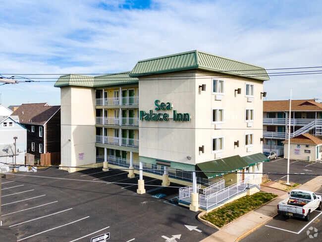


This Property Is For Sale
Property Detail
136 Sumner Ave
27-00015-0000-00028
90X100
Commercialnec
Ocean
RB
New Jersey
AE The base floodplain where base flood elevations are provided. AE Zones are now used on new format FIRMs instead of A1-A30 Zones.
28
2025
0.21 AC
2025
North Shore
728003
Northern New Jersey
8,752 SF
Lakewood-New Brunswick, NJ
NEARBY LISTINGS FOR SALE OR LEASE
DEMOGRAPHICS near 136 Sumner Ave
1 mile
3 mile
5 mile
2025 Total Population
9,826
27,714
68,809
2030 Population
11,283
31,485
74,735
Pop Growth 2025-2030
+ 14.83%
+ 13.61%
+ 8.61%
Average Age
45
48
45
2025 Total Households
4,703
13,191
29,347
HH Growth 2025-2030
+ 14.54%
+ 13.69%
+ 9.33%
Median Household Inc
$73,628
$83,342
$90,472
Avg Household Size
2.00
2.00
2.30
2025 Avg HH Vehicles
1.00
2.00
2.00
Median Home Value
$644,746
$692,010
$531,764
Median Year Built
1970
1970
1973
Nearby Places
Map Layers
Map Styles
 Street
 Aerial
Layers
 Traffic
 Biking
Places
Listings with unknown addresses are not visible on the map
- Restaurants
- Banks
- Shops
- Fitness
- Groceries
PUBLIC TRANSPORTATION
COMMUTER RAIL
Bay Head (North Jersey Coast Line - NJ Transit Commuter Rail (NJ Transit))
Drive
Walk
Distance
Bay Head (North Jersey Coast Line - NJ Transit Commuter Rail (NJ Transit))
20 min
9.7 mi
Freight Ports
New York Container Terminal
Drive
Walk
Distance
New York Container Terminal
84 min
66.5 mi
Nearby Properties
Address
Land Use
TOTAL SIZE
Lot Size
Zoning
Address
Land Use
TOTAL SIZE
Lot Size
Zoning
1.27 AC
P
Address
Land Use
TOTAL SIZE
Lot Size
Zoning
744 SF
0.69 AC
RB
Address
Land Use
TOTAL SIZE
Lot Size
Zoning
44,768 SF
0.62 AC
RRA
Address
Land Use
TOTAL SIZE
Lot Size
Zoning
Address
Land Use
TOTAL SIZE
Lot Size
Zoning
2.67 AC
SMF
Address
Land Use
TOTAL SIZE
Lot Size
Zoning
2,636 SF
2.90 AC
RRA
Address
Land Use
TOTAL SIZE
Lot Size
Zoning
12,520 SF
1.81 AC
RB
Address
Land Use
TOTAL SIZE
Lot Size
Zoning
3,926 SF
0.52 AC
RR
Address
Land Use
TOTAL SIZE
Lot Size
Zoning
12,494 SF
2.50 AC
RR
Address
Land Use
TOTAL SIZE
Lot Size
Zoning
1.19 AC
RB
Address
Land Use
TOTAL SIZE
Lot Size
Zoning
0.97 AC
RB
Address
Land Use
TOTAL SIZE
Lot Size
Zoning
12.70 AC
PUB
Address
Land Use
TOTAL SIZE
Lot Size
Zoning
0.82 AC
RB
Address
Land Use
TOTAL SIZE
Lot Size
Zoning
1.37 AC
RRS
Address
Land Use
TOTAL SIZE
Lot Size
Zoning
6.16 AC
MF16
Address
Land Use
TOTAL SIZE
Lot Size
Zoning
1.30 AC
RR
Address
Land Use
TOTAL SIZE
Lot Size
Zoning
920 SF
0.75 AC
RR
Address
Land Use
TOTAL SIZE
Lot Size
Zoning
20,271 SF
0.96 AC
PUB
Address
Land Use
TOTAL SIZE
Lot Size
Zoning
3,209 SF
7.40 AC
GB
Address
Land Use
TOTAL SIZE
Lot Size
Zoning
1.36 AC
PUB
Address
Land Use
TOTAL SIZE
Lot Size
Zoning
8.78 AC
P
Address
Land Use
TOTAL SIZE
Lot Size
Zoning
Address
Land Use
TOTAL SIZE
Lot Size
Zoning
2.50 AC
RR
Address
Land Use
TOTAL SIZE
Lot Size
Zoning
22,968 SF
0.20 AC
RR
Address
Land Use
TOTAL SIZE
Lot Size
Zoning
8.19 AC
P
Address
Land Use
TOTAL SIZE
Lot Size
Zoning
12,008 SF
0.53 AC
RB
Address
Land Use
TOTAL SIZE
Lot Size
Zoning
29,422 SF
1.30 AC
Address
Land Use
TOTAL SIZE
Lot Size
Zoning
1.29 AC
Address
Land Use
TOTAL SIZE
Lot Size
Zoning
2.04 AC
LDR
Address
Land Use
TOTAL SIZE
Lot Size
Zoning
12.01 AC
P
The World's #1 Commercial Real Estate Marketplace
Connect with us
© 2026 CoStar Group
The information above has been obtained from sources believed reliable. While we do not doubt its accuracy we have not verified it and make no guarantee, warranty or representation about it. It is your responsibility to independently confirm its accuracy and completeness. Any projections, opinions, assumptions, or estimates used are for example only and do not represent the current or future performance of the property. The value of this transaction to you depends on tax and other factors which should be evaluated by your tax, financial, and legal advisors. You and your advisors should conduct a careful, independent investigation of the property to determine to your satisfaction the suitability of the property for your needs.