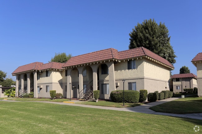
Property Record
1360 3Rd St, La Verne, CA 91750


Property Detail
1360 3Rd St
8381-036-017
RANCHO SAN JOSE LOT COM AT MOST S COR OF LAND MARKED 18.511 ACS (PER R S 62-8)TH NE ON SE LINE OF SD LAND AND NE PRO- LONGATION THEREOF TO SW LINE OF THIRD STSEE ASSESSOR MAPBOOK FOR MISSING PORTIONFT TH SE ON PALOMARES AVE 275 FT TO BEG
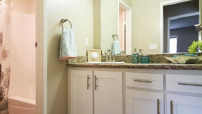
Multifamilydwelling
LOS ANGELES
LVPR
California
B and X Area of moderate flood hazard, usually the area between the limits of the 100-year and 500-year floods.
5.91 AC
2024
Bonita
2025
Los Angeles
401500
Los Angeles-Long Beach-Glendale, CA
72,840 SF
NEARBY LISTINGS FOR SALE OR LEASE
DEMOGRAPHICS near 1360 3Rd St
1 mile
3 mile
5 mile
2025 Total Population
12,592
108,962
303,637
2030 Population
12,551
108,084
301,368
Pop Growth 2025-2030
(0.33%)
(0.81%)
(0.75%)
Average Age
43
42
40
2025 Total Households
4,780
36,335
94,388
HH Growth 2025-2030
(0.61%)
(1.07%)
(0.97%)
Median Household Inc
$90,658
$99,509
$96,115
Avg Household Size
2.60
2.90
3.00
2025 Avg HH Vehicles
2.00
2.00
2.00
Median Home Value
$709,875
$730,225
$745,094
Median Year Built
1973
1972
1970
Nearby Places
Map Layers
Map Styles
 Street
 Aerial
Layers
 Traffic
 Biking
Places
Listings with unknown addresses are not visible on the map
- Restaurants
- Banks
- Shops
- Fitness
- Groceries
PUBLIC TRANSPORTATION
COMMUTER RAIL
Pomona (North) (San Bernardino Line - Southern California Regional Rail Authority (Metrolink))
Drive
Walk
Distance
Pomona (North) (San Bernardino Line - Southern California Regional Rail Authority (Metrolink))
6 min
2.7 mi
Downtown Pomona (Riverside Line - Southern California Regional Rail Authority (Metrolink))
Drive
Walk
Distance
Downtown Pomona (Riverside Line - Southern California Regional Rail Authority (Metrolink))
8 min
4.4 mi
AIRPORT
Ontario International
Drive
Walk
Distance
Ontario International
19 min
12.7 mi
John Wayne/Orange County
Drive
Walk
Distance
John Wayne/Orange County
44 min
35.8 mi
Long Beach (Daugherty Field)
Drive
Walk
Distance
Long Beach (Daugherty Field)
51 min
37.4 mi
Freight Ports
Port of Long Beach
Drive
Walk
Distance
Port of Long Beach
57 min
43.1 mi
Nearby Properties
Address
Land Use
TOTAL SIZE
Lot Size
Zoning
Address
Land Use
TOTAL SIZE
Lot Size
Zoning
369,745 SF
22.12 AC
LVO
Address
Land Use
TOTAL SIZE
Lot Size
Zoning
491,876 SF
22.46 AC
Address
Land Use
TOTAL SIZE
Lot Size
Zoning
126,533 SF
19.51 AC
Address
Land Use
TOTAL SIZE
Lot Size
Zoning
418,820 SF
4.42 AC
Address
Land Use
TOTAL SIZE
Lot Size
Zoning
173,240 SF
13.53 AC
SDMF15*
Address
Land Use
TOTAL SIZE
Lot Size
Zoning
172,108 SF
7.77 AC
POR31500S*
Address
Land Use
TOTAL SIZE
Lot Size
Zoning
125,388 SF
8.88 AC
LVPR15A*
Address
Land Use
TOTAL SIZE
Lot Size
Zoning
198,575 SF
7.72 AC
LUCPD*
Address
Land Use
TOTAL SIZE
Lot Size
Zoning
151,267 SF
8.26 AC
SDM1*
Address
Land Use
TOTAL SIZE
Lot Size
Zoning
411,984 SF
10.47 AC
LVCPD-PR8A
Address
Land Use
TOTAL SIZE
Lot Size
Zoning
107,525 SF
POR4*
Address
Land Use
TOTAL SIZE
Lot Size
Zoning
90,009 SF
6.22 AC
SDAP*
Address
Land Use
TOTAL SIZE
Lot Size
Zoning
355,816 SF
16.59 AC
POC4*
Address
Land Use
TOTAL SIZE
Lot Size
Zoning
104,676 SF
7.92 AC
LVPR15A*
Address
Land Use
TOTAL SIZE
Lot Size
Zoning
114,596 SF
11.44 AC
CLE*
Address
Land Use
TOTAL SIZE
Lot Size
Zoning
154,844 SF
13.73 AC
Address
Land Use
TOTAL SIZE
Lot Size
Zoning
217,976 SF
6.77 AC
SDM1*
Address
Land Use
TOTAL SIZE
Lot Size
Zoning
99,456 SF
5.38 AC
LCA17000*
Address
Land Use
TOTAL SIZE
Lot Size
Zoning
142,820 SF
7.28 AC
SDMF20000*
Address
Land Use
TOTAL SIZE
Lot Size
Zoning
238,268 SF
19.95 AC
POM1*
Address
Land Use
TOTAL SIZE
Lot Size
Zoning
54,977 SF
4.26 AC
SDM1*
Address
Land Use
TOTAL SIZE
Lot Size
Zoning
157,624 SF
8.10 AC
SDMF20*
Address
Land Use
TOTAL SIZE
Lot Size
Zoning
171,524 SF
4.40 AC
LVI*
Address
Land Use
TOTAL SIZE
Lot Size
Zoning
39,389 SF
2.84 AC
LVCPD*
Address
Land Use
TOTAL SIZE
Lot Size
Zoning
300,406 SF
7.80 AC
LUCPD*
Address
Land Use
TOTAL SIZE
Lot Size
Zoning
75,396 SF
6.17 AC
LVPR
Address
Land Use
TOTAL SIZE
Lot Size
Zoning
205,948 SF
4.93 AC
SDM1*
Address
Land Use
TOTAL SIZE
Lot Size
Zoning
237,631 SF
7.49 AC
LVCP
Address
Land Use
TOTAL SIZE
Lot Size
Zoning
57,850 SF
9.45 AC
LVPR8A*
The World's #1 Commercial Real Estate Marketplace
Connect with us
© 2026 CoStar Group
The information above has been obtained from sources believed reliable. While we do not doubt its accuracy we have not verified it and make no guarantee, warranty or representation about it. It is your responsibility to independently confirm its accuracy and completeness. Any projections, opinions, assumptions, or estimates used are for example only and do not represent the current or future performance of the property. The value of this transaction to you depends on tax and other factors which should be evaluated by your tax, financial, and legal advisors. You and your advisors should conduct a careful, independent investigation of the property to determine to your satisfaction the suitability of the property for your needs.