Property Record
1360 N Olive St, Ventura, CA 93001


NEARBY LISTINGS FOR SALE OR LEASE
Property Detail
1360 N Olive St
068-0-102-150
Valley Of San Buenaventura
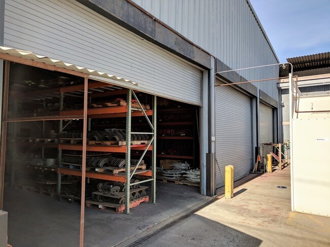
Warehouse
Ventura
X
California
06111C0741F
1.04 AC
2024
Ventura
2025
Los Angeles
002301
Oxnard-Thousand Oaks-Ventura, CA
5,275 SF
DEMOGRAPHICS near 1360 N Olive St
1 Mile
3 Mile
5 Mile
2024 Total Population
13,060
33,419
62,273
2029 Population
12,950
33,236
62,276
Pop Growth 2024-2029
(0.84%)
(0.55%)
0.00%
Average Age
36
40
42
2024 Total Households
4,257
13,004
24,506
HH Growth 2024-2029
(0.89%)
(0.47%)
+ 0.07%
Median Household Inc
$63,564
$76,516
$84,790
Avg Household Size
2.90
2.40
2.40
2024 Avg HH Vehicles
2.00
2.00
2.00
Median Home Value
$531,102
$764,760
$748,850
Median Year Built
1969
1961
1965
Nearby Places
Map Layers
Map Styles
 Street
 Aerial
- Restaurants
- Banks
- Shops
- Fitness
- Groceries
PUBLIC TRANSPORTATION
COMMUTER RAIL
Ventura Amtrak (Metrolink Ventura County Line - Amtrak, Pacific Surfliner - Amtrak)
DRIVE
WALK
Distance
Ventura Amtrak (Metrolink Ventura County Line - Amtrak, Pacific Surfliner - Amtrak)
5 min
1.6 mi
East Ventura Metrolink Station (Metrolink Ventura County Line - Metrolink Trains)
DRIVE
WALK
Distance
East Ventura Metrolink Station (Metrolink Ventura County Line - Metrolink Trains)
12 min
9.1 mi
Freight Ports
The Port of Hueneme
DRIVE
WALK
Distance
The Port of Hueneme
24 min
15.3 mi
SALE & LEASE HISTORY
LISTING DATE
SALE/LEASE

Feb 01, 2018
For Lease
Apr 15, 2019
For Sale
Nearby Properties
Address
Land Use
TOTAL SIZE
Lot Size
Zoning
Address
Land Use
TOTAL SIZE
Lot Size
Zoning
1.99 AC
Address
Land Use
TOTAL SIZE
Lot Size
Zoning
4.19 AC
H
Address
Land Use
TOTAL SIZE
Lot Size
Zoning
Address
Land Use
TOTAL SIZE
Lot Size
Zoning
7,280 SF
5.38 AC
C-T-O
Address
Land Use
TOTAL SIZE
Lot Size
Zoning
6.81 AC
C-T-O
Address
Land Use
TOTAL SIZE
Lot Size
Zoning
2.89 AC
C-T-O
Address
Land Use
TOTAL SIZE
Lot Size
Zoning
639.79 AC
Address
Land Use
TOTAL SIZE
Lot Size
Zoning
7,993 SF
3.71 AC
C-T-O
Address
Land Use
TOTAL SIZE
Lot Size
Zoning
7,233 SF
7.39 AC
C1
Address
Land Use
TOTAL SIZE
Lot Size
Zoning
Address
Land Use
TOTAL SIZE
Lot Size
Zoning
11,444 SF
6.57 AC
Address
Land Use
TOTAL SIZE
Lot Size
Zoning
42,655 SF
0.94 AC
Address
Land Use
TOTAL SIZE
Lot Size
Zoning
732 SF
0.51 AC
DR
Address
Land Use
TOTAL SIZE
Lot Size
Zoning
0.84 AC
Address
Land Use
TOTAL SIZE
Lot Size
Zoning
56,561 SF
14.56 AC
MPD
Address
Land Use
TOTAL SIZE
Lot Size
Zoning
57,554 SF
0.58 AC
Address
Land Use
TOTAL SIZE
Lot Size
Zoning
0.82 AC
POD
Address
Land Use
TOTAL SIZE
Lot Size
Zoning
9,572 SF
1.91 AC
MULT
Address
Land Use
TOTAL SIZE
Lot Size
Zoning
43,498 SF
1.67 AC
R33
Address
Land Use
TOTAL SIZE
Lot Size
Zoning
19,709 SF
0.14 AC
DC
Address
Land Use
TOTAL SIZE
Lot Size
Zoning
168 SF
7.87 AC
M3
Address
Land Use
TOTAL SIZE
Lot Size
Zoning
19,431 SF
0.59 AC
DR
Address
Land Use
TOTAL SIZE
Lot Size
Zoning
38,456 SF
1.49 AC
R33
Address
Land Use
TOTAL SIZE
Lot Size
Zoning
1.33 AC
DC
Address
Land Use
TOTAL SIZE
Lot Size
Zoning
29,058 SF
1.18 AC
C2
Address
Land Use
TOTAL SIZE
Lot Size
Zoning
3,596 SF
1.19 AC
Address
Land Use
TOTAL SIZE
Lot Size
Zoning
29,798 SF
0.57 AC
C1
Address
Land Use
TOTAL SIZE
Lot Size
Zoning
3.60 AC
8
Address
Land Use
TOTAL SIZE
Lot Size
Zoning
1.40 AC
7
The World's #1 Commercial Real Estate Marketplace
Connect with us
© 2026 CoStar Group
The information above has been obtained from sources believed reliable. While we do not doubt its accuracy we have not verified it and make no guarantee, warranty or representation about it. It is your responsibility to independently confirm its accuracy and completeness. Any projections, opinions, assumptions, or estimates used are for example only and do not represent the current or future performance of the property. The value of this transaction to you depends on tax and other factors which should be evaluated by your tax, financial, and legal advisors. You and your advisors should conduct a careful, independent investigation of the property to determine to your satisfaction the suitability of the property for your needs.