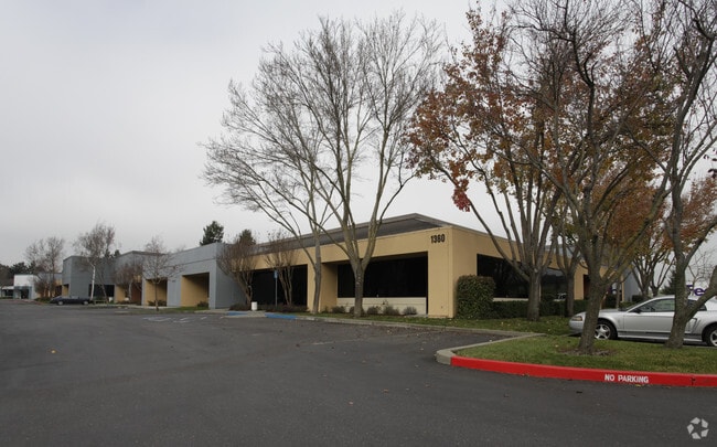
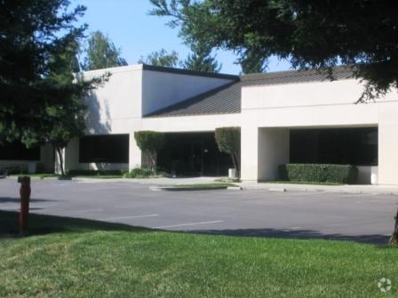
Property Record
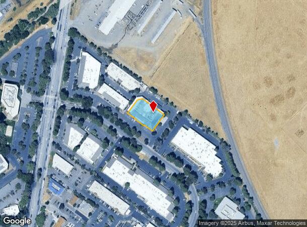
1360 Redwood Way, Petaluma, CA 94954

Current Lease Availabilities
NEARBY LISTINGS FOR SALE OR LEASE
Property Detail
1360 Redwood Way
137-250-004
Sequoia Terrace
Officebuilding
92 FM 137-011-01 CW02 SEQUOIA TERRACE PM 268 PCL 4
AE
Sonoma
06097C0893F
California
2024
0.52 AC
2025
Petaluma/Cotati/Rohnert
150607
North Bay/Santa Rosa
22,820 SF
Santa Rosa, CA
DEMOGRAPHICS near 1360 Redwood Way
1 Mile
3 Mile
5 Mile
2024 Total Population
1,553
29,472
101,912
2029 Population
1,476
28,804
100,546
Pop Growth 2024-2029
(4.96%)
(2.27%)
(1.34%)
Average Age
46
44
42
2024 Total Households
654
11,575
39,283
HH Growth 2024-2029
(5.05%)
(2.28%)
(1.38%)
Median Household Inc
$108,207
$107,937
$102,110
Avg Household Size
2.40
2.50
2.50
2024 Avg HH Vehicles
2.00
2.00
2.00
Median Home Value
$830,039
$794,303
$770,108
Median Year Built
1978
1984
1979
Nearby Places
- Restaurants
- Banks
- Shops
- Fitness
- Groceries
PUBLIC TRANSPORTATION
COMMUTER RAIL
Smart Petaluma North (Main Line - Sonoma Marin Area Rail Transit)
DRIVE
WALK
Distance
Smart Petaluma North (Main Line - Sonoma Marin Area Rail Transit)
3 min
1.2 mi
Petaluma Downtown Smart (Main Line - Sonoma Marin Area Rail Transit)
DRIVE
WALK
Distance
Petaluma Downtown Smart (Main Line - Sonoma Marin Area Rail Transit)
8 min
4.5 mi
AIRPORT
Charles M Schulz - Sonoma County
DRIVE
WALK
Distance
Charles M Schulz - Sonoma County
28 min
21.0 mi
Freight Ports
Port of Richmond
DRIVE
WALK
Distance
Port of Richmond
49 min
36.5 mi
Nearby Properties
Address
Land Use
TOTAL SIZE
Lot Size
Zoning
Address
Land Use
TOTAL SIZE
Lot Size
Zoning
231,609 SF
8.05 AC
Address
Land Use
TOTAL SIZE
Lot Size
Zoning
121,876 SF
16.14 AC
Address
Land Use
TOTAL SIZE
Lot Size
Zoning
149,242 SF
5.40 AC
CITYPE
Address
Land Use
TOTAL SIZE
Lot Size
Zoning
89,944 SF
14.63 AC
CITYPE
Address
Land Use
TOTAL SIZE
Lot Size
Zoning
170,524 SF
14.53 AC
Address
Land Use
TOTAL SIZE
Lot Size
Zoning
1.18 AC
Address
Land Use
TOTAL SIZE
Lot Size
Zoning
80,392 SF
7.13 AC
Address
Land Use
TOTAL SIZE
Lot Size
Zoning
195,837 SF
16.32 AC
PCD
Address
Land Use
TOTAL SIZE
Lot Size
Zoning
85,582 SF
2.61 AC
CITYPE
Address
Land Use
TOTAL SIZE
Lot Size
Zoning
Address
Land Use
TOTAL SIZE
Lot Size
Zoning
138,520 SF
10.36 AC
ML
Address
Land Use
TOTAL SIZE
Lot Size
Zoning
93,700 SF
6.02 AC
ML
Address
Land Use
TOTAL SIZE
Lot Size
Zoning
81,975 SF
5 AC
Address
Land Use
TOTAL SIZE
Lot Size
Zoning
88,482 SF
7.29 AC
Address
Land Use
TOTAL SIZE
Lot Size
Zoning
83,880 SF
5 AC
ML
Address
Land Use
TOTAL SIZE
Lot Size
Zoning
112,240 SF
6.30 AC
PUD
Address
Land Use
TOTAL SIZE
Lot Size
Zoning
83,977 SF
4.70 AC
Address
Land Use
TOTAL SIZE
Lot Size
Zoning
62,238 SF
5.21 AC
RM4
Address
Land Use
TOTAL SIZE
Lot Size
Zoning
78.31 AC
Address
Land Use
TOTAL SIZE
Lot Size
Zoning
81,682 SF
2.59 AC
CITYPE
Address
Land Use
TOTAL SIZE
Lot Size
Zoning
71,884 SF
0.65 AC
Address
Land Use
TOTAL SIZE
Lot Size
Zoning
141,168 SF
9.44 AC
18
Address
Land Use
TOTAL SIZE
Lot Size
Zoning
54,637 SF
0.66 AC
Address
Land Use
TOTAL SIZE
Lot Size
Zoning
51,462 SF
0.90 AC
CITYPE
Address
Land Use
TOTAL SIZE
Lot Size
Zoning
35,864 SF
1.67 AC
PUD
Address
Land Use
TOTAL SIZE
Lot Size
Zoning
90,530 SF
2.61 AC
Address
Land Use
TOTAL SIZE
Lot Size
Zoning
58,299 SF
0.72 AC
Address
Land Use
TOTAL SIZE
Lot Size
Zoning
42,066 SF
1.66 AC
Address
Land Use
TOTAL SIZE
Lot Size
Zoning
62,173 SF
12.69 AC
The World's #1 Commercial Real Estate Marketplace
Connect with us
© 2025 CoStar Group
The information above has been obtained from sources believed reliable. While we do not doubt its accuracy we have not verified it and make no guarantee, warranty or representation about it. It is your responsibility to independently confirm its accuracy and completeness. Any projections, opinions, assumptions, or estimates used are for example only and do not represent the current or future performance of the property. The value of this transaction to you depends on tax and other factors which should be evaluated by your tax, financial, and legal advisors. You and your advisors should conduct a careful, independent investigation of the property to determine to your satisfaction the suitability of the property for your needs.