Property Record
1360 Route 28A, Buzzards Bay, MA 02532


NEARBY LISTINGS FOR SALE OR LEASE
Property Detail
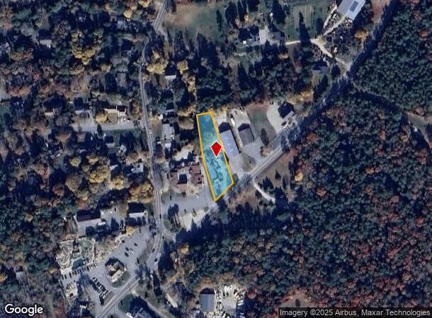
1360 Route 28A
Storebuilding
Barnstable
X
Massachusetts
25001C0511J
0.62 AC
2025
Cape Cod
2025
Other Market Areas
013700
Barnstable Town, MA
2,715 SF
BOUR-000510-000000-000041
DEMOGRAPHICS near 1360 Route 28A
1 Mile
3 Mile
5 Mile
2024 Total Population
979
8,642
19,338
2029 Population
932
8,658
19,412
Pop Growth 2024-2029
(4.80%)
+ 0.19%
+ 0.38%
Average Age
50
49
49
2024 Total Households
409
3,705
8,262
HH Growth 2024-2029
(5.62%)
(0.32%)
+ 0.02%
Median Household Inc
$173,979
$92,279
$92,667
Avg Household Size
2.20
2.20
2.20
2024 Avg HH Vehicles
2.00
2.00
2.00
Median Home Value
$655,213
$610,263
$499,826
Median Year Built
1980
1978
1980
Nearby Places
Map Layers
Map Styles
 Street
 Aerial
- Restaurants
- Banks
- Shops
- Fitness
- Groceries
PUBLIC TRANSPORTATION
COMMUTER RAIL
Bourne (CapeFLYER - Cape Cod Regional Transit Authority)
DRIVE
WALK
Distance
Bourne (CapeFLYER - Cape Cod Regional Transit Authority)
10 min
6.5 mi
Buzzards Bay (CapeFLYER - Cape Cod Regional Transit Authority)
DRIVE
WALK
Distance
Buzzards Bay (CapeFLYER - Cape Cod Regional Transit Authority)
16 min
9.5 mi
AIRPORT
Martha's Vineyard
DRIVE
WALK
Distance
Martha's Vineyard
80 min
25.4 mi
Freight Ports
Port of New Bedford Harbor
DRIVE
WALK
Distance
Port of New Bedford Harbor
45 min
33.8 mi
SALE & LEASE HISTORY
LISTING DATE
SALE/LEASE

Sep 25, 2016
For Lease
Sep 24, 2016
For Sale
May 16, 2017
For Sale
May 09, 2019
For Sale
Nearby Properties
Address
Land Use
TOTAL SIZE
Lot Size
Zoning
Address
Land Use
TOTAL SIZE
Lot Size
Zoning
191,993 SF
21.60 AC
RB
Address
Land Use
TOTAL SIZE
Lot Size
Zoning
22,000 SF
749.29 AC
GD
Address
Land Use
TOTAL SIZE
Lot Size
Zoning
53,202 SF
29.20 AC
PU
Address
Land Use
TOTAL SIZE
Lot Size
Zoning
6,516 SF
88.49 AC
AGAA
Address
Land Use
TOTAL SIZE
Lot Size
Zoning
11.20 AC
Address
Land Use
TOTAL SIZE
Lot Size
Zoning
5.06 AC
R-80
Address
Land Use
TOTAL SIZE
Lot Size
Zoning
17.50 AC
Address
Land Use
TOTAL SIZE
Lot Size
Zoning
1,199 SF
3.70 AC
R40
Address
Land Use
TOTAL SIZE
Lot Size
Zoning
2.82 AC
Address
Land Use
TOTAL SIZE
Lot Size
Zoning
21,711 SF
157.40 AC
AGAA
Address
Land Use
TOTAL SIZE
Lot Size
Zoning
5,887 SF
1.58 AC
R40
Address
Land Use
TOTAL SIZE
Lot Size
Zoning
57,806 SF
14.39 AC
LIA
Address
Land Use
TOTAL SIZE
Lot Size
Zoning
15.80 AC
Address
Land Use
TOTAL SIZE
Lot Size
Zoning
6,355 SF
3.77 AC
RA
Address
Land Use
TOTAL SIZE
Lot Size
Zoning
4.10 AC
R-80
Address
Land Use
TOTAL SIZE
Lot Size
Zoning
8.91 AC
R-80
Address
Land Use
TOTAL SIZE
Lot Size
Zoning
3,172 SF
2.23 AC
R40
Address
Land Use
TOTAL SIZE
Lot Size
Zoning
25,713 SF
4.70 AC
M
Address
Land Use
TOTAL SIZE
Lot Size
Zoning
Address
Land Use
TOTAL SIZE
Lot Size
Zoning
1.41 AC
R40
Address
Land Use
TOTAL SIZE
Lot Size
Zoning
5,597 SF
1.37 AC
R40
Address
Land Use
TOTAL SIZE
Lot Size
Zoning
1.56 AC
R40
Address
Land Use
TOTAL SIZE
Lot Size
Zoning
10,000 SF
80.22 AC
AGAA
Address
Land Use
TOTAL SIZE
Lot Size
Zoning
5,332 SF
1.55 AC
R40
Address
Land Use
TOTAL SIZE
Lot Size
Zoning
2.70 AC
R40
Address
Land Use
TOTAL SIZE
Lot Size
Zoning
3,429 SF
1.24 AC
R40
Address
Land Use
TOTAL SIZE
Lot Size
Zoning
6,853 SF
4.30 AC
R40
Address
Land Use
TOTAL SIZE
Lot Size
Zoning
118.50 AC
R40
Address
Land Use
TOTAL SIZE
Lot Size
Zoning
6,413 SF
3.23 AC
R40
Address
Land Use
TOTAL SIZE
Lot Size
Zoning
5.18 AC
R-80
The World's #1 Commercial Real Estate Marketplace
Connect with us
© 2025 CoStar Group
The information above has been obtained from sources believed reliable. While we do not doubt its accuracy we have not verified it and make no guarantee, warranty or representation about it. It is your responsibility to independently confirm its accuracy and completeness. Any projections, opinions, assumptions, or estimates used are for example only and do not represent the current or future performance of the property. The value of this transaction to you depends on tax and other factors which should be evaluated by your tax, financial, and legal advisors. You and your advisors should conduct a careful, independent investigation of the property to determine to your satisfaction the suitability of the property for your needs.