Property Record
13600 W Mcnichols Rd, Detroit, MI 48235


NEARBY LISTINGS FOR SALE OR LEASE
Property Detail
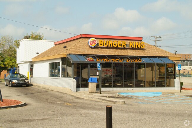
13600 W Mcnichols Rd
22-01408-493
Hartwig
Restaurantdrivein
N--W MC NICHOLS 35 THRU 24 HARTWIG SUB L47 P98 PLATS, W C R 22/134 250 X 110
X
Wayne
26163C0100E
Michigan
2025
0.63 AC
2025
Detroit W of Woodward
539500
Detroit
2,838 SF
Detroit-Warren-Dearborn, MI
DEMOGRAPHICS near 13600 W Mcnichols Rd
1 Mile
3 Mile
5 Mile
2024 Total Population
23,620
164,509
409,790
2029 Population
22,986
161,386
407,047
Pop Growth 2024-2029
(2.68%)
(1.90%)
(0.67%)
Average Age
39
39
39
2024 Total Households
8,807
64,339
166,525
HH Growth 2024-2029
(2.80%)
(1.94%)
(0.62%)
Median Household Inc
$40,169
$40,843
$41,976
Avg Household Size
2.60
2.50
2.40
2024 Avg HH Vehicles
1.00
1.00
1.00
Median Home Value
$79,286
$90,656
$109,842
Median Year Built
1950
1949
1950
Nearby Places
Map Layers
Map Styles
 Street
 Aerial
- Restaurants
- Banks
- Shops
- Fitness
- Groceries
PUBLIC TRANSPORTATION
COMMUTER RAIL
DRIVE
WALK
Distance
17 min
6.9 mi
DRIVE
WALK
Distance
13 min
7.4 mi
AIRPORT
Windsor International
DRIVE
WALK
Distance
Windsor International
38 min
19.8 mi
Detroit Metro Wayne County
DRIVE
WALK
Distance
Detroit Metro Wayne County
37 min
23.1 mi
Nearby Properties
Address
Land Use
TOTAL SIZE
Lot Size
Zoning
Address
Land Use
TOTAL SIZE
Lot Size
Zoning
925,367 SF
12.82 AC
R6
Address
Land Use
TOTAL SIZE
Lot Size
Zoning
783,976 SF
52.57 AC
M4
Address
Land Use
TOTAL SIZE
Lot Size
Zoning
300,830 SF
54 AC
LI
Address
Land Use
TOTAL SIZE
Lot Size
Zoning
97.05 AC
RS
Address
Land Use
TOTAL SIZE
Lot Size
Zoning
133,544 SF
19.65 AC
ERO
Address
Land Use
TOTAL SIZE
Lot Size
Zoning
273,000 SF
17.31 AC
LI
Address
Land Use
TOTAL SIZE
Lot Size
Zoning
11.11 AC
RS
Address
Land Use
TOTAL SIZE
Lot Size
Zoning
10.32 AC
LI
Address
Land Use
TOTAL SIZE
Lot Size
Zoning
163,661 SF
8.92 AC
PD
Address
Land Use
TOTAL SIZE
Lot Size
Zoning
165,829 SF
5.56 AC
R5
Address
Land Use
TOTAL SIZE
Lot Size
Zoning
14.10 AC
RS
Address
Land Use
TOTAL SIZE
Lot Size
Zoning
54,672 SF
1.37 AC
R6
Address
Land Use
TOTAL SIZE
Lot Size
Zoning
116,790 SF
5.86 AC
R4
Address
Land Use
TOTAL SIZE
Lot Size
Zoning
90,958 SF
11.78 AC
R5
Address
Land Use
TOTAL SIZE
Lot Size
Zoning
153,007 SF
7.74 AC
II
Address
Land Use
TOTAL SIZE
Lot Size
Zoning
63,216 SF
2.87 AC
R5
Address
Land Use
TOTAL SIZE
Lot Size
Zoning
66,870 SF
2.77 AC
Address
Land Use
TOTAL SIZE
Lot Size
Zoning
100,373 SF
5.65 AC
R4
Address
Land Use
TOTAL SIZE
Lot Size
Zoning
315,973 SF
12.18 AC
M4
Address
Land Use
TOTAL SIZE
Lot Size
Zoning
81,031 SF
8.15 AC
PD
Address
Land Use
TOTAL SIZE
Lot Size
Zoning
127,680 SF
3.90 AC
ERO
Address
Land Use
TOTAL SIZE
Lot Size
Zoning
64,566 SF
3.64 AC
PD
Address
Land Use
TOTAL SIZE
Lot Size
Zoning
128,759 SF
8.85 AC
LI
Address
Land Use
TOTAL SIZE
Lot Size
Zoning
248,737 SF
22.02 AC
AI
Address
Land Use
TOTAL SIZE
Lot Size
Zoning
84,453 SF
4.58 AC
Address
Land Use
TOTAL SIZE
Lot Size
Zoning
101,568 SF
8.67 AC
B-3
Address
Land Use
TOTAL SIZE
Lot Size
Zoning
118,027 SF
7.75 AC
R6
Address
Land Use
TOTAL SIZE
Lot Size
Zoning
551,443 SF
RS
Address
Land Use
TOTAL SIZE
Lot Size
Zoning
76,554 SF
3.51 AC
PD
Address
Land Use
TOTAL SIZE
Lot Size
Zoning
69,712 SF
3.41 AC
PD
The World's #1 Commercial Real Estate Marketplace
Connect with us
© 2026 CoStar Group
The information above has been obtained from sources believed reliable. While we do not doubt its accuracy we have not verified it and make no guarantee, warranty or representation about it. It is your responsibility to independently confirm its accuracy and completeness. Any projections, opinions, assumptions, or estimates used are for example only and do not represent the current or future performance of the property. The value of this transaction to you depends on tax and other factors which should be evaluated by your tax, financial, and legal advisors. You and your advisors should conduct a careful, independent investigation of the property to determine to your satisfaction the suitability of the property for your needs.