Property Record
13600 Brandywine Rd, Brandywine, MD 20613
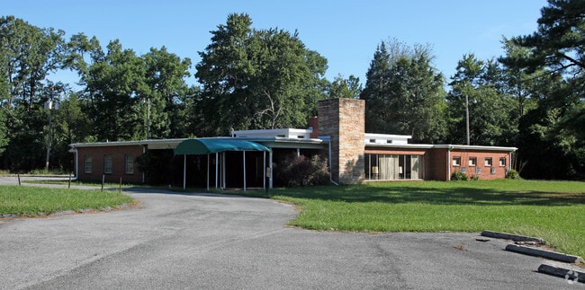

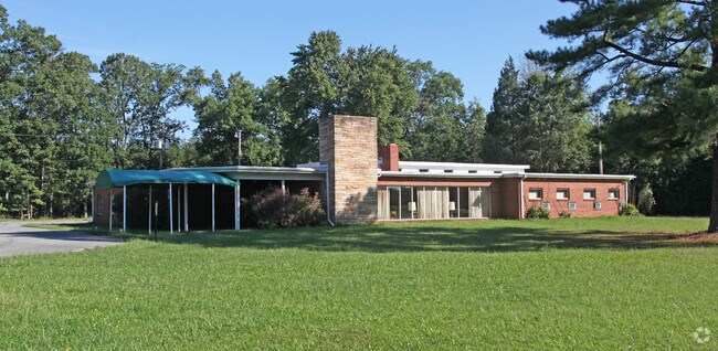
Property Detail
13600 Brandywine Rd
11-1136944
PT PAR 65
Medicalbuilding
Prince Georges
CGO
Maryland
B and X Area of moderate flood hazard, usually the area between the limits of the 100-year and 500-year floods.
1.91 AC
2024
Outlying PG County South
2025
Washington, DC
801004
Washington-Arlington-Alexandria, DC-VA-MD-WV
8,861 SF
NEARBY LISTINGS FOR SALE OR LEASE
-
-
View all Brandywine listings for sale on LoopNet.com
DEMOGRAPHICS near 13600 Brandywine Rd
1 mile
3 mile
5 mile
2025 Total Population
2,280
20,903
72,813
2030 Population
2,365
21,757
74,730
Pop Growth 2025-2030
+ 3.73%
+ 4.09%
+ 2.63%
Average Age
41
42
42
2025 Total Households
742
7,178
25,117
HH Growth 2025-2030
+ 4.04%
+ 4.35%
+ 2.80%
Median Household Inc
$167,083
$141,977
$124,918
Avg Household Size
3.00
2.80
2.80
2025 Avg HH Vehicles
3.00
2.00
2.00
Median Home Value
$596,502
$504,976
$446,194
Median Year Built
2004
2001
1991
Nearby Places
Map Layers
Map Styles
 Street
 Aerial
Transit
 Traffic
 Biking
Places
Listings with unknown addresses are not visible on the map
- Restaurants
- Banks
- Shops
- Fitness
- Groceries
PUBLIC TRANSPORTATION
AIRPORT
Ronald Reagan Washington Ntl
Drive
Walk
Distance
Ronald Reagan Washington Ntl
35 min
21.3 mi
Freight Ports
Port of Baltimore
Drive
Walk
Distance
Port of Baltimore
72 min
49.3 mi
Nearby Properties
Address
Land Use
TOTAL SIZE
Lot Size
Zoning
Address
Land Use
TOTAL SIZE
Lot Size
Zoning
801,684 SF
34.05 AC
IE
Address
Land Use
TOTAL SIZE
Lot Size
Zoning
7,670 SF
9.78 AC
TACC
Address
Land Use
TOTAL SIZE
Lot Size
Zoning
341,372 SF
14.74 AC
RR
Address
Land Use
TOTAL SIZE
Lot Size
Zoning
617,760 SF
25.75 AC
IE
Address
Land Use
TOTAL SIZE
Lot Size
Zoning
388,608 SF
28.45 AC
LCD
Address
Land Use
TOTAL SIZE
Lot Size
Zoning
76,906 SF
168.92 AC
AG
Address
Land Use
TOTAL SIZE
Lot Size
Zoning
126,592 SF
58.79 AC
ROS
Address
Land Use
TOTAL SIZE
Lot Size
Zoning
156,118 SF
17.01 AC
TACE
Address
Land Use
TOTAL SIZE
Lot Size
Zoning
62,838 SF
7.77 AC
TACE
Address
Land Use
TOTAL SIZE
Lot Size
Zoning
67,608 SF
4.01 AC
TACC
Address
Land Use
TOTAL SIZE
Lot Size
Zoning
98.41 AC
IH
Address
Land Use
TOTAL SIZE
Lot Size
Zoning
61,836 SF
9.63 AC
IE
Address
Land Use
TOTAL SIZE
Lot Size
Zoning
1,592.32 AC
ROS
Address
Land Use
TOTAL SIZE
Lot Size
Zoning
54,899 SF
5.23 AC
TACE
Address
Land Use
TOTAL SIZE
Lot Size
Zoning
128,909 SF
10.77 AC
TACE
Address
Land Use
TOTAL SIZE
Lot Size
Zoning
62,442 SF
4.84 AC
TACE
Address
Land Use
TOTAL SIZE
Lot Size
Zoning
28,508 SF
10 AC
TACC
Address
Land Use
TOTAL SIZE
Lot Size
Zoning
61,125 SF
10.10 AC
TACE
Address
Land Use
TOTAL SIZE
Lot Size
Zoning
127,206 SF
2.90 AC
TACE
Address
Land Use
TOTAL SIZE
Lot Size
Zoning
64.47 AC
IH
Address
Land Use
TOTAL SIZE
Lot Size
Zoning
41,441 SF
19.05 AC
IH
Address
Land Use
TOTAL SIZE
Lot Size
Zoning
87 AC
IH
Address
Land Use
TOTAL SIZE
Lot Size
Zoning
1,079 SF
14.88 AC
CS
Address
Land Use
TOTAL SIZE
Lot Size
Zoning
137,226 SF
25.66 AC
RR
Address
Land Use
TOTAL SIZE
Lot Size
Zoning
28.84 AC
IH
Address
Land Use
TOTAL SIZE
Lot Size
Zoning
48,100 SF
6.49 AC
TACC
Address
Land Use
TOTAL SIZE
Lot Size
Zoning
24,570 SF
39.87 AC
IE
Address
Land Use
TOTAL SIZE
Lot Size
Zoning
23,760 SF
1.48 AC
TACE
Address
Land Use
TOTAL SIZE
Lot Size
Zoning
25.21 AC
IE
Address
Land Use
TOTAL SIZE
Lot Size
Zoning
12,800 SF
1.43 AC
TACE
The World's #1 Commercial Real Estate Marketplace
Connect with us
© 2026 CoStar Group
The information above has been obtained from sources believed reliable. While we do not doubt its accuracy we have not verified it and make no guarantee, warranty or representation about it. It is your responsibility to independently confirm its accuracy and completeness. Any projections, opinions, assumptions, or estimates used are for example only and do not represent the current or future performance of the property. The value of this transaction to you depends on tax and other factors which should be evaluated by your tax, financial, and legal advisors. You and your advisors should conduct a careful, independent investigation of the property to determine to your satisfaction the suitability of the property for your needs.