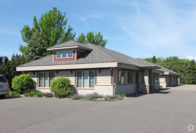
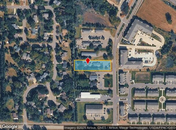
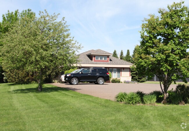
Property Record
13601 Balsam Ln N, Dayton, MN 55327
NEARBY LISTINGS FOR SALE OR LEASE
Property Detail
13601 Balsam Ln N
Minneapolis-St. Paul-Bloomington, MN-WI
Raintree 2Nd Addn
14-120-22-41-0009
LOT 007 BLOCK 001 A RAINTREE 2ND ADDN 100 X 350
Commercialnec
Hennepin
X
Minnesota
27053C0058F
7
2024
0.80 AC
2024
Northwest
026910
Minneapolis/St Paul
DEMOGRAPHICS near 13601 Balsam Ln N
1 Mile
3 Mile
5 Mile
2024 Total Population
5,808
42,826
107,264
2029 Population
5,924
43,985
109,537
Pop Growth 2024-2029
+ 2.00%
+ 2.71%
+ 2.12%
Average Age
40
40
40
2024 Total Households
2,230
16,930
40,433
HH Growth 2024-2029
+ 1.97%
+ 2.78%
+ 2.18%
Median Household Inc
$91,681
$81,979
$92,556
Avg Household Size
2.60
2.50
2.60
2024 Avg HH Vehicles
2.00
2.00
2.00
Median Home Value
$336,000
$298,502
$301,035
Median Year Built
1984
1988
1986
Nearby Places
Map Layers
Map Styles
 Street
 Aerial
- Restaurants
- Banks
- Shops
- Fitness
- Groceries
PUBLIC TRANSPORTATION
COMMUTER RAIL
Anoka Station (Northstar Corridor - Northstar Commuter Rail)
DRIVE
WALK
Distance
Anoka Station (Northstar Corridor - Northstar Commuter Rail)
9 min
3.7 mi
Coon Rapids-Riverdale Station (Northstar Corridor - Northstar Commuter Rail)
DRIVE
WALK
Distance
Coon Rapids-Riverdale Station (Northstar Corridor - Northstar Commuter Rail)
12 min
5.4 mi
AIRPORT
Minneapolis-St Paul International/Wold-Chamberlain
DRIVE
WALK
Distance
Minneapolis-St Paul International/Wold-Chamberlain
50 min
35.3 mi
SALE & LEASE HISTORY
LISTING DATE
SALE/LEASE

Apr 04, 2018
For Lease
Nearby Properties
Address
Land Use
TOTAL SIZE
Lot Size
Zoning
Address
Land Use
TOTAL SIZE
Lot Size
Zoning
468,099 SF
5.73 AC
MSMU
Address
Land Use
TOTAL SIZE
Lot Size
Zoning
3.80 AC
Address
Land Use
TOTAL SIZE
Lot Size
Zoning
3,491 SF
3.03 AC
Address
Land Use
TOTAL SIZE
Lot Size
Zoning
2,400 SF
72.45 AC
Address
Land Use
TOTAL SIZE
Lot Size
Zoning
4.99 AC
Address
Land Use
TOTAL SIZE
Lot Size
Zoning
363,449 SF
82.99 AC
R-1
Address
Land Use
TOTAL SIZE
Lot Size
Zoning
68,362 SF
Address
Land Use
TOTAL SIZE
Lot Size
Zoning
382,508 SF
Address
Land Use
TOTAL SIZE
Lot Size
Zoning
343,297 SF
25.42 AC
M-1
Address
Land Use
TOTAL SIZE
Lot Size
Zoning
153,964 SF
3.90 AC
Address
Land Use
TOTAL SIZE
Lot Size
Zoning
140,288 SF
5.12 AC
Address
Land Use
TOTAL SIZE
Lot Size
Zoning
300,547 SF
19.21 AC
Address
Land Use
TOTAL SIZE
Lot Size
Zoning
298,148 SF
17.70 AC
M-1
Address
Land Use
TOTAL SIZE
Lot Size
Zoning
319,019 SF
17.14 AC
Address
Land Use
TOTAL SIZE
Lot Size
Zoning
114,281 SF
3.19 AC
PRD-4
Address
Land Use
TOTAL SIZE
Lot Size
Zoning
319,664 SF
19.62 AC
M-1
Address
Land Use
TOTAL SIZE
Lot Size
Zoning
436,117 SF
17.75 AC
M-1
Address
Land Use
TOTAL SIZE
Lot Size
Zoning
190,285 SF
12.98 AC
Address
Land Use
TOTAL SIZE
Lot Size
Zoning
Address
Land Use
TOTAL SIZE
Lot Size
Zoning
118,208 SF
Address
Land Use
TOTAL SIZE
Lot Size
Zoning
Address
Land Use
TOTAL SIZE
Lot Size
Zoning
155,849 SF
0.83 AC
Address
Land Use
TOTAL SIZE
Lot Size
Zoning
201,859 SF
9.21 AC
Address
Land Use
TOTAL SIZE
Lot Size
Zoning
811,860 SF
Address
Land Use
TOTAL SIZE
Lot Size
Zoning
100 SF
5.42 AC
R-2
Address
Land Use
TOTAL SIZE
Lot Size
Zoning
60,588 SF
4.56 AC
Address
Land Use
TOTAL SIZE
Lot Size
Zoning
Address
Land Use
TOTAL SIZE
Lot Size
Zoning
83,357 SF
5.35 AC
Address
Land Use
TOTAL SIZE
Lot Size
Zoning
98,933 SF
9.61 AC
R-2
Address
Land Use
TOTAL SIZE
Lot Size
Zoning
172,332 SF
The World's #1 Commercial Real Estate Marketplace
Connect with us
© 2025 CoStar Group
The information above has been obtained from sources believed reliable. While we do not doubt its accuracy we have not verified it and make no guarantee, warranty or representation about it. It is your responsibility to independently confirm its accuracy and completeness. Any projections, opinions, assumptions, or estimates used are for example only and do not represent the current or future performance of the property. The value of this transaction to you depends on tax and other factors which should be evaluated by your tax, financial, and legal advisors. You and your advisors should conduct a careful, independent investigation of the property to determine to your satisfaction the suitability of the property for your needs.