Property Record
13605 S Halsted St, Riverdale, IL 60827


NEARBY LISTINGS FOR SALE OR LEASE
Property Detail
13605 S Halsted St
Taxexempt
Cook
X
Illinois
17031C0644J
1.05 AC
2023
Near South Cook
2025
Chicago
821500
Chicago-Naperville-Elgin, IL-IN
25,290 SF
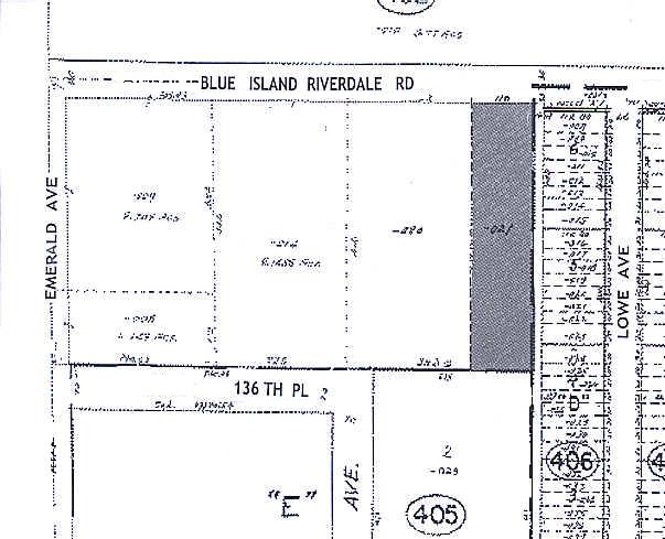
25-32-405-021-0000
DEMOGRAPHICS near 13605 S Halsted St
1 Mile
3 Mile
5 Mile
2024 Total Population
9,622
124,358
313,422
2029 Population
9,703
122,503
306,923
Pop Growth 2024-2029
+ 0.84%
(1.49%)
(2.07%)
Average Age
38
39
40
2024 Total Households
3,722
45,286
116,275
HH Growth 2024-2029
+ 0.59%
(1.82%)
(2.43%)
Median Household Inc
$29,384
$43,161
$51,201
Avg Household Size
2.50
2.70
2.60
2024 Avg HH Vehicles
1.00
1.00
1.00
Median Home Value
$92,831
$119,906
$148,733
Median Year Built
1958
1957
1958
Nearby Places
Map Layers
Map Styles
 Street
 Aerial
- Restaurants
- Banks
- Shops
- Fitness
- Groceries
PUBLIC TRANSPORTATION
COMMUTER RAIL
Riverdale Station (Metra Electric Line - Northeast Illinois Regional Commuter Railroad (Metra))
DRIVE
WALK
Distance
Riverdale Station (Metra Electric Line - Northeast Illinois Regional Commuter Railroad (Metra))
4 min
20 min
1.1 mi
Ivanhoe Station (Metra Electric Line - Northeast Illinois Regional Commuter Railroad (Metra))
DRIVE
WALK
Distance
Ivanhoe Station (Metra Electric Line - Northeast Illinois Regional Commuter Railroad (Metra))
5 min
2.0 mi
AIRPORT
Chicago Midway International
DRIVE
WALK
Distance
Chicago Midway International
29 min
16.2 mi
Chicago O'Hare International
DRIVE
WALK
Distance
Chicago O'Hare International
55 min
35.1 mi
Freight Ports
Port Milwaukee
DRIVE
WALK
Distance
Port Milwaukee
133 min
103.4 mi
Nearby Properties
Address
Land Use
TOTAL SIZE
Lot Size
Zoning
Address
Land Use
TOTAL SIZE
Lot Size
Zoning
8 AC
PD 1168
Address
Land Use
TOTAL SIZE
Lot Size
Zoning
0.51 AC
PD 1168
Address
Land Use
TOTAL SIZE
Lot Size
Zoning
1.08 AC
PD 1168
Address
Land Use
TOTAL SIZE
Lot Size
Zoning
11 AC
PD 1168
Address
Land Use
TOTAL SIZE
Lot Size
Zoning
1.45 AC
Address
Land Use
TOTAL SIZE
Lot Size
Zoning
307,335 SF
24.17 AC
PD 770
Address
Land Use
TOTAL SIZE
Lot Size
Zoning
67,348 SF
6.33 AC
PD 131
Address
Land Use
TOTAL SIZE
Lot Size
Zoning
88,008 SF
3.96 AC
Address
Land Use
TOTAL SIZE
Lot Size
Zoning
Address
Land Use
TOTAL SIZE
Lot Size
Zoning
83,005 SF
3.11 AC
Address
Land Use
TOTAL SIZE
Lot Size
Zoning
380,924 SF
19.13 AC
Address
Land Use
TOTAL SIZE
Lot Size
Zoning
129,837 SF
10.44 AC
PD 770
Address
Land Use
TOTAL SIZE
Lot Size
Zoning
Address
Land Use
TOTAL SIZE
Lot Size
Zoning
Address
Land Use
TOTAL SIZE
Lot Size
Zoning
Address
Land Use
TOTAL SIZE
Lot Size
Zoning
162,379 SF
10.59 AC
Address
Land Use
TOTAL SIZE
Lot Size
Zoning
Address
Land Use
TOTAL SIZE
Lot Size
Zoning
67,314 SF
1.19 AC
Address
Land Use
TOTAL SIZE
Lot Size
Zoning
451,400 SF
26.59 AC
M3-3
Address
Land Use
TOTAL SIZE
Lot Size
Zoning
1.71 AC
PD 1168
Address
Land Use
TOTAL SIZE
Lot Size
Zoning
37,306 SF
8.38 AC
M3-3
Address
Land Use
TOTAL SIZE
Lot Size
Zoning
2.26 AC
Address
Land Use
TOTAL SIZE
Lot Size
Zoning
Address
Land Use
TOTAL SIZE
Lot Size
Zoning
216,386 SF
16.84 AC
PD 42
Address
Land Use
TOTAL SIZE
Lot Size
Zoning
38,111 SF
6.70 AC
Address
Land Use
TOTAL SIZE
Lot Size
Zoning
440,257 SF
18.83 AC
M3-3
Address
Land Use
TOTAL SIZE
Lot Size
Zoning
Address
Land Use
TOTAL SIZE
Lot Size
Zoning
1.38 AC
PD 1168
Address
Land Use
TOTAL SIZE
Lot Size
Zoning
15,600 SF
7.77 AC
PMD 10
The World's #1 Commercial Real Estate Marketplace
Connect with us
© 2026 CoStar Group
The information above has been obtained from sources believed reliable. While we do not doubt its accuracy we have not verified it and make no guarantee, warranty or representation about it. It is your responsibility to independently confirm its accuracy and completeness. Any projections, opinions, assumptions, or estimates used are for example only and do not represent the current or future performance of the property. The value of this transaction to you depends on tax and other factors which should be evaluated by your tax, financial, and legal advisors. You and your advisors should conduct a careful, independent investigation of the property to determine to your satisfaction the suitability of the property for your needs.