Property Record
13607 National Pike, Clear Spring, MD 21722

Save to a Folder
{{folder.Name}}
{{folder.ListingIds.length}} Properties
{{folder.ListingIds.length}} Property
Create a New Folder
Property Detail
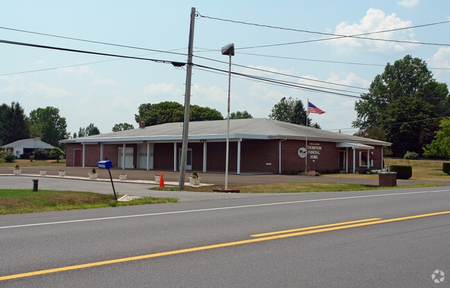
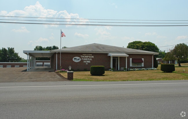
13607 National Pike
04-009266
LT .863AC FUNERAL HM 13607 NATIONAL PIKE CRNR USRT40 & ASHTON RD
Funeralhome
Washington
RB-E
Maryland
B and X Area of moderate flood hazard, usually the area between the limits of the 100-year and 500-year floods.
.863ac
2025
0.86 AC
2025
Washington County
010600
Washington, DC
6,313 SF
Hagerstown-Martinsburg, MD-WV
NEARBY LISTINGS FOR SALE OR LEASE
-
-
View all Clear Spring listings for sale on LoopNet.com
DEMOGRAPHICS near 13607 National Pike
1 mile
3 mile
5 mile
2025 Total Population
433
3,280
11,357
2030 Population
434
3,295
11,707
Pop Growth 2025-2030
+ 0.23%
+ 0.46%
+ 3.08%
Average Age
42
42
43
2025 Total Households
166
1,220
4,262
HH Growth 2025-2030
0.00%
+ 0.49%
+ 3.14%
Median Household Inc
$81,018
$84,000
$77,620
Avg Household Size
2.60
2.60
2.60
2025 Avg HH Vehicles
3.00
3.00
2.00
Median Home Value
$319,355
$298,863
$295,774
Median Year Built
1973
1976
1984
Nearby Places
Map Layers
Map Styles
 Street
 Aerial
Layers
 Traffic
 Biking
Places
Listings with unknown addresses are not visible on the map
- Restaurants
- Banks
- Shops
- Fitness
- Groceries
PUBLIC TRANSPORTATION
AIRPORT
Hagerstown Regional/Richard A Henson Field
Drive
Walk
Distance
Hagerstown Regional/Richard A Henson Field
20 min
12.9 mi
Nearby Properties
Address
Land Use
TOTAL SIZE
Lot Size
Zoning
Address
Land Use
TOTAL SIZE
Lot Size
Zoning
3,102 SF
183.57 AC
U
Address
Land Use
TOTAL SIZE
Lot Size
Zoning
43,393 SF
9.01 AC
RR
Address
Land Use
TOTAL SIZE
Lot Size
Zoning
3,648 SF
84.19 AC
A(R)
Address
Land Use
TOTAL SIZE
Lot Size
Zoning
41,174 SF
2.32 AC
HI
Address
Land Use
TOTAL SIZE
Lot Size
Zoning
8,040 SF
18.62 AC
A(R)
Address
Land Use
TOTAL SIZE
Lot Size
Zoning
3,926 SF
266.42 AC
A(R)
Address
Land Use
TOTAL SIZE
Lot Size
Zoning
5,906 SF
3 AC
A(R)
Address
Land Use
TOTAL SIZE
Lot Size
Zoning
7,819 SF
0.68 AC
U
Address
Land Use
TOTAL SIZE
Lot Size
Zoning
9,100 SF
1.97 AC
HI-1
Address
Land Use
TOTAL SIZE
Lot Size
Zoning
9,216 SF
16.04 AC
A(R)
Address
Land Use
TOTAL SIZE
Lot Size
Zoning
4,059 SF
0.91 AC
HI
Address
Land Use
TOTAL SIZE
Lot Size
Zoning
8,056 SF
1.48 AC
RR
Address
Land Use
TOTAL SIZE
Lot Size
Zoning
4,783 SF
1.88 AC
RR
Address
Land Use
TOTAL SIZE
Lot Size
Zoning
1,470 SF
11.17 AC
HI
Address
Land Use
TOTAL SIZE
Lot Size
Zoning
11,684 SF
0.60 AC
U
Address
Land Use
TOTAL SIZE
Lot Size
Zoning
1,827 SF
1.91 AC
HI
Address
Land Use
TOTAL SIZE
Lot Size
Zoning
7,234 SF
0.25 AC
U
Address
Land Use
TOTAL SIZE
Lot Size
Zoning
960 SF
11.08 AC
HI
Address
Land Use
TOTAL SIZE
Lot Size
Zoning
119.30 AC
P
Address
Land Use
TOTAL SIZE
Lot Size
Zoning
1,470 SF
0.90 AC
HI-1
Address
Land Use
TOTAL SIZE
Lot Size
Zoning
2,952 SF
0.24 AC
EC
Address
Land Use
TOTAL SIZE
Lot Size
Zoning
1.15 AC
HI
Address
Land Use
TOTAL SIZE
Lot Size
Zoning
4,180 SF
10.52 AC
RB-E
Address
Land Use
TOTAL SIZE
Lot Size
Zoning
2,798 SF
0.60 AC
U
Address
Land Use
TOTAL SIZE
Lot Size
Zoning
12,000 SF
3 AC
RR
Address
Land Use
TOTAL SIZE
Lot Size
Zoning
3,296 SF
0.39 AC
U
Address
Land Use
TOTAL SIZE
Lot Size
Zoning
5,441 SF
0.30 AC
U
Address
Land Use
TOTAL SIZE
Lot Size
Zoning
6.98 AC
A(R)
Address
Land Use
TOTAL SIZE
Lot Size
Zoning
2,000 SF
1.74 AC
RB-E
The World's #1 Commercial Real Estate Marketplace
Connect with us
© 2026 CoStar Group
The information above has been obtained from sources believed reliable. While we do not doubt its accuracy we have not verified it and make no guarantee, warranty or representation about it. It is your responsibility to independently confirm its accuracy and completeness. Any projections, opinions, assumptions, or estimates used are for example only and do not represent the current or future performance of the property. The value of this transaction to you depends on tax and other factors which should be evaluated by your tax, financial, and legal advisors. You and your advisors should conduct a careful, independent investigation of the property to determine to your satisfaction the suitability of the property for your needs.