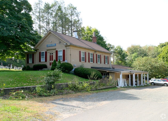
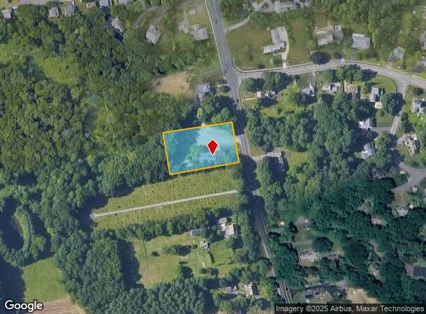
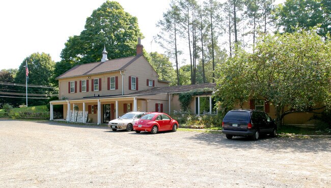
Property Record
1361 Main St, Glastonbury, CT 06033
NEARBY LISTINGS FOR SALE OR LEASE
Property Detail
1361 Main St
GLAS-000009D-004140-W000118
Hartford
Governmentalpublicusegeneral
Connecticut
X
w0118
09003C0536F
1.18 AC
2025
Glastonbury
2025
Hartford
520400
Hartford-West Hartford-East Hartford, CT
4,996 SF
DEMOGRAPHICS near 1361 Main St
1 Mile
3 Mile
5 Mile
2024 Total Population
3,469
27,207
89,117
2029 Population
3,462
27,129
88,738
Pop Growth 2024-2029
(0.20%)
(0.29%)
(0.43%)
Average Age
44
43
43
2024 Total Households
1,351
11,695
36,144
HH Growth 2024-2029
(0.15%)
(0.33%)
(0.44%)
Median Household Inc
$130,614
$106,649
$103,933
Avg Household Size
2.50
2.30
2.40
2024 Avg HH Vehicles
2.00
2.00
2.00
Median Home Value
$398,600
$343,980
$294,254
Median Year Built
1966
1972
1966
Nearby Places
Map Layers
Map Styles
 Street
 Aerial
- Restaurants
- Banks
- Shops
- Fitness
- Groceries
PUBLIC TRANSPORTATION
COMMUTER RAIL
Hartford (Hartford Line - Hartford Line)
DRIVE
WALK
Distance
Hartford (Hartford Line - Hartford Line)
13 min
8.7 mi
Hartford Amtrak Station (Amtrak Hartford Line - Amtrak, Northeast Regional - Amtrak, Valley Flyer - Amtrak, Vermonter - Amtrak)
DRIVE
WALK
Distance
Hartford Amtrak Station (Amtrak Hartford Line - Amtrak, Northeast Regional - Amtrak, Valley Flyer - Amtrak, Vermonter - Amtrak)
14 min
8.8 mi
AIRPORT
Bradley International
DRIVE
WALK
Distance
Bradley International
43 min
24.7 mi
Freight Ports
Port of New Haven
DRIVE
WALK
Distance
Port of New Haven
55 min
40.9 mi
Nearby Properties
Address
Land Use
TOTAL SIZE
Lot Size
Zoning
Address
Land Use
TOTAL SIZE
Lot Size
Zoning
49,219 SF
31.72 AC
Address
Land Use
TOTAL SIZE
Lot Size
Zoning
33.30 AC
R-20
Address
Land Use
TOTAL SIZE
Lot Size
Zoning
55.64 AC
Address
Land Use
TOTAL SIZE
Lot Size
Zoning
87,037 SF
10.44 AC
R-20
Address
Land Use
TOTAL SIZE
Lot Size
Zoning
7.07 AC
PBD
Address
Land Use
TOTAL SIZE
Lot Size
Zoning
9.09 AC
R-20
Address
Land Use
TOTAL SIZE
Lot Size
Zoning
188,427 SF
8.55 AC
SRD
Address
Land Use
TOTAL SIZE
Lot Size
Zoning
Address
Land Use
TOTAL SIZE
Lot Size
Zoning
11.95 AC
PAD
Address
Land Use
TOTAL SIZE
Lot Size
Zoning
Address
Land Use
TOTAL SIZE
Lot Size
Zoning
8.14 AC
Address
Land Use
TOTAL SIZE
Lot Size
Zoning
13.61 AC
RC
Address
Land Use
TOTAL SIZE
Lot Size
Zoning
8.56 AC
TC
Address
Land Use
TOTAL SIZE
Lot Size
Zoning
158,692 SF
2.89 AC
PAD
Address
Land Use
TOTAL SIZE
Lot Size
Zoning
38.84 AC
RC
Address
Land Use
TOTAL SIZE
Lot Size
Zoning
7.90 AC
Address
Land Use
TOTAL SIZE
Lot Size
Zoning
3.06 AC
Address
Land Use
TOTAL SIZE
Lot Size
Zoning
135,562 SF
3.15 AC
RC
Address
Land Use
TOTAL SIZE
Lot Size
Zoning
71,728 SF
13.65 AC
Address
Land Use
TOTAL SIZE
Lot Size
Zoning
20,472 SF
10.59 AC
Address
Land Use
TOTAL SIZE
Lot Size
Zoning
11.80 AC
R-20
Address
Land Use
TOTAL SIZE
Lot Size
Zoning
61,651 SF
9.98 AC
Address
Land Use
TOTAL SIZE
Lot Size
Zoning
76,090 SF
6.66 AC
RC
Address
Land Use
TOTAL SIZE
Lot Size
Zoning
57,457 SF
34.79 AC
Address
Land Use
TOTAL SIZE
Lot Size
Zoning
7.14 AC
Address
Land Use
TOTAL SIZE
Lot Size
Zoning
103,162 SF
8.80 AC
RC
Address
Land Use
TOTAL SIZE
Lot Size
Zoning
55,914 SF
3.36 AC
RC
Address
Land Use
TOTAL SIZE
Lot Size
Zoning
89,766 SF
11.18 AC
Address
Land Use
TOTAL SIZE
Lot Size
Zoning
216,532 SF
10.10 AC
R-20
Address
Land Use
TOTAL SIZE
Lot Size
Zoning
55,045 SF
2.88 AC
The World's #1 Commercial Real Estate Marketplace
Connect with us
© 2025 CoStar Group
The information above has been obtained from sources believed reliable. While we do not doubt its accuracy we have not verified it and make no guarantee, warranty or representation about it. It is your responsibility to independently confirm its accuracy and completeness. Any projections, opinions, assumptions, or estimates used are for example only and do not represent the current or future performance of the property. The value of this transaction to you depends on tax and other factors which should be evaluated by your tax, financial, and legal advisors. You and your advisors should conduct a careful, independent investigation of the property to determine to your satisfaction the suitability of the property for your needs.