Property Record
13612 State Highway 110 S, Tyler, TX 75707
NEARBY LISTINGS FOR SALE OR LEASE
Property Detail
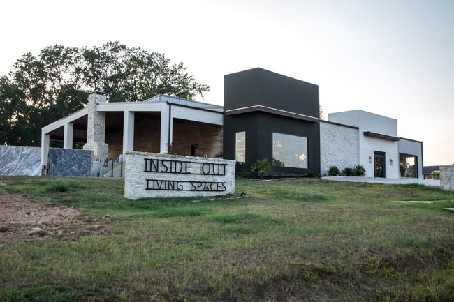
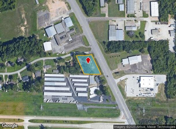
13612 State Highway 110 S
1-00000-0690-00-019000
A0690 L Mcguire
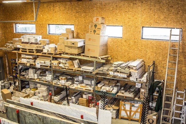
Storebuilding
ABST A0690 L MCGUIRETRACT 19
X
Smith
48423C0390D
Texas
2024
0.91 AC
2025
Tyler & Longview
002011
Other Market Areas
8,054 SF
Tyler, TX
DEMOGRAPHICS near 13612 State Highway 110 S
1 Mile
3 Mile
5 Mile
2024 Total Population
2,494
29,744
85,588
2029 Population
2,713
32,450
93,011
Pop Growth 2024-2029
+ 8.78%
+ 9.10%
+ 8.67%
Average Age
40
38
39
2024 Total Households
893
12,258
34,870
HH Growth 2024-2029
+ 8.17%
+ 8.63%
+ 8.14%
Median Household Inc
$54,303
$66,943
$68,509
Avg Household Size
2.60
2.30
2.30
2024 Avg HH Vehicles
2.00
2.00
2.00
Median Home Value
$170,059
$231,485
$218,705
Median Year Built
1996
1988
1985
Nearby Places
Map Layers
Map Styles
 Street
 Aerial
- Restaurants
- Banks
- Shops
- Fitness
- Groceries
PUBLIC TRANSPORTATION
AIRPORT
Tyler Pounds Regional
DRIVE
WALK
Distance
Tyler Pounds Regional
23 min
15.1 mi
SALE & LEASE HISTORY
LISTING DATE
SALE/LEASE

Sep 29, 2019
For Sale
Sep 23, 2019
For Sale
Nearby Properties
Address
Land Use
TOTAL SIZE
Lot Size
Zoning
Address
Land Use
TOTAL SIZE
Lot Size
Zoning
22,500 SF
214.44 AC
R1A
Address
Land Use
TOTAL SIZE
Lot Size
Zoning
33,409 SF
151.32 AC
M2
Address
Land Use
TOTAL SIZE
Lot Size
Zoning
18.37 AC
R1A
Address
Land Use
TOTAL SIZE
Lot Size
Zoning
49,544 SF
28.64 AC
Address
Land Use
TOTAL SIZE
Lot Size
Zoning
84,400 SF
13.98 AC
Address
Land Use
TOTAL SIZE
Lot Size
Zoning
3,052 SF
9.20 AC
PMF
Address
Land Use
TOTAL SIZE
Lot Size
Zoning
43,165 SF
7.33 AC
Address
Land Use
TOTAL SIZE
Lot Size
Zoning
3,189 SF
11.17 AC
RMF
Address
Land Use
TOTAL SIZE
Lot Size
Zoning
38,900 SF
20.11 AC
INT
Address
Land Use
TOTAL SIZE
Lot Size
Zoning
75,999 SF
5.09 AC
Address
Land Use
TOTAL SIZE
Lot Size
Zoning
37,536 SF
16.81 AC
RMF
Address
Land Use
TOTAL SIZE
Lot Size
Zoning
8,279 SF
14.06 AC
RMF
Address
Land Use
TOTAL SIZE
Lot Size
Zoning
2,676 SF
8.28 AC
RMF
Address
Land Use
TOTAL SIZE
Lot Size
Zoning
14,752 SF
9.64 AC
RMF
Address
Land Use
TOTAL SIZE
Lot Size
Zoning
52,557 SF
11.44 AC
RMF
Address
Land Use
TOTAL SIZE
Lot Size
Zoning
2,298 SF
9.08 AC
RMF
Address
Land Use
TOTAL SIZE
Lot Size
Zoning
2,987 SF
6 AC
RMF
Address
Land Use
TOTAL SIZE
Lot Size
Zoning
39,468 SF
7.99 AC
RMF
Address
Land Use
TOTAL SIZE
Lot Size
Zoning
1,664 SF
7.52 AC
RMF
Address
Land Use
TOTAL SIZE
Lot Size
Zoning
39,565 SF
9.01 AC
Address
Land Use
TOTAL SIZE
Lot Size
Zoning
93,250 SF
7.92 AC
RMF
Address
Land Use
TOTAL SIZE
Lot Size
Zoning
8,390 SF
12.79 AC
RMF
Address
Land Use
TOTAL SIZE
Lot Size
Zoning
76,216 SF
14.70 AC
PMF
Address
Land Use
TOTAL SIZE
Lot Size
Zoning
27,520 SF
5.91 AC
RMF
Address
Land Use
TOTAL SIZE
Lot Size
Zoning
63,574 SF
6.56 AC
C1
Address
Land Use
TOTAL SIZE
Lot Size
Zoning
61,500 SF
82.50 AC
Address
Land Use
TOTAL SIZE
Lot Size
Zoning
80,529 SF
2.25 AC
C1
Address
Land Use
TOTAL SIZE
Lot Size
Zoning
1,761 SF
7.03 AC
RMF
Address
Land Use
TOTAL SIZE
Lot Size
Zoning
216,428 SF
32.96 AC
C2
Address
Land Use
TOTAL SIZE
Lot Size
Zoning
4,781 SF
6.32 AC
RMF
The World's #1 Commercial Real Estate Marketplace
Connect with us
© 2025 CoStar Group
The information above has been obtained from sources believed reliable. While we do not doubt its accuracy we have not verified it and make no guarantee, warranty or representation about it. It is your responsibility to independently confirm its accuracy and completeness. Any projections, opinions, assumptions, or estimates used are for example only and do not represent the current or future performance of the property. The value of this transaction to you depends on tax and other factors which should be evaluated by your tax, financial, and legal advisors. You and your advisors should conduct a careful, independent investigation of the property to determine to your satisfaction the suitability of the property for your needs.