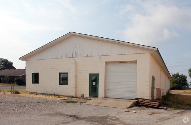
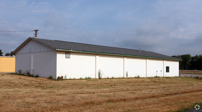
Property Record
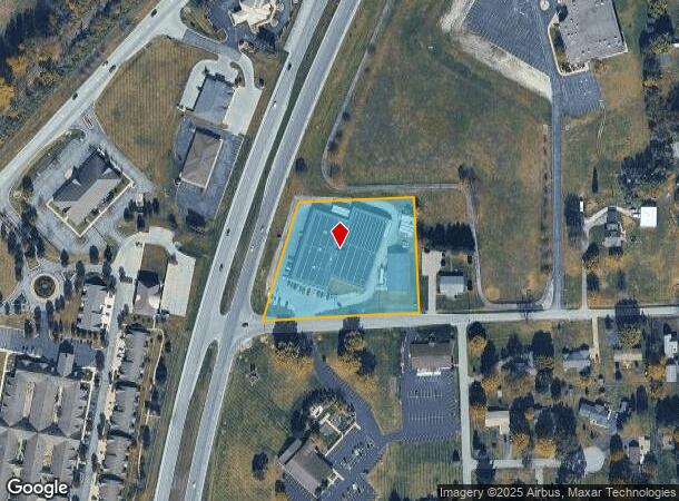
13615 N State Road 67, Camby, IN 46113
NEARBY LISTINGS FOR SALE OR LEASE
Property Detail
13615 N State Road 67
55-02-30-260-001.000-005
S30 T14 R2E PT NE 2.537 AC
Storebuilding
Morgan
X
Indiana
18109C0151E
2.54 AC
2024
Morgan County
2024
Indianapolis
510201
Indianapolis-Carmel-Anderson, IN
40,000 SF
DEMOGRAPHICS near 13615 N State Road 67
1 Mile
3 Mile
5 Mile
2024 Total Population
3,069
24,950
45,908
2029 Population
3,133
25,616
47,782
Pop Growth 2024-2029
+ 2.09%
+ 2.67%
+ 4.08%
Average Age
44
39
40
2024 Total Households
1,239
9,375
16,427
HH Growth 2024-2029
+ 2.02%
+ 2.71%
+ 3.85%
Median Household Inc
$66,575
$73,104
$76,339
Avg Household Size
2.40
2.60
2.60
2024 Avg HH Vehicles
2.00
2.00
2.00
Median Home Value
$176,958
$184,579
$207,928
Median Year Built
1980
1993
1992
Nearby Places
Map Layers
Map Styles
 Street
 Aerial
- Restaurants
- Banks
- Shops
- Fitness
- Groceries
Nearby Properties
Address
Land Use
TOTAL SIZE
Lot Size
Zoning
Address
Land Use
TOTAL SIZE
Lot Size
Zoning
86,017 SF
26.95 AC
Address
Land Use
TOTAL SIZE
Lot Size
Zoning
319,260 SF
Address
Land Use
TOTAL SIZE
Lot Size
Zoning
5,881 SF
17.35 AC
Address
Land Use
TOTAL SIZE
Lot Size
Zoning
11,404 SF
12.58 AC
Address
Land Use
TOTAL SIZE
Lot Size
Zoning
225,450 SF
98.28 AC
Address
Land Use
TOTAL SIZE
Lot Size
Zoning
12.57 AC
Address
Land Use
TOTAL SIZE
Lot Size
Zoning
76,295 SF
6.22 AC
Address
Land Use
TOTAL SIZE
Lot Size
Zoning
16.33 AC
Address
Land Use
TOTAL SIZE
Lot Size
Zoning
214,991 SF
24.91 AC
Address
Land Use
TOTAL SIZE
Lot Size
Zoning
3,155 SF
13.02 AC
ZO01
Address
Land Use
TOTAL SIZE
Lot Size
Zoning
193,909 SF
18.43 AC
Address
Land Use
TOTAL SIZE
Lot Size
Zoning
235,506 SF
17.85 AC
Address
Land Use
TOTAL SIZE
Lot Size
Zoning
48,454 SF
6.70 AC
Address
Land Use
TOTAL SIZE
Lot Size
Zoning
138,838 SF
16.27 AC
Address
Land Use
TOTAL SIZE
Lot Size
Zoning
9,765 SF
9.21 AC
ZO01
Address
Land Use
TOTAL SIZE
Lot Size
Zoning
98,014 SF
30.50 AC
Address
Land Use
TOTAL SIZE
Lot Size
Zoning
6,184 SF
8.53 AC
Address
Land Use
TOTAL SIZE
Lot Size
Zoning
3,000 SF
7 AC
Address
Land Use
TOTAL SIZE
Lot Size
Zoning
50,672 SF
0.71 AC
Address
Land Use
TOTAL SIZE
Lot Size
Zoning
105,381 SF
Address
Land Use
TOTAL SIZE
Lot Size
Zoning
11,325 SF
5.86 AC
Address
Land Use
TOTAL SIZE
Lot Size
Zoning
54,944 SF
2.50 AC
Address
Land Use
TOTAL SIZE
Lot Size
Zoning
40,709 SF
5.45 AC
Address
Land Use
TOTAL SIZE
Lot Size
Zoning
2,112 SF
21.14 AC
Address
Land Use
TOTAL SIZE
Lot Size
Zoning
54,228 SF
10.63 AC
Address
Land Use
TOTAL SIZE
Lot Size
Zoning
30,500 SF
16.29 AC
Address
Land Use
TOTAL SIZE
Lot Size
Zoning
51,800 SF
Address
Land Use
TOTAL SIZE
Lot Size
Zoning
22,402 SF
2.57 AC
Address
Land Use
TOTAL SIZE
Lot Size
Zoning
44,178 SF
21.80 AC
Address
Land Use
TOTAL SIZE
Lot Size
Zoning
143,336 SF
25.70 AC
The World's #1 Commercial Real Estate Marketplace
Connect with us
© 2025 CoStar Group
The information above has been obtained from sources believed reliable. While we do not doubt its accuracy we have not verified it and make no guarantee, warranty or representation about it. It is your responsibility to independently confirm its accuracy and completeness. Any projections, opinions, assumptions, or estimates used are for example only and do not represent the current or future performance of the property. The value of this transaction to you depends on tax and other factors which should be evaluated by your tax, financial, and legal advisors. You and your advisors should conduct a careful, independent investigation of the property to determine to your satisfaction the suitability of the property for your needs.