Property Record
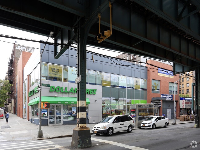
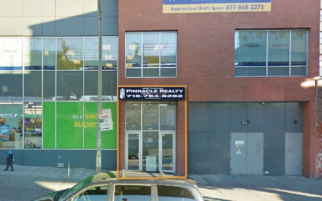
1362 Jerome Ave, Bronx, NY 10452

NEARBY LISTINGS FOR SALE OR LEASE
Property Detail
1362 Jerome Ave
02841-0005
Morris Stebbins Prop
Storebuilding
Bronx
X
New York
3604970083F
5
2024
0.28 AC
2025
Bronx
022101
Westchester/So Connecticut
33,325 SF
New York-Jersey City-White Plains, NY-NJ
DEMOGRAPHICS near 1362 Jerome Ave
1 Mile
3 Mile
5 Mile
2024 Total Population
234,801
1,263,055
2,221,708
2029 Population
219,776
1,179,078
2,064,951
Pop Growth 2024-2029
(6.40%)
(6.65%)
(7.06%)
Average Age
37
38
39
2024 Total Households
78,695
461,869
856,053
HH Growth 2024-2029
(7.14%)
(7.17%)
(7.51%)
Median Household Inc
$35,487
$40,972
$52,950
Avg Household Size
2.80
2.60
2.40
2024 Avg HH Vehicles
.00
.00
.00
Median Home Value
$418,450
$502,582
$673,607
Median Year Built
1950
1950
1952
Nearby Places
Map Layers
Map Styles
 Street
 Aerial
- Restaurants
- Banks
- Shops
- Fitness
- Groceries
PUBLIC TRANSPORTATION
TRANSIT/SUBWAY
170 Street (4 Line) (4 - New York MTA Subway (The Subway))
DRIVE
WALK
Distance
170 Street (4 Line) (4 - New York MTA Subway (The Subway))
0 min
1 min
0.1 mi
167 Street (4 Line) (4 - New York MTA Subway (The Subway))
DRIVE
WALK
Distance
167 Street (4 Line) (4 - New York MTA Subway (The Subway))
0 min
5 min
0.3 mi
170 Street (B,D Line) (B - New York MTA Subway (The Subway), D - New York MTA Subway (The Subway))
DRIVE
WALK
Distance
170 Street (B,D Line) (B - New York MTA Subway (The Subway), D - New York MTA Subway (The Subway))
1 min
6 min
0.3 mi
Mt Eden Avenue (4 - New York MTA Subway (The Subway))
DRIVE
WALK
Distance
Mt Eden Avenue (4 - New York MTA Subway (The Subway))
0 min
7 min
0.4 mi
167 Street (B,D Line) (B - New York MTA Subway (The Subway), D - New York MTA Subway (The Subway))
DRIVE
WALK
Distance
167 Street (B,D Line) (B - New York MTA Subway (The Subway), D - New York MTA Subway (The Subway))
1 min
9 min
0.5 mi
COMMUTER RAIL
Highbridge Yard (Hudson - Metro-North Railroad)
DRIVE
WALK
Distance
Highbridge Yard (Hudson - Metro-North Railroad)
4 min
18 min
1.0 mi
Melrose Station (Harlem Line - Metro-North Commuter Railroad Company (Metro-North))
DRIVE
WALK
Distance
Melrose Station (Harlem Line - Metro-North Commuter Railroad Company (Metro-North))
4 min
1.4 mi
AIRPORT
LaGuardia
DRIVE
WALK
Distance
LaGuardia
17 min
8.5 mi
John F Kennedy International
DRIVE
WALK
Distance
John F Kennedy International
27 min
19.8 mi
Newark Liberty International
DRIVE
WALK
Distance
Newark Liberty International
25 min
22.0 mi
Freight Ports
NY - Red Hook Container Terminal
DRIVE
WALK
Distance
NY - Red Hook Container Terminal
29 min
16.7 mi
SALE & LEASE HISTORY
LISTING DATE
SALE/LEASE

Nov 09, 2017
For Lease
May 12, 2023
For Lease
Jan 12, 2017
For Lease
Nearby Properties
Address
Land Use
TOTAL SIZE
Lot Size
Zoning
Address
Land Use
TOTAL SIZE
Lot Size
Zoning
3,693,539 SF
8.37 AC
R8
Address
Land Use
TOTAL SIZE
Lot Size
Zoning
400,160 SF
10.96 AC
R7-2
Address
Land Use
TOTAL SIZE
Lot Size
Zoning
1,299,700 SF
29.82 AC
R6
Address
Land Use
TOTAL SIZE
Lot Size
Zoning
1,743,584 SF
77.87 AC
R6
Address
Land Use
TOTAL SIZE
Lot Size
Zoning
26.93 AC
R8
Address
Land Use
TOTAL SIZE
Lot Size
Zoning
2,278,432 SF
5.99 AC
R7-2
Address
Land Use
TOTAL SIZE
Lot Size
Zoning
24.08 AC
B2-A
Address
Land Use
TOTAL SIZE
Lot Size
Zoning
4.87 AC
R11
Address
Land Use
TOTAL SIZE
Lot Size
Zoning
873,000 SF
9.95 AC
R7-2
Address
Land Use
TOTAL SIZE
Lot Size
Zoning
1,670,868 SF
9.14 AC
R8
Address
Land Use
TOTAL SIZE
Lot Size
Zoning
1,651,267 SF
1.23 AC
R8
Address
Land Use
TOTAL SIZE
Lot Size
Zoning
Address
Land Use
TOTAL SIZE
Lot Size
Zoning
2.61 AC
D5
Address
Land Use
TOTAL SIZE
Lot Size
Zoning
481,172 SF
205.58 AC
PARK
Address
Land Use
TOTAL SIZE
Lot Size
Zoning
478,842 SF
3.56 AC
C6-1
Address
Land Use
TOTAL SIZE
Lot Size
Zoning
891,040 SF
5.63 AC
R8
Address
Land Use
TOTAL SIZE
Lot Size
Zoning
0.36 AC
R8
Address
Land Use
TOTAL SIZE
Lot Size
Zoning
1,311,800 SF
9.89 AC
C4-4
Address
Land Use
TOTAL SIZE
Lot Size
Zoning
23.12 AC
PARK
Address
Land Use
TOTAL SIZE
Lot Size
Zoning
1,237,424 SF
21.25 AC
R6
Address
Land Use
TOTAL SIZE
Lot Size
Zoning
1,390,324 SF
6.87 AC
R8
Address
Land Use
TOTAL SIZE
Lot Size
Zoning
3.75 AC
Address
Land Use
TOTAL SIZE
Lot Size
Zoning
42.68 AC
P1
Address
Land Use
TOTAL SIZE
Lot Size
Zoning
2 AC
R11
Address
Land Use
TOTAL SIZE
Lot Size
Zoning
2.55 AC
D5
Address
Land Use
TOTAL SIZE
Lot Size
Zoning
807,327 SF
0.60 AC
R8
Address
Land Use
TOTAL SIZE
Lot Size
Zoning
892,550 SF
2.93 AC
M13R8
Address
Land Use
TOTAL SIZE
Lot Size
Zoning
2,531,670 SF
17.15 AC
R7-2
Address
Land Use
TOTAL SIZE
Lot Size
Zoning
390,750 SF
265 AC
PARK
Address
Land Use
TOTAL SIZE
Lot Size
Zoning
517,876 SF
1.83 AC
C6-1
The World's #1 Commercial Real Estate Marketplace
Connect with us
© 2026 CoStar Group
The information above has been obtained from sources believed reliable. While we do not doubt its accuracy we have not verified it and make no guarantee, warranty or representation about it. It is your responsibility to independently confirm its accuracy and completeness. Any projections, opinions, assumptions, or estimates used are for example only and do not represent the current or future performance of the property. The value of this transaction to you depends on tax and other factors which should be evaluated by your tax, financial, and legal advisors. You and your advisors should conduct a careful, independent investigation of the property to determine to your satisfaction the suitability of the property for your needs.