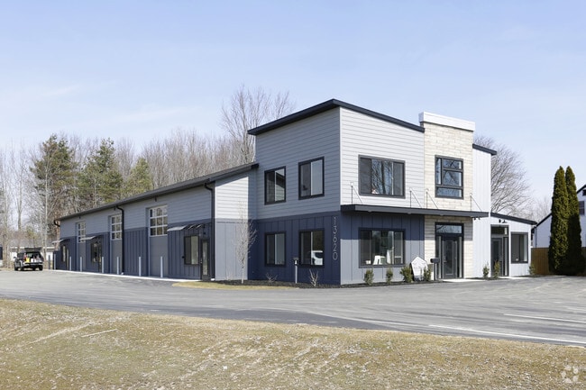
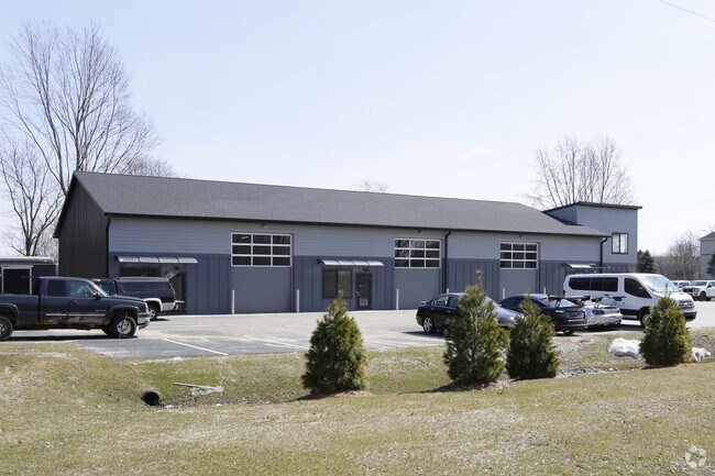
Property Record
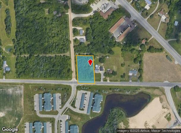
13620 2Nd Ave Nw, Grand Rapids, MI 49534
NEARBY LISTINGS FOR SALE OR LEASE
Property Detail
13620 2Nd Ave Nw
70-10-01-480-021
PART OF E 1/2 OF SE 1/4 COM S 87D 38M 42S E 66 FT FROM SW COR, TH N 02D 24M 08S W 270 FT ALG E LI OF 2ND AVE, S 87D 38M 44S E
Loftbuilding
Ottawa
X
Michigan
26081C0270D
0.88 AC
2024
Northern Ottawa County
2025
West Michigan
021402
Grand Rapids-Wyoming, MI
7,898 SF
DEMOGRAPHICS near 13620 2Nd Ave Nw
1 Mile
3 Mile
5 Mile
2024 Total Population
3,113
20,329
46,637
2029 Population
3,236
20,864
47,510
Pop Growth 2024-2029
+ 3.95%
+ 2.63%
+ 1.87%
Average Age
41
40
41
2024 Total Households
1,255
7,763
19,119
HH Growth 2024-2029
+ 4.14%
+ 2.61%
+ 1.78%
Median Household Inc
$74,099
$74,549
$74,351
Avg Household Size
2.50
2.60
2.40
2024 Avg HH Vehicles
2.00
2.00
2.00
Median Home Value
$279,316
$261,317
$250,279
Median Year Built
1991
1986
1979
Nearby Places
Map Layers
Map Styles
 Street
 Aerial
- Restaurants
- Banks
- Shops
- Fitness
- Groceries
PUBLIC TRANSPORTATION
AIRPORT
Gerald R Ford International
DRIVE
WALK
Distance
Gerald R Ford International
33 min
23.2 mi
Freight Ports
Port Milwaukee
DRIVE
WALK
Distance
Port Milwaukee
308 min
263.5 mi
SALE & LEASE HISTORY
LISTING DATE
SALE/LEASE

Jun 16, 2021
For Lease
Jan 29, 2019
For Lease
Jan 29, 2019
For Lease
Jan 29, 2019
For Sale
Feb 18, 2021
For Sale
Dec 04, 2023
For Sale
Nearby Properties
Address
Land Use
TOTAL SIZE
Lot Size
Zoning
Address
Land Use
TOTAL SIZE
Lot Size
Zoning
340,744 SF
69.50 AC
RPUD - 2
Address
Land Use
TOTAL SIZE
Lot Size
Zoning
278,832 SF
NOT APP
Address
Land Use
TOTAL SIZE
Lot Size
Zoning
410,206 SF
54.36 AC
MH
Address
Land Use
TOTAL SIZE
Lot Size
Zoning
198,000 SF
NOT APP
Address
Land Use
TOTAL SIZE
Lot Size
Zoning
190,882 SF
30.17 AC
MP
Address
Land Use
TOTAL SIZE
Lot Size
Zoning
113,016 SF
33.69 AC
IPUD
Address
Land Use
TOTAL SIZE
Lot Size
Zoning
132,680 SF
17.24 AC
IPUD
Address
Land Use
TOTAL SIZE
Lot Size
Zoning
162,765 SF
22.63 AC
MP
Address
Land Use
TOTAL SIZE
Lot Size
Zoning
59.89 AC
R-4
Address
Land Use
TOTAL SIZE
Lot Size
Zoning
267,000 SF
15.63 AC
IPUD
Address
Land Use
TOTAL SIZE
Lot Size
Zoning
247,168 SF
9.60 AC
MP
Address
Land Use
TOTAL SIZE
Lot Size
Zoning
332,315 SF
17.71 AC
MP
Address
Land Use
TOTAL SIZE
Lot Size
Zoning
250,469 SF
14.11 AC
ML
Address
Land Use
TOTAL SIZE
Lot Size
Zoning
134,118 SF
17.04 AC
IPUD
Address
Land Use
TOTAL SIZE
Lot Size
Zoning
200,831 SF
11.69 AC
MH
Address
Land Use
TOTAL SIZE
Lot Size
Zoning
140,841 SF
8.96 AC
Address
Land Use
TOTAL SIZE
Lot Size
Zoning
285,000 SF
17.66 AC
MH
Address
Land Use
TOTAL SIZE
Lot Size
Zoning
197,220 SF
10.94 AC
MP
Address
Land Use
TOTAL SIZE
Lot Size
Zoning
222,833 SF
20.49 AC
MH
Address
Land Use
TOTAL SIZE
Lot Size
Zoning
85,472 SF
12.17 AC
ARM - MULT
Address
Land Use
TOTAL SIZE
Lot Size
Zoning
278,088 SF
22.75 AC
MP
Address
Land Use
TOTAL SIZE
Lot Size
Zoning
150,000 SF
19.41 AC
IPUD
Address
Land Use
TOTAL SIZE
Lot Size
Zoning
261,550 SF
15.72 AC
MP
Address
Land Use
TOTAL SIZE
Lot Size
Zoning
104,000 SF
NOT APP
Address
Land Use
TOTAL SIZE
Lot Size
Zoning
Address
Land Use
TOTAL SIZE
Lot Size
Zoning
196,250 SF
12.67 AC
MP
Address
Land Use
TOTAL SIZE
Lot Size
Zoning
141,672 SF
11.82 AC
MP
Address
Land Use
TOTAL SIZE
Lot Size
Zoning
200,000 SF
13.41 AC
MP
Address
Land Use
TOTAL SIZE
Lot Size
Zoning
119,000 SF
7.73 AC
IPUD
Address
Land Use
TOTAL SIZE
Lot Size
Zoning
209,325 SF
11.55 AC
MP
The World's #1 Commercial Real Estate Marketplace
Connect with us
© 2025 CoStar Group
The information above has been obtained from sources believed reliable. While we do not doubt its accuracy we have not verified it and make no guarantee, warranty or representation about it. It is your responsibility to independently confirm its accuracy and completeness. Any projections, opinions, assumptions, or estimates used are for example only and do not represent the current or future performance of the property. The value of this transaction to you depends on tax and other factors which should be evaluated by your tax, financial, and legal advisors. You and your advisors should conduct a careful, independent investigation of the property to determine to your satisfaction the suitability of the property for your needs.